Islip Saddle
Pacific Crest Trail Trip 15 August 21 to 24th - 2005- Silverwood Lake to Cloudburst Summit – 68 miles
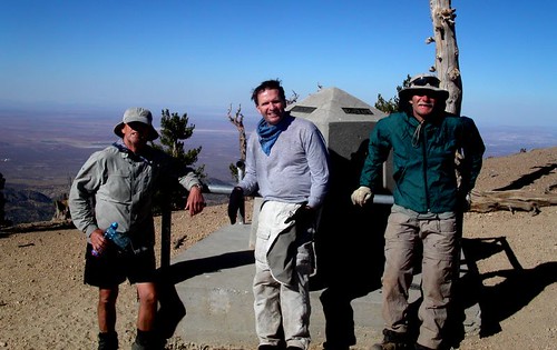
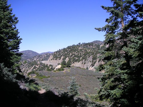
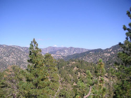
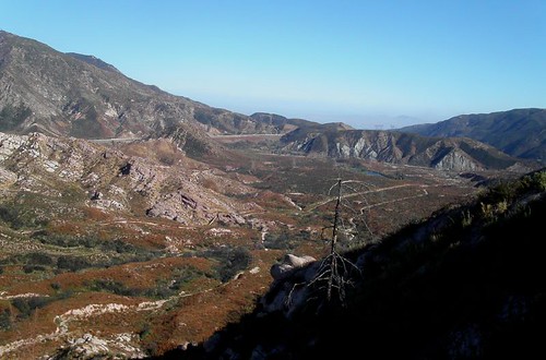
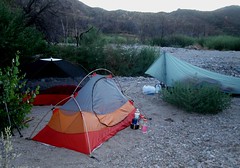
This was a beautiful and exciting section. We camped late on the 20th next to a creek bed at Silverwood Recreation Area. Visitors nearby, but unseen, whupped it up until about 3:00AM. Males in the group successfully got coyotes to sing along with them. Bizarre! Leaving camp the next morning we quickly passed through creek bottoms so washed out from the season's rains that we lost and found the trail several times. Bill's GPS shows where the next waypoint is but you can't always get to one directly. We gained Cleghorn Ridge via a detour because of damaged trail. Every once in a while the gentle grade of the PCT turns very steep. This time I tried walking backwards. I had cached water at three points on this trip and it turned out to be a perfect balance between natural sources and dry places. This first day took us along Highway 138 and a view of a train transfer station of some sort to the north. 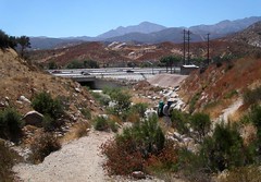 These giant trains all seem to be a mile long. I imagine they carry everything from all over the world. The trail here snakes steeply down sharp ridges to Highway 15. Crowder Canyon Creek was running well and you can see that it may have been the original road over the pass, maybe a toll road. We surprised people on the river panning for gold uncovered by the season's rains. They didn't realize that the trail passed just above their heads. At the frontage road we went to McDonalds for lunch! It felt like cheating. Ray relaxed in the culvert under the freeway and we brought him a burger and soda with plenty of ice. Passing to the other side is a zigzag through high bushes and creeks. We got to a big train curve under the Mormon Rocks and were confused by a detour around damaged trail for about 15 minutes. We passed around Ralston Peak to a great camp in Swartout Canyon. The next day we found a hikers cache on the west side of the canyon toward Lytle Creek Ridge. Day two was the hardest day with a gain of 6000 feet and a loss of 1400! My water cache was farther than Bill thought because I wasn't clear about it. It was about half way to Guffy Campground which worked well. We saw a lot of buckwheat and dreamed about fresh pancakes on the trail. We got a view up higher of Telescope Peak to the north though the Mojave was pretty murky. This is a long section and Guffy Campground is the top of a mountain! We saw some deer. We had to go downhill to find the spring. Bill's waypoint for it was right but the map was wrong. I found it 300 yards downhill from camp on the other side of a chasm. It was surrounded by a tropical jungle and I nearly burst my heart from my chest bringing back the bucket and Ray's cook pot filled with water. The boy's met me half way up and we traded off to the top. Bill said I looked like he felt before his heart attack. Comforting. He asked me to rest a bit and I did. I got an incredible desire for meat and wolfed down several pieces of jerky. Weird. Bill didn't feel like eating. We went to sleep in wind swept tents. Day three brought us down to Highway 2 and Mount Baden Powell. It got steep and rocky down to the top of the Wrightwood ski areas. A rocky trail gets uncomfortable fast. Both of the ski runs have massive reservoirs to make snow with on the top. It was strange to walk across dry ski slopes. We made it to the highway and basically followed it on the north side to Grassy Hollow campground. We tanked up, used the facilities and rested here. We passed two trail runners, one of them large, red, and without a tee shirt, a scary sight. There is a huge downhill to the road at the base of Baden Powell. We mused that it would be easier to build bridges straight across in places but we won't hold our breath. I had cached water here and was so concerned that we would need all we could carry I lugged along another half gallon in a jug. I encouraged the boys to fill all their containers even though Lamel Spring lay only few miles further. We wouldn't have another chance for water until the next day. Baden Powell is a big, steep four mile zigzag to the top. It felt surprisingly easy. Lamel Spring was running well. The top of Baden Powell is a new climate with a rare gnarled but beautiful tree called the Limber Pine. There is a large monument to Baden Powell, the Boy Scout founder, on the top. Getting the concrete and steel up there for it was an act of faith. We met a local hiking expert named John who gave us a good camp spot a mile or so past the peak and pointed out a B-24 crash on a far mountain that occurred after WW11. It was a dream camp in a draw beneath Mount Burnham facing the Mojave. We got a great view of Edwards Air Force Base where the shuttle recently landed. The most surprising thing was all the lights at night from a rapidly urbanized desert. I slept well. We passed our first hiker, Dale, in 35 miles with two backpacking Saluki dogs. There is a lot of downhill again along ridges here but it went quickly to Little Jimmy Spring where we filled up from our waterless camp. Someone has built a nice place here to rest and hydrate. We passed Windy Gap which though windy was the least windy of the many gaps we passed and descended to Islip Saddle which is unique in look with a wide table of brushy land between mountains. Passing a group of Senior Sierra Club Weekday hikers we crossed Highway 2 again. Trail mix sucks. Time and again on our trips we get disgusted with one of our trail foods and often it is trail mix. You want to avoid eating it and only do so for survival. Passing the Highway 2 to Mount Williamson to what the handbook calls a moderate ascent was a heart pounding bitch and we agreed if the author was there we would have strangled him. Ray fell sensibly behind while Bill and I forced ourselves up the grade and took a big break near the top. I grabbed a low hanging pine cone saying that in California the fruit is ripe for the picking and got sap all over my glove. Very soon the trail plunges back to the highway past a rock chasm Bill had to photograph and a parallel trail to Eagles Roost. We paused here and left a message for my daughter that we had decided to go to Cloudburst Summit. Going down an old jeep trail we entered Rattlesnake Canyon. Lot's of water here. We topped off at Little Rock Creek and moved on. We crossed good streams several times and entered Cooper Canyon which eventually goes up and around, way around, to Cloudburst Summit. It is very pretty down near the water. You could spend a week down here on vacation. Ray fell behind and made a wrong turn up a dirt road which fortuitously brought him right to the end of the trail, whew! Janessa was waiting for us with her laptop open working on Medical School Applications. This was a beautiful section of the PCT. Plenty of hard work and lots of great views.
No comments:
Post a Comment