Fobes Saddle to Fuller Ridge Remote Campsite July 25th, 2004
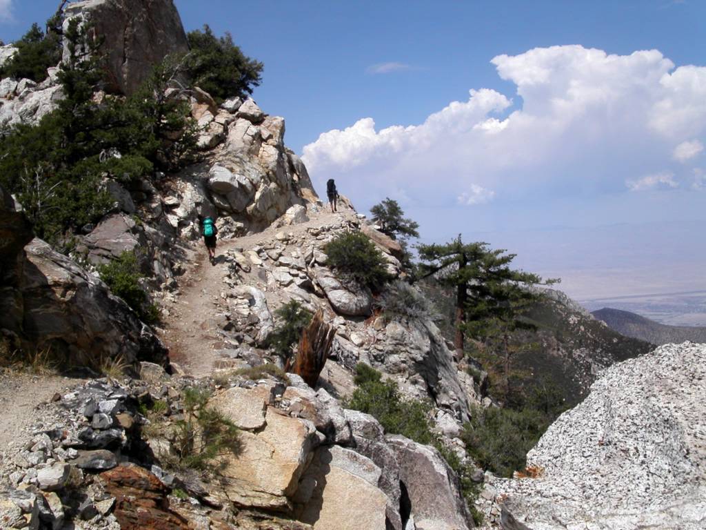
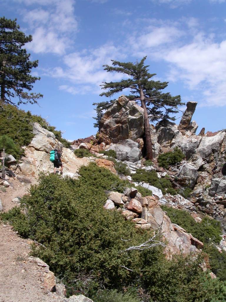
The first morning, we didn’t start at the Fobes Saddle spur trail till after eight and got to the PCT at the Saddle just after nine. The early starts are getting harder the farther north we go. We found a six gallon cache here courtesy of Bill’s Trail Kitchen. The trail gets steep immediately. We passed Spitler peak on the way to Apache peak.
Bill stopped to fix a hot spot on his foot. I have never had a problem with my New Balance trail runners, but they slip too easily. I have fallen for the ultra light mantra about using these shoes instead of boots. I think without hiking poles I would have hurt myself. I have a new pair, and if they don’t improve my stability I am looking for another shoe.
It was already about 85 degrees here with a fair wind. Very few wildflowers at this time of year, but we did see some Red Penstemon, Indian Paintbrush, and a very cool plant with a red cone and purple flowers. When the pictures come back we have to identify it.
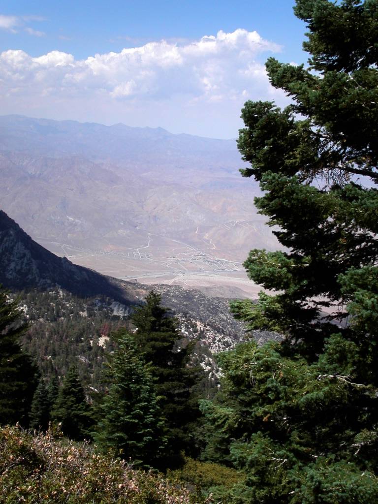
We lunched at about 1:00 after Apache peak, and were already wiped out. Ray said, “When I feel like this I am ready to stop.” I got a headache from the altitude but Advil, food, and a break made me feel like a new man. You can see the Coachella Valley all along this part of the trail.
Near Antsell Rock, we ran into a shirtless man with a British accent walking the other direction who said he was from the Zen Mountain Center. We don’t know where he entered the trail. We ran into gnats that flew around our faces like a mask of bugs. I inhaled one in my nose and it came out my mouth. Ray ate one and said, “Good protein!” The trail is carved out of solid rock in many places here and must have been a Herculean task to build. This section is dangerous in the winter with snow. We are glad to be walking it in dry conditions. Red Tahquitz Peak is literally red, and we had to round it on the east side to enter the forest beyond.
The wilderness up here is a patchwork of National Forest and Mount San Jacinto State Park. We entered the Eden that is the top of Mount San Jacinto. It looks like a punchbowl surrounded by peaks. At first glance you might think it is a dormant volcano. It is filled with trees, and has a big green meadow, Skunk Cabbage Meadow, near the bottom northeast side. Unfortunately up here the bark beetle infestation is in full force, and a good twenty percent of the trees are dead or dying. Only several years of average or better rainfall will solve the problem. It is still quite beautiful.
The grade went down into the valley and it was a welcome breather. Our permit was for Strawberry Junction Campground, and it was still 7 miles away. Just before the trail meets a 1/3 mile cutoff to water in Tahquitz Meadow, we came across good flowing Tahquitz Creek. This stream, which surprised us, came from Tahquitz Peak above, and since all the snow is gone Bill and Ray surmised that it originated from ground water. It was a lot of water. We filtered about 10 liters of good, cold water between us. We decided any pauper can have water down the mountain, but on the mountain the man with water is King! I drank six liters today! We saw a mule deer and heard some doves. We were exhausted and no where near our goal.
We arrived at Saddle Junction to see a very tired man about 30 years old sitting on a tree stump. “I used to hike all the time, and this is first time I’ve been out in two years,” he said. Apparently, the 2-1/2 mile Devil’s Slide Trail had been more than enough for him. We finally decided to camp north of Saddle Junction on a sandy area overlooking Idyllwild and Hemet beyond. We had covered nine miles. It was impossible to get to Strawberry Junction, where we had arranged for the camping permit, from Fobes Saddle in a day of hiking, but that was the only permit area available to us. We felt bad about it, but it was getting dark. We all agreed to tell the truth if we ran into a Ranger. We didn’t have a choice. I understand why they restrict camping: People have damaged the area in the past. We treaded lightly. I was stunned to realize that I had left my new stove at home. Ray shared his cooking gear with me, and I enjoyed Red Beans and Rice. I added tuna to both our dishes. Bill had lent me a tent because my Tarptent had not arrived in time. Unfortunately, he brought the wrong poles, but my hiking poles crossed and adjusted did the trick, and I had a tent. It was a warm night, and with a half-moon everything was quite clear.
We heard some people whooping as they descending the trail to Humber Park. It became obvious we were probably the only people on the whole mountain; a strange but powerful feeling, especially with millions below in our view. I did not fall asleep till 1:00AM, but lay there for nine hours. I don’t know why; perhaps I was too tired. I heard Ray rustling at 5:30 and woke up. Bill had blisters on both heels. He treated them and we were on our way by 7:00AM. We climbed another 900 feet in the next few miles. We were over 9000 feet, a record so far. It was cooler than the day before. It took my body a while to wake up.
Strawberry Cienega was a revelation. It was really a seep. It takes only a little water to change the flora dramatically. All the plants are different and lush for over a hundred feet on each side, with Ferns, Bracken and Skunk Cabbage (which Bill says works well as toilet paper, although I’ll take his word for it). As usual, Bill took a lot of great pictures. We got to Strawberry Junction and stopped for a snack. There are some giant boulders beyond here with large, pock-marked faces. People have decorated the holes with pine cones. Bill said he had learned that these “soft spots” form when different kinds of molten rocks come together in a lava flow, and later erode more quickly leaving the pocks. We shall call them “Devil’s Marbles”. We saw and smelled some beautiful Wild Azaleas. We soon crossed a creek. It wasn’t much, but we could dip Ray’s cook pot in to fill his bucket for filtering. We loaded up.
We had much more shade today and the walk was easier. After we took the Fuller Ridge turn-off, we came across a whopper of a creek. It turns out this was the north fork of the San Jacinto River and boy was it running well! We didn’t need water ,but we marveled at it for a few minutes. Fuller Ridge, like the San Felipe Hill before it, has made us nervous. We thought it was sun baked; lacking shade. That is not true. It is well shaded, but it is perilous at times. It is mostly rock, and during the winter I am sure it is dangerous. I slid about some and found the trail hard to follow at times for the lack of soil. A little snow and you could get lost. The grade was mostly downhill, but the steep incline up to Castle Rocks is short but hard. We could see the San Jacinto Peak from here, and also the burned trail area down to Highway 10. It is really something and worth the walk. We met our third and final person on the way to Fuller Ridge Remote Campsite. He was sunburned, without a hat, and carrying a backpack with the tag still on it. His name was Gerald, and he seemed a bit addled. He was heading for an overnight up the trail. I realized he was mumbling something about us not having a ride at the campsite, and this being a bit late in the season for through hikers. Actually I think he was fine but I was confused. We found his motorcycle at the campsite. Past the campground we passed Black Mountain Truck Trail, and found the barricaded final section to Highway 10. We will go as soon as it opens. We walked down to Black Mountain Campground and were picked up by my daughter, Janessa, and her friend Christie soon after. A great, hard and beautiful trip.