Sunday, October 28, 2007


Thursday, September 06, 2007
PCT trip 22 August 5th through the 17th. 171 miles.
Click on the links for photos and videos.
Our sections get farther and farther away. We have walked every step of the PCT consecutively north from Campo, Ca. It now means it really takes a whole day to get to the trailhead. In this case we had to drop off a car at Tuolumne Meadows, spend a night in the backpacker’s campground, and get a ride to Onion Valley near Independence to reenter the trail. There was a search on up in the Yosemite area for a lost hiker. The rangers didn’t have time to talk. Our driver was Rachel Ginsburg of Oakland. She was my “blind date” early this year when I picked her up at the San Diego for a ride to a PCT segment here in San Diego. I have a lot to do to make up for her help on this long section. Getting back to our latest section means walking over Kearsarge Pass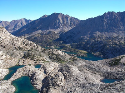 , just west of Independence which itself is over 11000 feet. It wasn’t easy getting out last year and a bit harder getting in. I am in good shape but none of us could be prepared for the altitude. Ray Ellis got up there first after one of my water bottles sprung a leak and I fell back. I rearranged my pack and Rachel accompanied me for an hour. Paul Freiman went up before me but I caught up to him in a little while. He started feeling unwell quickly; something that would bother him for most of the trip. This is a dramatic spot, one of the great views of the Sierras. Once we joined up at the pass we descended past a section which had been recently rerouted and improved.
Our first night was spent at the northern junction above Charlotte Lake. I shoehorned my tent into a tight space and realized I should have placed us at the bigger junction. At my first dinner I found out I had forgotten my salmon. Fortunately between jerky and protein bars I was fine.
Our first true mountain pass the next morning was Glen Pass.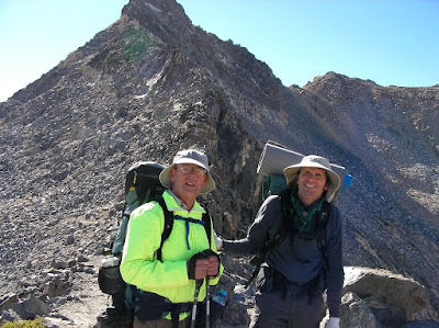 At the time it seemed incredibly challenging but as the hike progressed it was remembered a merely as a good warm up. Most passes are bleak rocky ascents into a treeless world. Some like Selden Pass have a beautiful run up. Still they are an alien place. After Glen Pass we passed through Rae Lakes
 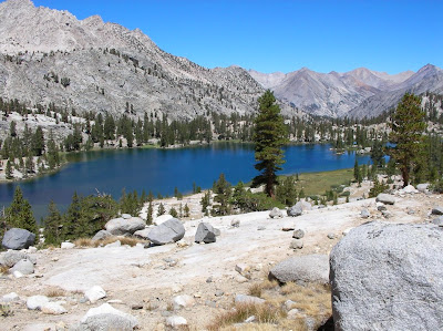 a fine area and crossed our first creek ford. In this case a lake outlet. We were reminded how difficult it must be for early or wet season hikers to cross these things. It is dangerous, time consuming and scary. For me it was sobering.
On day two we ran into a hiker looking for the local Forest Ranger. A diabetic man on Taboose Pass had collapsed and needed help. He said that two doctors were with him, which should be no surprise because of the talent, experience, and quality of the people out hiking. We saw a helicopter fly over later and found out the next day he was in the hospital and doing fine. Saw 103 people on the first full day and 28 women.
I bent one of my hiking poles going up Pinchot Pass which was a bitch with a dozen switchbacks up a nearly vertical rock slide of talus; like walking through steep gravel pit. Many are what I have deemed “Landslide Trails.” Steep rocky trails in a gravel pit. One earthquake and the pass would be blocked. Water is scarcer this year and we make sure to get plenty when we need it. We did Pinchot and Mather in one day. It was too big a chunk. We ran into a very clean hiker: shaved, sparkling, a real scout who said “one pass a day for me.” He was a bit smug. We passed one cool suspension bridge over I believe South Forks Woods Creek. Only one person at a time passes while it swings back and forth. I keep saying to myself “keep looking straight ahead”, spooky. I had blown out two of my three Platypus water bottles. Ray gave me a Nalgene bottle that I used for the rest of the trip. I have to buy new bottles for each trip or risk having none.
The Muir trail section of the PCT is a roller coaster, a pass, a deep valley, steep climbs and descents, a pass and so on. Most of them are beautiful but difficult. Descending in to Deer Meadow we saw patches of dead trees. This was sad because the flora in the Sierras is in such good shape. I thought it was the Bark Beetle but turned out it was fire damage. It appeared a lightening attack had centered itself there.
Paul Freiman decided to fall back and hike at a more comfortable pace to reduce his discomfort from the altitude. His plan was to exit earlier and meet us at the end. I got pretty sick of my protein bars by this time. We always find a food we can’t stand on a trip. I could never get enough beef jerky but later replaced my food bars with Snickers at Vermillion Valley Resort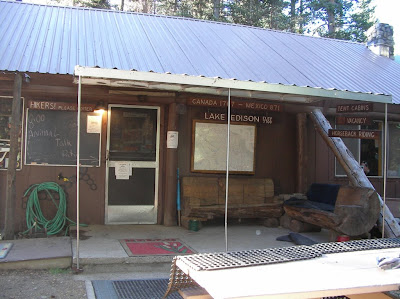 , heaven! We are averaging 11 hour days. Brief stops for water and a short lunch. Before Muir Pass we had the largest campsite, Big Pete Meadow. An early stop, good wash from the creek and lots of really nice people to talk to. There are lot’s of sharp interesting people on the trail. It is a self selected group of educated, aware, motivated people. One lady, a newbie, with a big dream who had struggled in that day over Bishop Pass asked “will Muir Pass be hard?” I told her I hadn’t been there but they were all hard. Very few minorities except for the Asian’s mostly of American extraction. Are white people in general the most likely to enjoy outdoor pursuits? Is this a cultural thing? Ran into to two African Americans both youths with scout groups. I have seen lots of people with fishing poles but only one person with fish.
We had a late camp one night at high altitude above the Palisades Lake near a feeder creek. It was near freezing in the morning. It is never easy to get out of the sleeping bag when there is a chill. Saw a naked man on a rock fresh from a bath, female co hiker looking on. We descended the Golden Staircase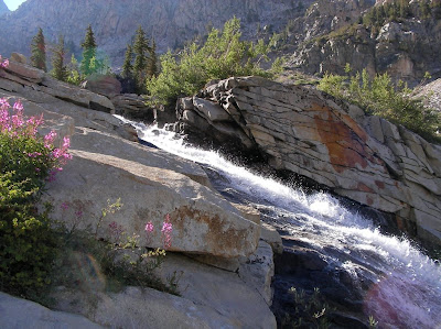 which is blasted out of the rock in a narrow canyon. The handbook says that it was the last section of the Muir trail to be finished and I can see why. We expected summer rains on this trip but it never happened. We had blue skies almost every day. Saw two other people with ULA Catalyst packs. Like me they had changed from the ultra light packs that just don’t carry enough weight. It is a lot more comfortable too.
I like the Sierras but don’t always see the beauty others find. Muir Pass was really a long hard slog but quite a pay off with the view. The Muir hut is one cool thing. Bigger than I imagined. Must have been a heck of a project. Saw Marmots and their babies.
We crossed a lot of rivers on this trip. Most of them were quite low. I can’t imagine trying to cross them in a normal season of snow and rain. It must be quite difficult for early season hikers. I had to take off my shoes once and those rocks hurt bare feet. Only reason I could imagine taking ugly Crocks. I have never had camp shoes.
It got a bit frosty on a couple of mornings. I have 20 degree down bag and I was toasty except for the coldest night. I felt the chill a little.
Ran into a guy who had named himself Wilderness Destroyer the day before when the Rangers asked him to move his tent farther away from the river and trail. He cussed a lot about the situation. Claims he dared the Rangers to give him a ticket. Don’t believe him. I think he is a coward and had the conversation in his tiny head. Ran into a nerd hiker who had just “bushwhacked cross-country.” I got the feeling he felt real winners had what it took to go cross-country. I’d like to try it sometime but not by myself.
Ran into our first Pack Train. There are hikers up here with small packs doing about 10 miles a day that are supported in every way by pack trains. Tents, food, fuel and anything else except the basics is carried for them. I wouldn’t do this plan but it still sounds like a sweet deal. Horses have a pretty good deal up here too. They can poop on the trail. Forgot the riders name but he had 8 horses and mules packed to the gills.
Near Selden Pass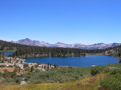 I tripped and fell flat on my face. Banged up my legs and right knee. It would be so easy to get hurt up here. I was carrying my poles while walking on a flat rocky trail and promised myself it wouldn’t happen again. Quite a scare but I was fine. You have to pay attention all the time. You can’t spend too much time sightseeing when you are walking. Selden had the best approach to a pass. Two wonderfully pretty lakes and the perfect forest. It reminded me a bit of some of the trees in the San Bernardino’s that all the same height with no messy forest floor; like a Christmas tree farm. This bit of Eden was enhanced by another beautiful pigtailed hiker who wanted to talk. I think these young women see me as a father figure. I can go with that. They all remind me of my daughter anyway.
My friend and former co hiker Bill Redman is a few days ahead of us on the trail. He has become my PR agent telling several groups we were behind him and describing us. Three groups of hikers recognized me from his description. I feel like a celebrity. I wear a bandana over my face when I hike to protect myself from the sun. I think that is what Bill has told them to look for. One lady who didn’t know me said “you look gangster” and another guy said “I thought I was going to be robbed.” I cover up completely when I hike. I wear long sleeves, long pants, gloves, big hat, sun block and the bandana. The sun is the devil to the skin. We are getting plenty of Vitamin D just being out there. Young hikers look awfully good but the older hikers with a lifetime of sun worship look like a wrinkled leather bags. Not a pretty picture.
Every time I unload my pack it looks like I getting ready for a yard sale. What a mess of bags and detritus. The contents are organized and essential but it doesn’t look like it.
My legs are really starting to ache at night. This was an eleven day trip but I could see a through hiker could never heal with one zero day. This is the hardest consistent physical effort I have ever done and that is saying a lot.
We got to Mono Creek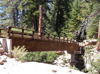 and peeled off to Edison Lake for a ferry to Vermillion Valley Resort. The lake is very low. I heard it was 30 feet below normal. It is pretty surreal. You walk about a mile across mud flats to a place deep enough for the pick up. Three low life young people drinking beer arrived with the Ferry. 15 hikers filled up the ferry which is a euphemism. It is a flat pontoon boat. The pilot put his empty bottle of Stone Ale at his feet and lost control of it as it rolled about and he did foot ballet to keep it there. Most of us looked at each other in stunned silence. I suppose it is difficult to find good help in the middle of nowhere but this was the low end. The “Resort” was a scream. Like a trailer park after an earthquake. The food was great and the young losers that picked us up turned out to nice enough just lost early in life. We suspected the owner who was in town getting supplies lost control when he left the property; when the cats away the mice play. You do get a free tent cabin to sleep in the first night. The chef, waitress and store manager
 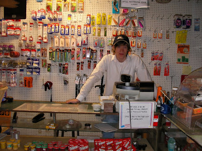 were fine people. After I went to sleep Ray sat at the campfire and watched a bear attack the camp looking for chow. They fired some sort of cherry bomb gun at it with mixed success. We had time to meet some cool people at VVR. One lady, an American living in Oman, we get our help as she comes into the dry Southland.
Going north on the trail means 90 percent of the hikers pass you quickly going the other way so having time to meet people is special. We ran into Paul Freiman getting on the “ferry” when we left. He is doing better. After getting back on the trail had a very stiff climb which ended with 53 switchbacks on the other side of the mountain. Hiking the Muir/PCT trail is a roller coaster. I pitied the people going up that side even though we had done the same in other places. Not long after we stopped for water and creature the size of a fox run by with a small squirrel in its mouth. It must have been his dinner. Saw several deer.
Silver Pass was a gentle climb and pretty one too. There is a notch at the top that turns out to be the pass. Bill Redman’s PR got me recognized by two hiking ladies my age near the top. This trail is becoming very dusty. One particular day I found I had a fine layer of dust on everything.
We had a scare the day before Reds Meadow.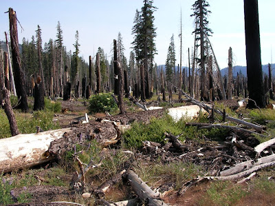 In the morning we were climbing up out of Tully Hole and I said to Ray “it is pretty hazy today.” Later it got worse and I smelled smoke. At Lake Virginia the sky was completely socked in. The first trail gossip we heard turned out to be correct. He said that a Ranger told him it was from the fires near Santa Barbara. For a few hours though we were trying to figure out how we would escape a Sierra Fire. This was a big day for us, 18.5 miles into Reds Meadow. The last 10 miles is pretty pleasant walking. It was good to have a hot meal and a free hot springs shower. The old building has no lights and I had to leave the door open a crack to wash up but it was wonderful. I met owner of the restaurant, store and stables: Bob Tanner. He has run the place for the last 47 years. He has had three strokes and moves at a snails pace with a cane but his mind is great. He doesn’t think that Ansel Adams deserved a forest. He says that he and his buddies did more for the Sierras’ by blocking the Trans Sierra Highway that was going to be built from the Owens Valley to Fresno in the 1960’s, very interesting guy.
Leaving Red’s the next day we walked past the Devil’s Postpile. Having seen it as a child in the nineteen sixties it does, as one older hiker said to me, “look smaller now.” It still is a remarkable geologic site. After Agnew Meadow there is a steep climb into higher altitude but virtually treeless. There is a lot of water here. This mountain must be a big sponge. The view of the Minarets and Shadow Lake is breathtaking. The skies were still hazy from the fire. I will find a picture of the view we had and post it here. My photo wouldn’t have done it justice. As I mentioned before I quickly get my fill of the beauty of nature after hiking for days but this transcended it. The Muir Trail which splits from the PCT after Red’s rejoins it in this section.
We camped at Badger Lake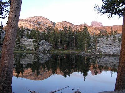 off trail after we met the Badger Lake Chamber of Commerce. This was a family that was camping there and insisted we meet them later. We went to the lake and kept hearing them say “over here, over here” and then never saw them again. Except for a few fisherman it was empty. My feet were in good shape. Haven’t had a blister in all these miles but my legs started to ache at night in the tent.
 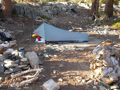 Thank goodness for ibuprofen. Did I mention catch and release fishing is silly. You should eat them unless they are too small. Not that I am fishing. What a lousy hobby if you can’t eat the result.
We came down into Thousand Island Lakes the next morning and I missed a turn and wasted an hour touring the shoreline. When we finally got out of there I tried not to turn back and look at it. I was afraid I’d turn into dressing.
Our last pass was Donahue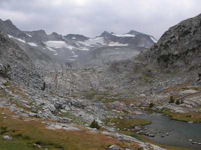 and it looked like a piece of cake on paper but it is a pile of rocks on both sides. It is a real leg beater. I got really tired going up to the summit. I didn’t want to slow down because some clouds were coming in and I didn’t want to get stuck up there in a storm. I waited for Ray and said “let’s get the hell off this pass before something happens.” He said “I don’t care if it rains.” I replied “who cares about rain.” Descending from Donahue is rougher than ascending. Both sides are very rocky but the north side is bone shaking and knee jarring. Just when you can’t take it anymore it smoothes out to flat Lyell Canyon the best way to finish this section. We spent the night at the trail for Vogelsang High Sierra Camp. I thought I saw a Bigfoot but it turned out to be a teenager. The last day was very chilly till the sun came into the canyon and then an easy short walk to Tuolumne Meadows.
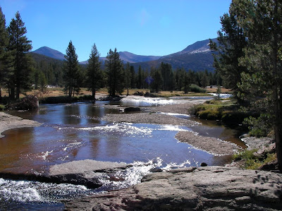 We ran into Paul Freiman early just as he said and to our surprise Bill Redman who was hanging around for a permit to go. We had a tough but fulfilling hike. As soon as I was done I started thinking about the next segment north to Lake Tahoe. Often I can’t wait for a hike to end but then….
I was reading about poetry in a history of Japan. The poet-scholar Tsurayuki said “In a world full of things man strives to find words to express the impression left on his heart by sight and sound.” The impression I have is that the Sierras are dramatic, stark, beautiful and inhospitable right below the surface. We only have a small window in which we can pass fairly safely. The biggest impression for me was the achievement of finishing this section. Personal accomplishment moves me more than nature. I could never be a poet.
Our sections get farther and farther away. We have walked every step of the PCT consecutively north from Campo, Ca. It now means it really takes a whole day to get to the trailhead. In this case we had to drop off a car at Tuolumne Meadows, spend a night in the backpacker’s campground, and get a ride to Onion Valley near Independence to reenter the trail. There was a search on up in the Yosemite area for a lost hiker. The rangers didn’t have time to talk. Our driver was Rachel Ginsburg of Oakland. She was my “blind date” early this year when I picked her up at the San Diego for a ride to a PCT segment here in San Diego. I have a lot to do to make up for her help on this long section. Getting back to our latest section means walking over Kearsarge Pass
 , just west of Independence which itself is over 11000 feet. It wasn’t easy getting out last year and a bit harder getting in. I am in good shape but none of us could be prepared for the altitude. Ray Ellis got up there first after one of my water bottles sprung a leak and I fell back. I rearranged my pack and Rachel accompanied me for an hour. Paul Freiman went up before me but I caught up to him in a little while. He started feeling unwell quickly; something that would bother him for most of the trip. This is a dramatic spot, one of the great views of the Sierras. Once we joined up at the pass we descended past a section which had been recently rerouted and improved.
Our first night was spent at the northern junction above Charlotte Lake. I shoehorned my tent into a tight space and realized I should have placed us at the bigger junction. At my first dinner I found out I had forgotten my salmon. Fortunately between jerky and protein bars I was fine.
Our first true mountain pass the next morning was Glen Pass.
 At the time it seemed incredibly challenging but as the hike progressed it was remembered a merely as a good warm up. Most passes are bleak rocky ascents into a treeless world. Some like Selden Pass have a beautiful run up. Still they are an alien place. After Glen Pass we passed through Rae Lakes
  a fine area and crossed our first creek ford. In this case a lake outlet. We were reminded how difficult it must be for early or wet season hikers to cross these things. It is dangerous, time consuming and scary. For me it was sobering.
On day two we ran into a hiker looking for the local Forest Ranger. A diabetic man on Taboose Pass had collapsed and needed help. He said that two doctors were with him, which should be no surprise because of the talent, experience, and quality of the people out hiking. We saw a helicopter fly over later and found out the next day he was in the hospital and doing fine. Saw 103 people on the first full day and 28 women.
I bent one of my hiking poles going up Pinchot Pass which was a bitch with a dozen switchbacks up a nearly vertical rock slide of talus; like walking through steep gravel pit. Many are what I have deemed “Landslide Trails.” Steep rocky trails in a gravel pit. One earthquake and the pass would be blocked. Water is scarcer this year and we make sure to get plenty when we need it. We did Pinchot and Mather in one day. It was too big a chunk. We ran into a very clean hiker: shaved, sparkling, a real scout who said “one pass a day for me.” He was a bit smug. We passed one cool suspension bridge
 over I believe South Forks Woods Creek. Only one person at a time passes while it swings back and forth. I keep saying to myself “keep looking straight ahead”, spooky. I had blown out two of my three Platypus water bottles. Ray gave me a Nalgene bottle that I used for the rest of the trip. I have to buy new bottles for each trip or risk having none.
 The Muir trail section of the PCT is a roller coaster, a pass, a deep valley, steep climbs and descents, a pass and so on. Most of them are beautiful but difficult. Descending in to Deer Meadow we saw patches of dead trees. This was sad because the flora in the Sierras is in such good shape. I thought it was the Bark Beetle but turned out it was fire damage. It appeared a lightening attack had centered itself there.
Paul Freiman decided to fall back and hike at a more comfortable pace to reduce his discomfort from the altitude. His plan was to exit earlier and meet us at the end. I got pretty sick of my protein bars by this time. We always find a food we can’t stand on a trip. I could never get enough beef jerky but later replaced my food bars with Snickers at Vermillion Valley Resort
 , heaven! We are averaging 11 hour days. Brief stops for water and a short lunch. Before Muir Pass we had the largest campsite, Big Pete Meadow. An early stop, good wash from the creek and lots of really nice people to talk to. There are lot’s of sharp interesting people on the trail. It is a self selected group of educated, aware, motivated people. One lady, a newbie, with a big dream who had struggled in that day over Bishop Pass asked “will Muir Pass be hard?” I told her I hadn’t been there but they were all hard. Very few minorities except for the Asian’s mostly of American extraction. Are white people in general the most likely to enjoy outdoor pursuits? Is this a cultural thing? Ran into to two African Americans both youths with scout groups. I have seen lots of people with fishing poles but only one person with fish.
We had a late camp one night at high altitude above the Palisades Lake near a feeder creek. It was near freezing in the morning. It is never easy to get out of the sleeping bag when there is a chill. Saw a naked man on a rock fresh from a bath, female co hiker looking on. We descended the Golden Staircase
 which is blasted out of the rock in a narrow canyon. The handbook says that it was the last section of the Muir trail to be finished and I can see why. We expected summer rains on this trip but it never happened. We had blue skies almost every day. Saw two other people with ULA Catalyst packs. Like me they had changed from the ultra light packs that just don’t carry enough weight. It is a lot more comfortable too.
I like the Sierras but don’t always see the beauty others find. Muir Pass was really a long hard slog but quite a pay off with the view. The Muir hut is one cool thing. Bigger than I imagined. Must have been a heck of a project. Saw Marmots and their babies.
We crossed a lot of rivers on this trip. Most of them were quite low. I can’t imagine trying to cross them in a normal season of snow and rain. It must be quite difficult for early season hikers. I had to take off my shoes once and those rocks hurt bare feet. Only reason I could imagine taking ugly Crocks. I have never had camp shoes.
It got a bit frosty on a couple of mornings. I have 20 degree down bag and I was toasty except for the coldest night. I felt the chill a little.
Ran into a guy who had named himself Wilderness Destroyer the day before when the Rangers asked him to move his tent farther away from the river and trail. He cussed a lot about the situation. Claims he dared the Rangers to give him a ticket. Don’t believe him. I think he is a coward and had the conversation in his tiny head. Ran into a nerd hiker who had just “bushwhacked cross-country.” I got the feeling he felt real winners had what it took to go cross-country. I’d like to try it sometime but not by myself.
Ran into our first Pack Train. There are hikers up here with small packs doing about 10 miles a day that are supported in every way by pack trains. Tents, food, fuel and anything else except the basics is carried for them. I wouldn’t do this plan but it still sounds like a sweet deal. Horses have a pretty good deal up here too. They can poop on the trail. Forgot the riders name but he had 8 horses and mules packed to the gills.
Near Selden Pass
 I tripped and fell flat on my face. Banged up my legs and right knee. It would be so easy to get hurt up here. I was carrying my poles while walking on a flat rocky trail and promised myself it wouldn’t happen again. Quite a scare but I was fine. You have to pay attention all the time. You can’t spend too much time sightseeing when you are walking. Selden had the best approach to a pass. Two wonderfully pretty lakes and the perfect forest. It reminded me a bit of some of the trees in the San Bernardino’s that all the same height with no messy forest floor; like a Christmas tree farm. This bit of Eden was enhanced by another beautiful pigtailed hiker who wanted to talk. I think these young women see me as a father figure. I can go with that. They all remind me of my daughter anyway.
 My friend and former co hiker Bill Redman is a few days ahead of us on the trail. He has become my PR agent telling several groups we were behind him and describing us. Three groups of hikers recognized me from his description. I feel like a celebrity. I wear a bandana over my face when I hike to protect myself from the sun. I think that is what Bill has told them to look for. One lady who didn’t know me said “you look gangster” and another guy said “I thought I was going to be robbed.” I cover up completely when I hike. I wear long sleeves, long pants, gloves, big hat, sun block and the bandana. The sun is the devil to the skin. We are getting plenty of Vitamin D just being out there. Young hikers look awfully good but the older hikers with a lifetime of sun worship look like a wrinkled leather bags. Not a pretty picture.
Every time I unload my pack it looks like I getting ready for a yard sale. What a mess of bags and detritus. The contents are organized and essential but it doesn’t look like it.
My legs are really starting to ache at night. This was an eleven day trip but I could see a through hiker could never heal with one zero day. This is the hardest consistent physical effort I have ever done and that is saying a lot.
We got to Mono Creek
 and peeled off to Edison Lake for a ferry to Vermillion Valley Resort. The lake is very low. I heard it was 30 feet below normal. It is pretty surreal. You walk about a mile across mud flats to a place deep enough for the pick up. Three low life young people drinking beer arrived with the Ferry. 15 hikers filled up the ferry which is a euphemism. It is a flat pontoon boat. The pilot put his empty bottle of Stone Ale at his feet and lost control of it as it rolled about and he did foot ballet to keep it there. Most of us looked at each other in stunned silence. I suppose it is difficult to find good help in the middle of nowhere but this was the low end. The “Resort” was a scream. Like a trailer park after an earthquake. The food was great and the young losers that picked us up turned out to nice enough just lost early in life. We suspected the owner who was in town getting supplies lost control when he left the property; when the cats away the mice play. You do get a free tent cabin to sleep in the first night. The chef, waitress and store manager
  were fine people. After I went to sleep Ray sat at the campfire and watched a bear attack the camp looking for chow. They fired some sort of cherry bomb gun at it with mixed success. We had time to meet some cool people at VVR. One lady, an American living in Oman, we get our help as she comes into the dry Southland.
Going north on the trail means 90 percent of the hikers pass you quickly going the other way so having time to meet people is special. We ran into Paul Freiman getting on the “ferry” when we left. He is doing better. After getting back on the trail had a very stiff climb which ended with 53 switchbacks on the other side of the mountain. Hiking the Muir/PCT trail is a roller coaster. I pitied the people going up that side even though we had done the same in other places. Not long after we stopped for water and creature the size of a fox run by with a small squirrel in its mouth. It must have been his dinner. Saw several deer.
Silver Pass was a gentle climb and pretty one too. There is a notch at the top that turns out to be the pass. Bill Redman’s PR got me recognized by two hiking ladies my age near the top. This trail is becoming very dusty. One particular day I found I had a fine layer of dust on everything.
We had a scare the day before Reds Meadow.
 In the morning we were climbing up out of Tully Hole and I said to Ray “it is pretty hazy today.” Later it got worse and I smelled smoke. At Lake Virginia the sky was completely socked in. The first trail gossip we heard turned out to be correct. He said that a Ranger told him it was from the fires near Santa Barbara. For a few hours though we were trying to figure out how we would escape a Sierra Fire. This was a big day for us, 18.5 miles into Reds Meadow. The last 10 miles is pretty pleasant walking. It was good to have a hot meal and a free hot springs shower. The old building has no lights and I had to leave the door open a crack to wash up but it was wonderful. I met owner of the restaurant, store and stables: Bob Tanner. He has run the place for the last 47 years. He has had three strokes and moves at a snails pace with a cane but his mind is great. He doesn’t think that Ansel Adams deserved a forest. He says that he and his buddies did more for the Sierras’ by blocking the Trans Sierra Highway that was going to be built from the Owens Valley to Fresno in the 1960’s, very interesting guy.
Leaving Red’s the next day we walked past the Devil’s Postpile. Having seen it as a child in the nineteen sixties it does, as one older hiker said to me, “look smaller now.” It still is a remarkable geologic site. After Agnew Meadow there is a steep climb into higher altitude but virtually treeless. There is a lot of water here. This mountain must be a big sponge. The view of the Minarets and Shadow Lake is breathtaking. The skies were still hazy from the fire. I will find a picture of the view we had and post it here. My photo wouldn’t have done it justice. As I mentioned before I quickly get my fill of the beauty of nature after hiking for days but this transcended it. The Muir Trail which splits from the PCT after Red’s rejoins it in this section.
We camped at Badger Lake
 off trail after we met the Badger Lake Chamber of Commerce. This was a family that was camping there and insisted we meet them later. We went to the lake and kept hearing them say “over here, over here” and then never saw them again. Except for a few fisherman it was empty. My feet were in good shape. Haven’t had a blister in all these miles but my legs started to ache at night in the tent.
  Thank goodness for ibuprofen. Did I mention catch and release fishing is silly. You should eat them unless they are too small. Not that I am fishing. What a lousy hobby if you can’t eat the result.
We came down into Thousand Island Lakes the next morning and I missed a turn and wasted an hour touring the shoreline. When we finally got out of there I tried not to turn back and look at it. I was afraid I’d turn into dressing.
Our last pass was Donahue
 and it looked like a piece of cake on paper but it is a pile of rocks on both sides. It is a real leg beater. I got really tired going up to the summit. I didn’t want to slow down because some clouds were coming in and I didn’t want to get stuck up there in a storm. I waited for Ray and said “let’s get the hell off this pass before something happens.” He said “I don’t care if it rains.” I replied “who cares about rain.” Descending from Donahue is rougher than ascending. Both sides are very rocky but the north side is bone shaking and knee jarring. Just when you can’t take it anymore it smoothes out to flat Lyell Canyon the best way to finish this section. We spent the night at the trail for Vogelsang High Sierra Camp. I thought I saw a Bigfoot but it turned out to be a teenager. The last day was very chilly till the sun came into the canyon and then an easy short walk to Tuolumne Meadows.
 We ran into Paul Freiman early just as he said and to our surprise Bill Redman who was hanging around for a permit to go. We had a tough but fulfilling hike. As soon as I was done I started thinking about the next segment north to Lake Tahoe. Often I can’t wait for a hike to end but then….
 I was reading about poetry in a history of Japan. The poet-scholar Tsurayuki said “In a world full of things man strives to find words to express the impression left on his heart by sight and sound.” The impression I have is that the Sierras are dramatic, stark, beautiful and inhospitable right below the surface. We only have a small window in which we can pass fairly safely. The biggest impression for me was the achievement of finishing this section. Personal accomplishment moves me more than nature. I could never be a poet.
Sunday, September 24, 2006
Pacific Crest Trail trip 21 – August 18th through August 25th, 2006. 87 Miles.
See the photos here:
This was the longest trip yet. We spent seven days on the trail and took a ton of food. As always it took a bit of work dropping off a vehicle at the end and getting back to Kennedy Meadows. We hired Gary from Ridgecrest to take us to Kennedy. It took about 10 hours to pull it off and then we walked 11 miles. The weather was nice for the whole trip. I don't think it got much above 80 degrees. We passed and saw Beck and Monache Meadows. There was a controlled burn in this area that made the view a little murky. There never was a real clear day because of other fires. We are all carrying about 40lbs with food and bear canisters. It is the law up here and three extra pounds. I immediately felt the extra weight. I decided to bring my Mariposa Pack and it is overloaded. I took a chance with a light pack that turned out well. There is a lot of water up here. I think the farthest distance between water sources is seven miles and that is a miracle after 700 miles in Southern California. This is still cow country. We saw a big black object near the South Kern. Our eyes are old enough that for a while we thought it was a bear. Only a bovine. At the South Kern River we ran into a Sierra Club group that had bagged Olancha Peak. A guy came up to us in the dark and recommended we camp on the other side of the river. He thought we were part of his group and frankly he was a little nosy. After he found out we weren't with him he kept giving us advice. He turned me off. We were at 8000 or so feet and the stars were awesome. We got frost the next morning and our water bladders were frozen. It was a reminder to sleep with your water bottles. You can't filter water either with frozen tubes. Our first leg took us a long way up Cow Canyon. We filtered along the way: 14 hard miles today. We did see a lot of skunk cabbage. It was a bit hard to follow the trail in places because the whole area is so recently wet that every bush and plant is growing like a weed. There are still some wildflowers at higher altitudes which is a pleasure. We crossed Gomez Meadow on a causeway (a word I like to use) that keeps your feet out of the swampy meadow. A sheepherder carved a man smoking a pipe on a tree here about 100 years ago. I like ancient graffiti. We took a long to time to go the eight miles to pass the turn off for Olancha Peak and then down into Death Canyon. Our camp location that night was sensibly set by Bill before a 2000 foot climb that next day. I have developed a rash again on my lower back from the heavy pack. I think it is from the pack. I put duct tape on it and wrapped my fleece around my waist to stop its progress. The big climb on the 20th gave us a great view of Owens Valley to the east and the White Mountains. Perhaps we shall investigate them some day. We ran into Dave Drew recently retired from the Alaska DOT doing a section. Most of the hiking today followed a ridge that had several places to go off trail for water. I watched them all closely so we could get water at the last possible one, Dutch Meadow, to reduce water weight and then I missed it. We had to walk to Corpsman Creek to get water and we were thrilled when we saw it. We passed Trail Pass Trail. We needed a good camping spot and we found it at the edge of Poison Meadow which had a beautiful view east and west here.
On the 21st after Cottonwood Pass we passed Chicken Spring Lake. This beautiful lake with surrounding dramatic rocks called cirques marked the beginning of uniquely Sierran views. We had a big up after this and walked through a nasty section of rocks and sand. It slows you down and beats up your feet. There were some great views of mountains to the west. We passed a young couple. The women was pregnant and seemed to be far along. It couldn't be too long until a hiker baby was born. Another hiker, Bill, was starting his JMT trek from Cottonwood Pass. He was way overloaded and later we shared our water so he could survive to the next source. This day was the shortest. We slowly descended into Rock Creek, one beautiful place. We were alone when we arrived but soon there were 20 other hikers in the campground, a Sierra Club group, some older Boy Scouts with dads and a few strays. Bill, Ray and I were able to wash off very well in the river and even do some laundry. This has to be one of the more idyllic places we have ever been. One guy in the Sierra group figured out Bill's age and accomplishments and went on and on about how amazing he was. It made his day or week. It was nice to have some company to talk to. Saw our first Ranger who wanted to see our permits and bear canister. I showed her everything she needed while washing Ray's hair. She looked at the permit and said, "Where's Manning?" I explained it was the Canadian border. We attained Guyot Peak by 9:00AM the morning of the 22nd on the way to Crabtree Meadow. 3800 foot gain today which is the biggest of the hike. At 1:00PM today we met the John Muir Trail. The PCT and JMT join each other for 176 miles. It came after Crabtree Meadow which has a terrific view of the mountains to the east including Whitney. We had a big tiring climb up to the Bighorn Plateau that we were sure was badly routed. I renamed it "What's the Point" but it turned out to be the best way. Most of all our hiking has been at ten or eleven thousand feet, often above the tree line. The plateau has a 360 view of every mountain range within 50 miles. I saw my first Marmot. Our camp was at the crossing of Tyndale Creek which appears to run through blocks of rock stacked like Legos. I found a personal pool protected from the rushing water. It was wonderful. I almost got clean. We put our food in a Bear Box for the first time, a bear canister in a bear box, funny.
The next day we went over Forrester Pass after passing through a land of mystery and beauty. It was a something out of Tolkien. We passed creeks, ponds, grass, views of Whitney and patches of snow, some of which was watermelon snow, pink from algae. It reminded me of a Chinese contemplative garden. Now we have seen what they try to recreate in an urban setting. We met a very attractive lady, a Veterinarian from Canada, on the way up, obviously a veteran hiker. We took her picture and Bill and I were smitten. The trail over Forester Pass is a remarkable achievement. In places it seems to be carved out of the rock. Huge boulders everywhere. A nineteen year old died in 1930 when it was built and there is a plaque commemorating his death. We all felt very strong going up to the highest point on the PCT. There were at least eight hikers coming up the other way when we arrived. This turned into a flood of people we passed in the next few hours. Most of them loaded to the gills. I was worried that we had too much weight but almost everyone else had to be carrying ten to twenty pounds more. I felt sorry for them. I passed through a strip of snow covering the trail and the guys decided to walk around it on the talus. Bill said "you seem to be doing well" and then I fell on my butt. Soft landing and I was fine. Pride goeth
before the snow fall. There are lots of lakes here and many have a beaten path to them. I am sure the angling is good because we can see the fish hitting the surface. We descended into Vidette Meadows in a lovely treed area with Bubb's Creek nearby. We passed a lot of small streams and near the end of the meadow there were about six in a row which must be a record. We took a long break near the end of the day for a meal, washing and rest before climbing steeply out of the canyon. We saw a batch of lightly loaded hikers on the way up. There was a large pack train near the bottom and we deduced that they had been dropped off near the top to get the hiking experience. This climb was hard. We arrived about 7:00PM for our final camp near the junction of Kearsarge Pass and Charlotte Lake trails. We started the walk over Kearsarge early the next morning. It was Ray's 61st birthday. There are several lakes near and below the trail on both sides. Several feeder streams cross the trail. We never had to take off our shoes to ford a stream on this trip. The way out of a Sierra hike is a familiar one now with a sharp climb to a place in a rock wall and then down. There was good stream of hikers passing us on the way down. The first had a fishing pole and a Labrador. A Lab seems like the perfect trail dog and happy to be hiking. It is a long way down to the parking lot. We arrived about 11:00AM. I saw 154 hikers on this trip. The Sierras are pristine. People seem to be taking careful care in their travels. This was tough hiking. The views are becoming more beautiful and dramatic. It don't think, with snow pack, that we will be able to continue our journey for at least 10 or 11 months but we hope to get in some kind of trip in the meantime.
This was the longest trip yet. We spent seven days on the trail and took a ton of food. As always it took a bit of work dropping off a vehicle at the end and getting back to Kennedy Meadows. We hired Gary from Ridgecrest to take us to Kennedy. It took about 10 hours to pull it off and then we walked 11 miles. The weather was nice for the whole trip. I don't think it got much above 80 degrees. We passed and saw Beck and Monache Meadows. There was a controlled burn in this area that made the view a little murky. There never was a real clear day because of other fires. We are all carrying about 40lbs with food and bear canisters. It is the law up here and three extra pounds. I immediately felt the extra weight. I decided to bring my Mariposa Pack and it is overloaded. I took a chance with a light pack that turned out well. There is a lot of water up here. I think the farthest distance between water sources is seven miles and that is a miracle after 700 miles in Southern California. This is still cow country. We saw a big black object near the South Kern. Our eyes are old enough that for a while we thought it was a bear. Only a bovine. At the South Kern River we ran into a Sierra Club group that had bagged Olancha Peak. A guy came up to us in the dark and recommended we camp on the other side of the river. He thought we were part of his group and frankly he was a little nosy. After he found out we weren't with him he kept giving us advice. He turned me off. We were at 8000 or so feet and the stars were awesome. We got frost the next morning and our water bladders were frozen. It was a reminder to sleep with your water bottles. You can't filter water either with frozen tubes. Our first leg took us a long way up Cow Canyon. We filtered along the way: 14 hard miles today. We did see a lot of skunk cabbage. It was a bit hard to follow the trail in places because the whole area is so recently wet that every bush and plant is growing like a weed. There are still some wildflowers at higher altitudes which is a pleasure. We crossed Gomez Meadow on a causeway (a word I like to use) that keeps your feet out of the swampy meadow. A sheepherder carved a man smoking a pipe on a tree here about 100 years ago. I like ancient graffiti. We took a long to time to go the eight miles to pass the turn off for Olancha Peak and then down into Death Canyon. Our camp location that night was sensibly set by Bill before a 2000 foot climb that next day. I have developed a rash again on my lower back from the heavy pack. I think it is from the pack. I put duct tape on it and wrapped my fleece around my waist to stop its progress. The big climb on the 20th gave us a great view of Owens Valley to the east and the White Mountains. Perhaps we shall investigate them some day. We ran into Dave Drew recently retired from the Alaska DOT doing a section. Most of the hiking today followed a ridge that had several places to go off trail for water. I watched them all closely so we could get water at the last possible one, Dutch Meadow, to reduce water weight and then I missed it. We had to walk to Corpsman Creek to get water and we were thrilled when we saw it. We passed Trail Pass Trail. We needed a good camping spot and we found it at the edge of Poison Meadow which had a beautiful view east and west here.
On the 21st after Cottonwood Pass we passed Chicken Spring Lake. This beautiful lake with surrounding dramatic rocks called cirques marked the beginning of uniquely Sierran views. We had a big up after this and walked through a nasty section of rocks and sand. It slows you down and beats up your feet. There were some great views of mountains to the west. We passed a young couple. The women was pregnant and seemed to be far along. It couldn't be too long until a hiker baby was born. Another hiker, Bill, was starting his JMT trek from Cottonwood Pass. He was way overloaded and later we shared our water so he could survive to the next source. This day was the shortest. We slowly descended into Rock Creek, one beautiful place. We were alone when we arrived but soon there were 20 other hikers in the campground, a Sierra Club group, some older Boy Scouts with dads and a few strays. Bill, Ray and I were able to wash off very well in the river and even do some laundry. This has to be one of the more idyllic places we have ever been. One guy in the Sierra group figured out Bill's age and accomplishments and went on and on about how amazing he was. It made his day or week. It was nice to have some company to talk to. Saw our first Ranger who wanted to see our permits and bear canister. I showed her everything she needed while washing Ray's hair. She looked at the permit and said, "Where's Manning?" I explained it was the Canadian border. We attained Guyot Peak by 9:00AM the morning of the 22nd on the way to Crabtree Meadow. 3800 foot gain today which is the biggest of the hike. At 1:00PM today we met the John Muir Trail. The PCT and JMT join each other for 176 miles. It came after Crabtree Meadow which has a terrific view of the mountains to the east including Whitney. We had a big tiring climb up to the Bighorn Plateau that we were sure was badly routed. I renamed it "What's the Point" but it turned out to be the best way. Most of all our hiking has been at ten or eleven thousand feet, often above the tree line. The plateau has a 360 view of every mountain range within 50 miles. I saw my first Marmot. Our camp was at the crossing of Tyndale Creek which appears to run through blocks of rock stacked like Legos. I found a personal pool protected from the rushing water. It was wonderful. I almost got clean. We put our food in a Bear Box for the first time, a bear canister in a bear box, funny.
The next day we went over Forrester Pass after passing through a land of mystery and beauty. It was a something out of Tolkien. We passed creeks, ponds, grass, views of Whitney and patches of snow, some of which was watermelon snow, pink from algae. It reminded me of a Chinese contemplative garden. Now we have seen what they try to recreate in an urban setting. We met a very attractive lady, a Veterinarian from Canada, on the way up, obviously a veteran hiker. We took her picture and Bill and I were smitten. The trail over Forester Pass is a remarkable achievement. In places it seems to be carved out of the rock. Huge boulders everywhere. A nineteen year old died in 1930 when it was built and there is a plaque commemorating his death. We all felt very strong going up to the highest point on the PCT. There were at least eight hikers coming up the other way when we arrived. This turned into a flood of people we passed in the next few hours. Most of them loaded to the gills. I was worried that we had too much weight but almost everyone else had to be carrying ten to twenty pounds more. I felt sorry for them. I passed through a strip of snow covering the trail and the guys decided to walk around it on the talus. Bill said "you seem to be doing well" and then I fell on my butt. Soft landing and I was fine. Pride goeth
before the snow fall. There are lots of lakes here and many have a beaten path to them. I am sure the angling is good because we can see the fish hitting the surface. We descended into Vidette Meadows in a lovely treed area with Bubb's Creek nearby. We passed a lot of small streams and near the end of the meadow there were about six in a row which must be a record. We took a long break near the end of the day for a meal, washing and rest before climbing steeply out of the canyon. We saw a batch of lightly loaded hikers on the way up. There was a large pack train near the bottom and we deduced that they had been dropped off near the top to get the hiking experience. This climb was hard. We arrived about 7:00PM for our final camp near the junction of Kearsarge Pass and Charlotte Lake trails. We started the walk over Kearsarge early the next morning. It was Ray's 61st birthday. There are several lakes near and below the trail on both sides. Several feeder streams cross the trail. We never had to take off our shoes to ford a stream on this trip. The way out of a Sierra hike is a familiar one now with a sharp climb to a place in a rock wall and then down. There was good stream of hikers passing us on the way down. The first had a fishing pole and a Labrador. A Lab seems like the perfect trail dog and happy to be hiking. It is a long way down to the parking lot. We arrived about 11:00AM. I saw 154 hikers on this trip. The Sierras are pristine. People seem to be taking careful care in their travels. This was tough hiking. The views are becoming more beautiful and dramatic. It don't think, with snow pack, that we will be able to continue our journey for at least 10 or 11 months but we hope to get in some kind of trip in the meantime.
Tuesday, June 20, 2006
Pacific Crest Trail Hike 20
Walker Pass to Kennedy Meadows – June 5th – 8th, 2006 51.6 miles.
See the pictures here
Listen to the Podcast here
powered by ODEO
On June 5th we left Walker Pass Trailhead after 2:00PM. These hikes are getting more difficult to get to. We had Dollar rent-a-car pick us up in Kennedy Meadows and drop us off. It was 91 degrees. A few minutes into the walk a fighter jet flew west through the canyon below us. It was very quiet. At first Ray thought it was a big rig. In five miles we got a big view of Inyokern, China Lake and Ridgecrest and plenty of budding Pinyon Trees. We still haven't eaten from them yet. There is a memorial plaque here to Jim Jenkins who helped the PCT a lot before he left this world early at the age of 28. Lots of footsteps from the through hikers here. This is the season. I have mixed feelings about the through hikers. I want to see them and talk to them but we have the trail to ourselves, at least so far, for most of the year. We met 10 hikers in 50 miles. I can't imagine why I think this might be important. It was a joy to see all 10 of them.
We got in 8 miles that first day and climbed several thousand feet to the Owens and Jenkins Mountains saddle. Its big shadow is projected on the Mojave Desert at dusk. Met the Mad Scientists, Amy and Mike. She is a botanist; he is a wildlife expert. They have done California before and this time they are using the trip to gather information for their graduate thesis on determining what kind of wildlife exists based on the vegetation in an area. They both attend UC Davis. Great couple. We slept well and had good views east and west.
The next day we got our water at the seasonal creek before Joshua Springs spur trail (the water source at Joshua Springs has traces of uranium in it, and though not serious is worth missing) before going down Spanish Needle Creek. We saw Nolina Plants (Parry's Nolina) which are related to the Yucca but with an incredible lantern of small yellow blossoms that are firm like a leaf. At a Spanish Needle Creek tributary we had lunch in cool shade and filled up on water for our steepest climb of the trip. Along the way, we spooked two families of Mountain Quail with cute tiny chicks running around. The moms aren't as nervous around us when they have kids and spend their time rounding them up. It is funny to watch. Fortunately out first two
afternoons were cloudy and cool. Trainman had just gone through this section with his hiking partner a few days before and had a tougher time of it, I suppose because of the heat. The saddle above Spanish Needle near Lamont Peak provided a nice view and break. Soon we got another great view of the Mojave. The trail is in good shape here. We arrived tired after a 20 mile day. We bumped into Tadpole at a creek before Chimney Creek Camp and were barely civil. We apologized later. We walked up Canebrake road to the camp and met Moondancer and his son Prickly Pear at the campground. This kid is precocious and quite a climber. Talking to Moondancer later, he says, "Are your Dana Law?" Turns out he had called me several months
earlier about information on a previous section. He is a professor at Boise State University. Birds of a feather hike together! Thirty million people in California but if you have a niche interest you will probably meet someone who shares it. Three other hikers came into camp, two young men and a lady. Her name was Twisted Sister. You gotta love trail names. The three left early the next morning and we didn't see them again. A good camp and pleasant dinner, though my alcohol stove is getting sooty. I think my fuel has been contaminated.
On June 7th, we had big climb but over many miles. We saw a lone Sequoia far south of its usual habitat. Passed Fox Mill Springs and entered into the 14 mile burned section. Did some magic tricks for Prickly Pear on the trail. He has money in his ears! Crossed the highest point on the trip, over 8000 feet. Not much to look at because of the burn but got a beautiful view of the Dome Lands National Park. It looks like a climber's paradise. Also a great view again of the snow-capped Sierras. Bill could pick out Mount Langley which hides Mount Whitney nearby. We had a long descent into Woodpecker Meadow crossing many diorite rivers of rock down to Rockhouse
Basin. Long two-hour lunch with hot food under a giant burned out tree. Good stream here. I washed just about everything. We arrived at the first true river in 700 miles, the Kern. Even though Whitewater River was big last year because of the record rains, The Kern is a true river. For some reason I thought we had to cross the thing but that was not the case. Ray said, "I am not crossing any rivers!" and I felt the same. We won't have that luxury further up the Sierras. We camped with Sonny and Tadpole at Pine Creek before it runs into the Kern River. They had seen a big bear on the trail that day. Tadpole is as nice as she can be, and Sonny is the same with the addition that he is a total gear head and loves learning about every aspect of hiking. I wish when I was that age I asked as many questions. He was picking up a ULA pack in Kennedy Meadows that we didn't get to see. I gave him my pack of salmon I wouldn't have been able to eat, and he filtered my water at the creek. We had some thunder and a bit of rain that made us put our rainflys on but they came off for a night of a nearly-full moon and bright stars. It cooled off and chilled our water for the last day's segment.
June 8th: We walked about seven miles into Kennedy Meadows, a pretty area. The Kennedy Store looks just as a mountain store should. We had drinks and snacks with Tadpole and Sonny. We ran into the famous Lawn Ornament (famous to me for her trail name). The trail ahead is the most challenging because we will have to make much longer sections during a limited time of the year. We will go again for as long as we can in August. Hiking is outdoor therapy.
See the pictures here
Listen to the Podcast here
powered by ODEO
On June 5th we left Walker Pass Trailhead after 2:00PM. These hikes are getting more difficult to get to. We had Dollar rent-a-car pick us up in Kennedy Meadows and drop us off. It was 91 degrees. A few minutes into the walk a fighter jet flew west through the canyon below us. It was very quiet. At first Ray thought it was a big rig. In five miles we got a big view of Inyokern, China Lake and Ridgecrest and plenty of budding Pinyon Trees. We still haven't eaten from them yet. There is a memorial plaque here to Jim Jenkins who helped the PCT a lot before he left this world early at the age of 28. Lots of footsteps from the through hikers here. This is the season. I have mixed feelings about the through hikers. I want to see them and talk to them but we have the trail to ourselves, at least so far, for most of the year. We met 10 hikers in 50 miles. I can't imagine why I think this might be important. It was a joy to see all 10 of them.
We got in 8 miles that first day and climbed several thousand feet to the Owens and Jenkins Mountains saddle. Its big shadow is projected on the Mojave Desert at dusk. Met the Mad Scientists, Amy and Mike. She is a botanist; he is a wildlife expert. They have done California before and this time they are using the trip to gather information for their graduate thesis on determining what kind of wildlife exists based on the vegetation in an area. They both attend UC Davis. Great couple. We slept well and had good views east and west.
The next day we got our water at the seasonal creek before Joshua Springs spur trail (the water source at Joshua Springs has traces of uranium in it, and though not serious is worth missing) before going down Spanish Needle Creek. We saw Nolina Plants (Parry's Nolina) which are related to the Yucca but with an incredible lantern of small yellow blossoms that are firm like a leaf. At a Spanish Needle Creek tributary we had lunch in cool shade and filled up on water for our steepest climb of the trip. Along the way, we spooked two families of Mountain Quail with cute tiny chicks running around. The moms aren't as nervous around us when they have kids and spend their time rounding them up. It is funny to watch. Fortunately out first two
afternoons were cloudy and cool. Trainman had just gone through this section with his hiking partner a few days before and had a tougher time of it, I suppose because of the heat. The saddle above Spanish Needle near Lamont Peak provided a nice view and break. Soon we got another great view of the Mojave. The trail is in good shape here. We arrived tired after a 20 mile day. We bumped into Tadpole at a creek before Chimney Creek Camp and were barely civil. We apologized later. We walked up Canebrake road to the camp and met Moondancer and his son Prickly Pear at the campground. This kid is precocious and quite a climber. Talking to Moondancer later, he says, "Are your Dana Law?" Turns out he had called me several months
earlier about information on a previous section. He is a professor at Boise State University. Birds of a feather hike together! Thirty million people in California but if you have a niche interest you will probably meet someone who shares it. Three other hikers came into camp, two young men and a lady. Her name was Twisted Sister. You gotta love trail names. The three left early the next morning and we didn't see them again. A good camp and pleasant dinner, though my alcohol stove is getting sooty. I think my fuel has been contaminated.
On June 7th, we had big climb but over many miles. We saw a lone Sequoia far south of its usual habitat. Passed Fox Mill Springs and entered into the 14 mile burned section. Did some magic tricks for Prickly Pear on the trail. He has money in his ears! Crossed the highest point on the trip, over 8000 feet. Not much to look at because of the burn but got a beautiful view of the Dome Lands National Park. It looks like a climber's paradise. Also a great view again of the snow-capped Sierras. Bill could pick out Mount Langley which hides Mount Whitney nearby. We had a long descent into Woodpecker Meadow crossing many diorite rivers of rock down to Rockhouse
Basin. Long two-hour lunch with hot food under a giant burned out tree. Good stream here. I washed just about everything. We arrived at the first true river in 700 miles, the Kern. Even though Whitewater River was big last year because of the record rains, The Kern is a true river. For some reason I thought we had to cross the thing but that was not the case. Ray said, "I am not crossing any rivers!" and I felt the same. We won't have that luxury further up the Sierras. We camped with Sonny and Tadpole at Pine Creek before it runs into the Kern River. They had seen a big bear on the trail that day. Tadpole is as nice as she can be, and Sonny is the same with the addition that he is a total gear head and loves learning about every aspect of hiking. I wish when I was that age I asked as many questions. He was picking up a ULA pack in Kennedy Meadows that we didn't get to see. I gave him my pack of salmon I wouldn't have been able to eat, and he filtered my water at the creek. We had some thunder and a bit of rain that made us put our rainflys on but they came off for a night of a nearly-full moon and bright stars. It cooled off and chilled our water for the last day's segment.
June 8th: We walked about seven miles into Kennedy Meadows, a pretty area. The Kennedy Store looks just as a mountain store should. We had drinks and snacks with Tadpole and Sonny. We ran into the famous Lawn Ornament (famous to me for her trail name). The trail ahead is the most challenging because we will have to make much longer sections during a limited time of the year. We will go again for as long as we can in August. Hiking is outdoor therapy.
Friday, May 19, 2006
Wednesday, May 17, 2006
Pacific Crest Trail Hike 19 – Highway 58 Tehachapi Pass to Highway 178 at Walker Pass. 84 miles May 7th to May 12th 2006
This remarkably diverse section goes through mountains and deserts. After the traditional musical cars we slept in windy wash next to Highway 58 the night of May 7th and it was noisy, dirty and difficult to sleep. The walk up from Tehachapi Pass is steep and I got dehydrated and bonked at the end of about 18 miles; don’t know why. I thought I drank enough water. Saw 3 plastic PCT signs knocked over. Lots of Pinyon Pines which I found out always exist below the pine forests in dryer areas. Too bad pine nuts are out of season. Begin to see some wildflowers beginning with lupine. We scared off a large animal at Golden Oak Spring which is running well. We couldn’t see what it was because of the trees but it was big. Lots of cow pies in this section. This windy mix of public and private land means windmills for about 25 miles. Our first camp was at a very nice saddle. I slept for 9 hours! The body is a walking biology lab and some days the chemistry is out of balance.
On May 9th we left the camp under west facing windmills and walked to Robin Bird Spring. Keystone Kid and Balls from Portland joined us. They started the PCT early and skipped Section C because of the snow. Very nice young men and Balls is my son’s age. We saw a lot of cow pies in this area but no cows until we saw a giant black steer that ran away from us. Bill has cached water at two places for this trip but we had to depend on this and the last spring for the first 36 miles of the trip. Ray lost a walking stick; a nice one that had been made by a friend. We made a very nice camp above Cottonwood Creek and its tributary. Very quiet no wind. Balls and the Keystone kid passed by as we prepared our dinner. We never saw them again.
May 10th brought beautiful healthy pine forests along Landers Creek with an abandoned miners sluice box at waters edge. Crossed Piute Mountain road and found a trail journal with an invite for the house down the road about half a mile and history of this area once a town site called Claraville. Saw Velvet Ants, Grey Rats with a white butt (Bill calls them Bobtail Rats) and something that looks like babies breath and smells just as great. Got to Kelso Valley road after a big downward slope that took us completely out of the forest to a desert floor where the only shade is Joshua Trees. When we came near the road miraculously Mary Barcik super trail angel drove by. I hailed her and she said, “finally some through hikers.” We aren’t through hikers but we were thrilled to see her too. She said Robin Bird Pass road was repaired thanks to the efforts of Warner Springs Monty and some PCT hikers haranguing the proper officials and she had cached water at this important spot. She took Ray and my home numbers to call our wives as there is no signal in any part of this area. The walking is pretty easy afterwards but becomes a hot bitch on the way up to Desert Divide. We passed it about 1.6 miles to a great camp overlooking the desert. Through hikers who come through this area later must really suffer from the heat. We camped at the top of a wide desert valley to the east. We heard the braying of wild mules left over from the days of the prospectors. Hope they don’t come up here and try to mate.
May 11th gave us an early start out of lower elevations. It got hot yesterday which is what killed us. I have come up with a definition of PCT hiking especially in this area. It is a forced march with breaks. We have to cover so many miles to accomplish our goal that we must good use of daylight. I don’t want to walk at night even though we encountered our first full moon in three years of segment hiking. We saw an old rusty bus in a ravine and then as we descended farther found the hoof prints of the mules we heard the night before and then a carpet of flowers on the way to Bird Spring Pass. They smell great but they make Ray sneeze. We saw a rattler at the pass and curiously a Jackrabbit rolling in the dust like a happy dog. He didn’t seem too worried about us. Mary has a big cache here. Bill had left 4 gallons for us and we drank or packed it all out of there. There is no spring at Bird Spring Pass. Four well equipped motorcyclists went by on Hondas while we enjoyed our lunch break. Skinner Mountain is the big jump after the pass and the highest point on the trip at 6900 feet. We ascended 1100 feet in 1.1 mile fully loaded with water. Bill started to get sick. We still can’t figure out why because he fully hydrated at the bottom. Maybe he drank too much but we don’t know for sure. We got back into the Pinyon Pines on the north side of Skinner. I finally realized that it isn’t just altitude that brings you back into the forests but the side of the mountain. It can be barren desert at altitude on one side and a lush forest on the other. Bill couldn’t eat or drink at our next break. His stomach had taken over his body.
There are some killer views of the snow capped Sierra from here; beautiful. This has been first really clear day on the trip. Bill slowed downed and finally stopped. I went ahead to scout a camp and got my first cell phone signal when I recorded a journal note on my phone. We finally camped in a craggily haunted forest after Yellow Jacket spring. Bill lay down and slowly recovered but wasn’t able to eat or drink until the next morning.
May 12th we passed a big white steer in burn area that was just a nervous as the first one. There are a lot of blow downs here and it is bleak because of the burn. Didn’t see the road to McIvers Spring but saw a seasonal stream crossing near there. It is mostly flat here before descending to Walker Pass. We have our best view yet of the Sierras. The forest reappeared and smelled great along with the wild flowers. We met two older men coming up from Walker Pass campground one of which was the father of a PCTA board member named Corsine-Dennis. That is only four hikers in 84 miles. It was a joy to be near the end. We have never walked farther. A great guy named James who worked at China Lake and had done some hiking took us all the way into Ridgecrest. I apologized for us smelling up the truck and he said it was payback for all the times he had done the same to others. A hard but wonderful section of the trail.
On May 9th we left the camp under west facing windmills and walked to Robin Bird Spring. Keystone Kid and Balls from Portland joined us. They started the PCT early and skipped Section C because of the snow. Very nice young men and Balls is my son’s age. We saw a lot of cow pies in this area but no cows until we saw a giant black steer that ran away from us. Bill has cached water at two places for this trip but we had to depend on this and the last spring for the first 36 miles of the trip. Ray lost a walking stick; a nice one that had been made by a friend. We made a very nice camp above Cottonwood Creek and its tributary. Very quiet no wind. Balls and the Keystone kid passed by as we prepared our dinner. We never saw them again.
May 10th brought beautiful healthy pine forests along Landers Creek with an abandoned miners sluice box at waters edge. Crossed Piute Mountain road and found a trail journal with an invite for the house down the road about half a mile and history of this area once a town site called Claraville. Saw Velvet Ants, Grey Rats with a white butt (Bill calls them Bobtail Rats) and something that looks like babies breath and smells just as great. Got to Kelso Valley road after a big downward slope that took us completely out of the forest to a desert floor where the only shade is Joshua Trees. When we came near the road miraculously Mary Barcik super trail angel drove by. I hailed her and she said, “finally some through hikers.” We aren’t through hikers but we were thrilled to see her too. She said Robin Bird Pass road was repaired thanks to the efforts of Warner Springs Monty and some PCT hikers haranguing the proper officials and she had cached water at this important spot. She took Ray and my home numbers to call our wives as there is no signal in any part of this area. The walking is pretty easy afterwards but becomes a hot bitch on the way up to Desert Divide. We passed it about 1.6 miles to a great camp overlooking the desert. Through hikers who come through this area later must really suffer from the heat. We camped at the top of a wide desert valley to the east. We heard the braying of wild mules left over from the days of the prospectors. Hope they don’t come up here and try to mate.
May 11th gave us an early start out of lower elevations. It got hot yesterday which is what killed us. I have come up with a definition of PCT hiking especially in this area. It is a forced march with breaks. We have to cover so many miles to accomplish our goal that we must good use of daylight. I don’t want to walk at night even though we encountered our first full moon in three years of segment hiking. We saw an old rusty bus in a ravine and then as we descended farther found the hoof prints of the mules we heard the night before and then a carpet of flowers on the way to Bird Spring Pass. They smell great but they make Ray sneeze. We saw a rattler at the pass and curiously a Jackrabbit rolling in the dust like a happy dog. He didn’t seem too worried about us. Mary has a big cache here. Bill had left 4 gallons for us and we drank or packed it all out of there. There is no spring at Bird Spring Pass. Four well equipped motorcyclists went by on Hondas while we enjoyed our lunch break. Skinner Mountain is the big jump after the pass and the highest point on the trip at 6900 feet. We ascended 1100 feet in 1.1 mile fully loaded with water. Bill started to get sick. We still can’t figure out why because he fully hydrated at the bottom. Maybe he drank too much but we don’t know for sure. We got back into the Pinyon Pines on the north side of Skinner. I finally realized that it isn’t just altitude that brings you back into the forests but the side of the mountain. It can be barren desert at altitude on one side and a lush forest on the other. Bill couldn’t eat or drink at our next break. His stomach had taken over his body.
There are some killer views of the snow capped Sierra from here; beautiful. This has been first really clear day on the trip. Bill slowed downed and finally stopped. I went ahead to scout a camp and got my first cell phone signal when I recorded a journal note on my phone. We finally camped in a craggily haunted forest after Yellow Jacket spring. Bill lay down and slowly recovered but wasn’t able to eat or drink until the next morning.
May 12th we passed a big white steer in burn area that was just a nervous as the first one. There are a lot of blow downs here and it is bleak because of the burn. Didn’t see the road to McIvers Spring but saw a seasonal stream crossing near there. It is mostly flat here before descending to Walker Pass. We have our best view yet of the Sierras. The forest reappeared and smelled great along with the wild flowers. We met two older men coming up from Walker Pass campground one of which was the father of a PCTA board member named Corsine-Dennis. That is only four hikers in 84 miles. It was a joy to be near the end. We have never walked farther. A great guy named James who worked at China Lake and had done some hiking took us all the way into Ridgecrest. I apologized for us smelling up the truck and he said it was payback for all the times he had done the same to others. A hard but wonderful section of the trail.
Thursday, May 04, 2006
Wednesday, March 22, 2006
Tuesday, March 14, 2006
PCT 18 - Section E – Highway 138 to Highway 58 - 48 miles.
Check out the photos here http://flickr.com/photos/mindreader/
We crossed the desert in the winter! What a difference compared to our early days leaving the border. We spent the night before the trip in White's Motel in Mojave. White’s Motel has seen better days. Unless you are enthralled by the opportunity to hear trains all night as they stop to take a dinner break at the McDonald's next door, you’d be better off spending the night in your own sleeping bag.
The first day takes you on dirt roads mostly following the Los Angeles aqueduct. This is the one that "stole" water from the Owens Valley to feed the speedy growth of Los Angeles in the early 1900's. It is about 16 miles of flat walking all the way to Cottonwood Bridge. You pass through Joshua tree forests that look like Christmas tree farms. We were passed several times by languid aqueduct security in an SUV. The water is off right now and a work crew unknowingly provided a port-a-potty for us along the way. I got a hot spot on my right foot about 12 miles into the trip and cured it with duct tape; never bothered me again!
There are some terrific PCT signs here, they are heavy iron, maybe the best since Campo, and it helps keep the hiker from taking one of the many trails that cross it. The spooky thing was we started to hear gunshots, and not just single shot but automatic fire. I have fired a lot of rounds in my life but I think they fired as many in that afternoon as I have in all my days. We never saw them and fortunately we slowly moved away from the sound. We had water cached by Bill just past Cottonwood Creek and the trough, which was dry. Two of the four gallons had tipped over and run out. We suspect that they freeze and fall over easily. It was the first time this had happened. Fortunately two gallons was plenty. We decided to put in a couple of extra miles to make the next day easier. Unfortunately it got harder and harder to find a flat place to camp. We found one in a draw near the base of the mountain. I am getting better and better at eyeballing a flat spot but it was hard to avoid the cow pies in this area. Bill and I cooked our dinner in the biting wind while Ray got right into his tent, warmed up, and had a cold dinner.
The next morning I woke up to frost on the inside of my canopy. It was 28 degrees. That was cool, literally. This whole section is usually windy and hot, so our winter trip, though sometimes brisk, was a real gift. We saw a red tailed hawk or chicken hawk; a good looking bird. I had put my camera in my sleeping bag to warm it up and left it there by mistake. Bill took pictures that day. The climb up to the Tehachapi’s is not particularly steep but it is over 6200 feet where we crossed over. We made one wrong turn and wasted 40 minutes and some energy going the wrong way. We had a short snow flurry and passed through some pinyon pines. I can't wait to try the nuts when they are in season. There are a mess of motorcycle trails here; a group of bikers stopped to talk and promised to stay off the PCT as much as possible, which is not easy. Tylerhorse Canyon had water but Gamble was dry. There is a stiff series of switchback here. We crossed over the top in pleasant trees and views of the Antelope Valley. The north side of the mountain has a nice secluded ridge of cabins and more motorcycle trails. We paid close attention and had to reroute twice to get back on the PCT. The snow from the last storm ran about two to four inches in places. Our trail runners stayed dry. We saw cute little bunny and deer tracks. It was mighty cool. I need winter gloves for this but the rest of me was warm and comfy.
The trail goes down, down, down past the first wind farm above Oak Creek where we camped for the night. It was plenty chilly again so we all jumped in our tents for an early night and a cold dinner. Better to eat it in a warm sleeping bag where I found my camera. This camp is right by Tehachapi-Willow Springs Road, which we crossed in the morning to go over rolling hills filled with wind farms. There are old school windmills here with their new modern giants next to them. It wasn't too windy this time but this is the place to catch the power. The trail goes gently up and finally descends steeply to Highway 58 with a great view of the Southern Sierras. We have made it to the Tierra Del Fuego tip of the mountains ahead. Near the Highway, Ishmael from Tehachapi Taxi picked us up for the trip to Mojave. This wasn't too difficult a hike - the next trip is 84 miles.
We crossed the desert in the winter! What a difference compared to our early days leaving the border. We spent the night before the trip in White's Motel in Mojave. White’s Motel has seen better days. Unless you are enthralled by the opportunity to hear trains all night as they stop to take a dinner break at the McDonald's next door, you’d be better off spending the night in your own sleeping bag.
The first day takes you on dirt roads mostly following the Los Angeles aqueduct. This is the one that "stole" water from the Owens Valley to feed the speedy growth of Los Angeles in the early 1900's. It is about 16 miles of flat walking all the way to Cottonwood Bridge. You pass through Joshua tree forests that look like Christmas tree farms. We were passed several times by languid aqueduct security in an SUV. The water is off right now and a work crew unknowingly provided a port-a-potty for us along the way. I got a hot spot on my right foot about 12 miles into the trip and cured it with duct tape; never bothered me again!
There are some terrific PCT signs here, they are heavy iron, maybe the best since Campo, and it helps keep the hiker from taking one of the many trails that cross it. The spooky thing was we started to hear gunshots, and not just single shot but automatic fire. I have fired a lot of rounds in my life but I think they fired as many in that afternoon as I have in all my days. We never saw them and fortunately we slowly moved away from the sound. We had water cached by Bill just past Cottonwood Creek and the trough, which was dry. Two of the four gallons had tipped over and run out. We suspect that they freeze and fall over easily. It was the first time this had happened. Fortunately two gallons was plenty. We decided to put in a couple of extra miles to make the next day easier. Unfortunately it got harder and harder to find a flat place to camp. We found one in a draw near the base of the mountain. I am getting better and better at eyeballing a flat spot but it was hard to avoid the cow pies in this area. Bill and I cooked our dinner in the biting wind while Ray got right into his tent, warmed up, and had a cold dinner.
The next morning I woke up to frost on the inside of my canopy. It was 28 degrees. That was cool, literally. This whole section is usually windy and hot, so our winter trip, though sometimes brisk, was a real gift. We saw a red tailed hawk or chicken hawk; a good looking bird. I had put my camera in my sleeping bag to warm it up and left it there by mistake. Bill took pictures that day. The climb up to the Tehachapi’s is not particularly steep but it is over 6200 feet where we crossed over. We made one wrong turn and wasted 40 minutes and some energy going the wrong way. We had a short snow flurry and passed through some pinyon pines. I can't wait to try the nuts when they are in season. There are a mess of motorcycle trails here; a group of bikers stopped to talk and promised to stay off the PCT as much as possible, which is not easy. Tylerhorse Canyon had water but Gamble was dry. There is a stiff series of switchback here. We crossed over the top in pleasant trees and views of the Antelope Valley. The north side of the mountain has a nice secluded ridge of cabins and more motorcycle trails. We paid close attention and had to reroute twice to get back on the PCT. The snow from the last storm ran about two to four inches in places. Our trail runners stayed dry. We saw cute little bunny and deer tracks. It was mighty cool. I need winter gloves for this but the rest of me was warm and comfy.
The trail goes down, down, down past the first wind farm above Oak Creek where we camped for the night. It was plenty chilly again so we all jumped in our tents for an early night and a cold dinner. Better to eat it in a warm sleeping bag where I found my camera. This camp is right by Tehachapi-Willow Springs Road, which we crossed in the morning to go over rolling hills filled with wind farms. There are old school windmills here with their new modern giants next to them. It wasn't too windy this time but this is the place to catch the power. The trail goes gently up and finally descends steeply to Highway 58 with a great view of the Southern Sierras. We have made it to the Tierra Del Fuego tip of the mountains ahead. Near the Highway, Ishmael from Tehachapi Taxi picked us up for the trip to Mojave. This wasn't too difficult a hike - the next trip is 84 miles.
Sunday, January 29, 2006

PCT Trip 17 Aqua Dulce, Ca to Highway 138 at Neenach, Ca January 22nd to 25th 2006.
This was almost 62 miles. We picked up Captain Bivy (Paul Freiman) at Highway 138 and dropped him off in the dark at Elizabeth Canyon to complete a section for himself. It wasn’t until we got there that we saw what a tough climb he had ahead. We were fortunate to be able to stay with the Saufley’s at Hiker Heaven in Agua Dulce, CA, the night before the hike. They have a trailer behind the house and it was heated! They are the best PCT Angels and wonderful people.
We managed about four hours of sleep before the first day but I never felt tired. You follow the road out of town for a mile or so before you hit the dirt again. What looks like a junk yard has the fuselage of a large commercial aircraft in it. It was a very windy day and as we gained a view of the lovely sequestered Annan Ranch, we were almost blown off our feet. There is a large exposed vein of quartz along the trail and scattered pieces all about as if someone had tried to blow it out of the ground. The mountain here is called Sierra Pelona. It is better looking than most mountains, and though it is high the trail is an easy grade. It was plenty windy on top so we didn’t dawdle long.
We passed some French day-hikers on the way down and took our lunch in a quiet spot soon after. Ray took a quick nap which he does so easily. I’m jealous anyway. We got to Bouquet Canyon Road, the source of the day-hikers, crossed the street, and started another trek up the hill there. Within a mile and a quarter we saw two small streams running well. It appears, though there have been some recent rains, that last year’s massive downpours have kept a lot of streams and springs going into the new season. Our day ended at 4:30PM with about 18 miles traveled. We worry about finding camping spots in this chaparral cloaked area, but were surprised to find the Anderson’s Oasis water cache before road 6N09 to be the perfect spot. They hollowed out an area under a large Manzanita, put in lawn chairs, a pink flamingo and a hanging skeleton – I guess for a Halloween theme. It fit two of our tents, and Bill put his in a big spot on the trail. We cooked our new trail food: Tortellini with dried tomatoes. It was terrific! It got to 36 degrees that night, but we were warm and comfortable in our bags.
The chaparral here is boring and unattractive. This is a devilish section in the late spring and summer. We weren’t consuming a lot of water but it is critical later in the year. For the first time on the PCT, I wore my wind stopper jacket all day. The trail after Bouquet Canyon Road is in poor shape. It needs maintenance. We saw the first evidence of motorcycles using the trail. They had ripped up the tread in many places where the ground was soft and muddy. It creates erosion zones, is bad for the trail and just plain illegal. I believe about 70% of the trail has been used by them between Agua Dulce and Highway 138. We hate the results of what they are doing. Bill said if he lived closer to this section he would come out on the weekend with a lawn chair and a camera and get them in trouble.
There are remnants of wild cucumber on the entire section. This is one strange looking plant. Passing San Francisquito Canyon, another big climb, we saw two big water caches that had been brought up from the dirt road below. Elizabeth Canyon was running well. This is a tough section because you are going up and down crossing canyons. We are strong hikers but it wasn’t easy. We saw some great views of the eastern Antelope Valley. The desert and surrounding mountains are beautiful. We have a great view of the sections ahead. At length, we ran into some conifers, big cone spruce, and soon after saw some black oaks with their acorns making the ground slippery. The big surprise, though it shouldn’t have been, was snow. It started to cover the ground in patches and eventually nearly covered it completely. We passed a beautiful stand of trees that looked good for camping but was too windy. Our camp for the night was built by a scout troop in the nineties and, though chilly, had a very soft duff so we slept very well. We didn’t cook hot breakfast because of the shortness of the days – wanting to make the most of daylight. We are all coffee drinkers and Ray brought some magic beans from his wife Kay (at least that is what I named them) – chocolate covered coffee beans, to feed our need at the beginning of the day.
The next morning we passed a stream that had a cap of ice over the small waterfall, and
a small pond behind it that would have been the perfect ice rink for fairies. You can see the Pacific here; I don’t remember ever seeing it since the start at Campo. The coulter pines are a beautiful species with a large cone. They are found here healthy and beautiful. Also sprinkled about are incense cedars which they make pencils from. Most of the hills are chaparral and brush so these trees are a gift to walk through.
We always carry a ton of information on these trips. I have step-by-step directions, Bill has a GPS and maps, and we always study the section before we go. Still sometimes we get confused. There is an intersection of the old and new PCT on Liebre Mountain. The sign is broken and we stood around, walked around, and consulted our notes and the stars before taking off the right way. Our friend. Paul Freiman, 2 days ahead of us, wasn’t so lucky. He went 2 miles down the wrong way before stopping for the night and doubling back in the morning.
On the way down to Pine Canyon Road, we made our last camp under a massive oak in a grass covered saddle sprinkled with ice. No wind and soft undergrowth. I spent my 12 hours in my tent sleeping or listening to Stephen King’s Carrie. The whole area has clumps of Miner’s Lettuce which I ate a handful of. Bill and I promised ourselves to make a salad the next time we run into it.
We left our long underwear on for the last cool segment but we had to strip them off at Pine Canyon Road. On the way down we saw maybe two tons of Mistletoe hanging everywhere, 4 or 5 washouts of the trail in the creeks, the remains of last year’s fire, a bizarre post conflagration plant and, surprisingly, fruit trees. We couldn’t figure out which kind from the mummified fruit on the ground, but it was remarkable at that altitude. Miner’s Lettuce everywhere, and beautiful views of the valley below including a giant crop circle of green grass or alfalfa. The trail is in rough condition here. We descended slowly, sure in our minds this would be an easy day. At Pine Canyon there is a river, and we passed a bucolic vernal pond with ducks. A road worker grading the sides of the road from a washout said he would like to hike, too, but hadn’t been in that kind of shape since the army. We assured him he could do it. He also said that deer sightings in the area, once common, were way down due to increasing populations of mountain lions: something I confirmed later. Comforting…
Then we crossed the street into No Man’s Land. The map showed a gentle slope down to our terminus of about 7 miles, but it turned into a roller coaster through Hell’s Half Acre. A topographic map shows altitude in 40 foot contours so it looked like we would go down about 1000 feet until the end, but in reality it goes up and down meaninglessly and strenuously through hills until the last 500 or so yards. To top it off the whole section is burned out. Very few pleasant sights except the occasional glimpse of the valley ahead and the shock of a gingerbread mansion dream house on a hill nearby. The PCT handbook says this torturous section was designed by lawyers from the Tejon Ranch who kept the PCT skirting their land 20 years ago. They have agreed to reroute the trail through their property sometime in the future, which will take it out of the desert and properly through the mountains as God intended.
We found a dead ostrich tied to a fence not long before highway 138. Our first impression was of an animal owner’s cruelty though we will never know. We were pretty tired and achy at the end, but took the time to visit Bob at Hikertown across the street to get permission to park our car there for our next segment. We walked a mile east to Gil’s Country Store in Neenach to wait for Jeff Saufley for our ride back to Agua Dulce. Those 3 hours will live in our memories forever. We met, saw and listened to the strange and interesting characters of a small town.
Gil of course doesn’t sell stuff on credit anymore. His wife runs the store now because he is laid up in the trailer out back: He shattered his leg while trying to collect on a debt. Patty, who has worked at the store for 6 years through 3 owners, was there, and the guy who built the store in ’75 and ran it for 15 years stopped by to say, “Hi.” Another “Gil”, Gilbert, a big hulk of a man from Lebec “since 48”, who knew everything about the surrounding area, played with the giant five month old dog who tried to eat our food. A cowboy, who stopped by to pick up hay, went in and out of the place 5 times, walking like he spent most of his time on a horse. At least five school buses dropped off kids from area schools while parents picked them up. Several people got the new lecture about no credit, and one slightly brain damaged young man asked for a case of beer that he would pay for on Thursday, while his Methamphetamine-high friend waited in the truck for him. I asked Patty what percentage of their sales was alcohol and cigarettes and she said, “All of it.” It was almost more interesting than the last 4 days.
We have traveled 519 miles on the trail and it has been challenging and fun. The next segment crosses 16 miles of desert before going up into the Tehachapi’s. See you soon.
We managed about four hours of sleep before the first day but I never felt tired. You follow the road out of town for a mile or so before you hit the dirt again. What looks like a junk yard has the fuselage of a large commercial aircraft in it. It was a very windy day and as we gained a view of the lovely sequestered Annan Ranch, we were almost blown off our feet. There is a large exposed vein of quartz along the trail and scattered pieces all about as if someone had tried to blow it out of the ground. The mountain here is called Sierra Pelona. It is better looking than most mountains, and though it is high the trail is an easy grade. It was plenty windy on top so we didn’t dawdle long.
We passed some French day-hikers on the way down and took our lunch in a quiet spot soon after. Ray took a quick nap which he does so easily. I’m jealous anyway. We got to Bouquet Canyon Road, the source of the day-hikers, crossed the street, and started another trek up the hill there. Within a mile and a quarter we saw two small streams running well. It appears, though there have been some recent rains, that last year’s massive downpours have kept a lot of streams and springs going into the new season. Our day ended at 4:30PM with about 18 miles traveled. We worry about finding camping spots in this chaparral cloaked area, but were surprised to find the Anderson’s Oasis water cache before road 6N09 to be the perfect spot. They hollowed out an area under a large Manzanita, put in lawn chairs, a pink flamingo and a hanging skeleton – I guess for a Halloween theme. It fit two of our tents, and Bill put his in a big spot on the trail. We cooked our new trail food: Tortellini with dried tomatoes. It was terrific! It got to 36 degrees that night, but we were warm and comfortable in our bags.
The chaparral here is boring and unattractive. This is a devilish section in the late spring and summer. We weren’t consuming a lot of water but it is critical later in the year. For the first time on the PCT, I wore my wind stopper jacket all day. The trail after Bouquet Canyon Road is in poor shape. It needs maintenance. We saw the first evidence of motorcycles using the trail. They had ripped up the tread in many places where the ground was soft and muddy. It creates erosion zones, is bad for the trail and just plain illegal. I believe about 70% of the trail has been used by them between Agua Dulce and Highway 138. We hate the results of what they are doing. Bill said if he lived closer to this section he would come out on the weekend with a lawn chair and a camera and get them in trouble.
There are remnants of wild cucumber on the entire section. This is one strange looking plant. Passing San Francisquito Canyon, another big climb, we saw two big water caches that had been brought up from the dirt road below. Elizabeth Canyon was running well. This is a tough section because you are going up and down crossing canyons. We are strong hikers but it wasn’t easy. We saw some great views of the eastern Antelope Valley. The desert and surrounding mountains are beautiful. We have a great view of the sections ahead. At length, we ran into some conifers, big cone spruce, and soon after saw some black oaks with their acorns making the ground slippery. The big surprise, though it shouldn’t have been, was snow. It started to cover the ground in patches and eventually nearly covered it completely. We passed a beautiful stand of trees that looked good for camping but was too windy. Our camp for the night was built by a scout troop in the nineties and, though chilly, had a very soft duff so we slept very well. We didn’t cook hot breakfast because of the shortness of the days – wanting to make the most of daylight. We are all coffee drinkers and Ray brought some magic beans from his wife Kay (at least that is what I named them) – chocolate covered coffee beans, to feed our need at the beginning of the day.
The next morning we passed a stream that had a cap of ice over the small waterfall, and
a small pond behind it that would have been the perfect ice rink for fairies. You can see the Pacific here; I don’t remember ever seeing it since the start at Campo. The coulter pines are a beautiful species with a large cone. They are found here healthy and beautiful. Also sprinkled about are incense cedars which they make pencils from. Most of the hills are chaparral and brush so these trees are a gift to walk through.
We always carry a ton of information on these trips. I have step-by-step directions, Bill has a GPS and maps, and we always study the section before we go. Still sometimes we get confused. There is an intersection of the old and new PCT on Liebre Mountain. The sign is broken and we stood around, walked around, and consulted our notes and the stars before taking off the right way. Our friend. Paul Freiman, 2 days ahead of us, wasn’t so lucky. He went 2 miles down the wrong way before stopping for the night and doubling back in the morning.
On the way down to Pine Canyon Road, we made our last camp under a massive oak in a grass covered saddle sprinkled with ice. No wind and soft undergrowth. I spent my 12 hours in my tent sleeping or listening to Stephen King’s Carrie. The whole area has clumps of Miner’s Lettuce which I ate a handful of. Bill and I promised ourselves to make a salad the next time we run into it.
We left our long underwear on for the last cool segment but we had to strip them off at Pine Canyon Road. On the way down we saw maybe two tons of Mistletoe hanging everywhere, 4 or 5 washouts of the trail in the creeks, the remains of last year’s fire, a bizarre post conflagration plant and, surprisingly, fruit trees. We couldn’t figure out which kind from the mummified fruit on the ground, but it was remarkable at that altitude. Miner’s Lettuce everywhere, and beautiful views of the valley below including a giant crop circle of green grass or alfalfa. The trail is in rough condition here. We descended slowly, sure in our minds this would be an easy day. At Pine Canyon there is a river, and we passed a bucolic vernal pond with ducks. A road worker grading the sides of the road from a washout said he would like to hike, too, but hadn’t been in that kind of shape since the army. We assured him he could do it. He also said that deer sightings in the area, once common, were way down due to increasing populations of mountain lions: something I confirmed later. Comforting…
Then we crossed the street into No Man’s Land. The map showed a gentle slope down to our terminus of about 7 miles, but it turned into a roller coaster through Hell’s Half Acre. A topographic map shows altitude in 40 foot contours so it looked like we would go down about 1000 feet until the end, but in reality it goes up and down meaninglessly and strenuously through hills until the last 500 or so yards. To top it off the whole section is burned out. Very few pleasant sights except the occasional glimpse of the valley ahead and the shock of a gingerbread mansion dream house on a hill nearby. The PCT handbook says this torturous section was designed by lawyers from the Tejon Ranch who kept the PCT skirting their land 20 years ago. They have agreed to reroute the trail through their property sometime in the future, which will take it out of the desert and properly through the mountains as God intended.
We found a dead ostrich tied to a fence not long before highway 138. Our first impression was of an animal owner’s cruelty though we will never know. We were pretty tired and achy at the end, but took the time to visit Bob at Hikertown across the street to get permission to park our car there for our next segment. We walked a mile east to Gil’s Country Store in Neenach to wait for Jeff Saufley for our ride back to Agua Dulce. Those 3 hours will live in our memories forever. We met, saw and listened to the strange and interesting characters of a small town.
Gil of course doesn’t sell stuff on credit anymore. His wife runs the store now because he is laid up in the trailer out back: He shattered his leg while trying to collect on a debt. Patty, who has worked at the store for 6 years through 3 owners, was there, and the guy who built the store in ’75 and ran it for 15 years stopped by to say, “Hi.” Another “Gil”, Gilbert, a big hulk of a man from Lebec “since 48”, who knew everything about the surrounding area, played with the giant five month old dog who tried to eat our food. A cowboy, who stopped by to pick up hay, went in and out of the place 5 times, walking like he spent most of his time on a horse. At least five school buses dropped off kids from area schools while parents picked them up. Several people got the new lecture about no credit, and one slightly brain damaged young man asked for a case of beer that he would pay for on Thursday, while his Methamphetamine-high friend waited in the truck for him. I asked Patty what percentage of their sales was alcohol and cigarettes and she said, “All of it.” It was almost more interesting than the last 4 days.
We have traveled 519 miles on the trail and it has been challenging and fun. The next segment crosses 16 miles of desert before going up into the Tehachapi’s. See you soon.
Wednesday, November 30, 2005
Cloudburst Summit to Aqua Dulce- October 2nd through 5th, 2005.
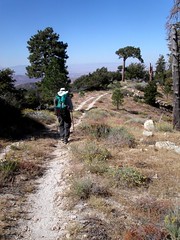

Bill Redman and I parked at the Saufley’s in Agua Dulce and got a ride up to the trailhead from Salt and Pepper. They had just finished the PCT in sections after four years! The have the perfect van for section hiking. It was the size of an airport van all fitted out for getting where you need to be to hike. We got there late and took off to Camp Glenwood in the dark with fresh peaches. It was an easy cool downhill. During the night I reached out to replace a tent peg that the wind blew out and tore a muscle in my side. It hurt like hell at times. The next day paralleled above SR-2 for a while with some shear cliffs and good views. The pines are healthy here and the forest looks very good. Sulfur Spring is verdant and we saw remnants of some sort of pagan ritual with sand made into a symbol and burnt incense sticks placed like birthday candles. We should have taken a picture. We passed a good spring after Sulfur springs running across the trail. It may have been Fountainhead Spring. The days were cool and the trail good. There has been some work done along this stretch. Some glimpses of the Mojave here as well. We ran into some ripe Blueberries. We’ll they aren’t Blueberries but they were blue, had a pit like an apricot, and were tasty. I ate about 20 and didn’t die. The trail down to Mill Creek Ranger Station is steep and long. We saw a bunch of footprints near days end and found that a bunch of firefighters from Oregon had used it to stay in shape. They had come down for the Topanga Fire as a reserve force. They have to carry a lot more weight than a hiker. It was hard finding a good spot near the Station for camp. The next day we crossed the Angeles Forest Highway to follow the crest west. We spent a surprising amount of time in the shade this day. We also ran into regular carpets of fallen acorns. We both fell several times on nature’s seasonal slip and slide. We passed below the prison camp on the north side and had great views of the mountains we must pass through. I can’t believe we have come so far. It was unimaginable just a few years ago. Once again we were paralleling a road, rarely used, for car campers, bicyclists and prisoners. Apparently the road was for a Nike Missle base, now defunct, near the end. I planted too much water for this trip so it was a pleasure to leave some for future hikers. Several times in the San Bernardino’s and Angeles Crest we walk along the crest of a long mountain and then finally leave it steeply at the end. Such was the case after Messenger Flats Campground when we zoomed down to North Fork Saddle Station a weird outpost which according to its caretaker of seven years, Todd, was the most isolated in the Angeles Crest: so isolated that there are no paved roads and no permanent Fire Fighters. It is a staging area for troubled times in the mountains. Todd has a dog, TV and the Internet and he likes it. He watches the place and paints the signs we see all over the mountains. It was very windy and he gave us permission to camp on the least windy side of the saddle. We cooked on a bare spot in the horse corrals. There is a special kind of weed here that stuck to everything. The next morning we got an early start down the edge of a long canyon. This was another day of being able to see the end of the hike from the beginning. There was a good flow of water in Mattox Canyon. We ran into a Skydiving instructor on his day off. He said he would pass us again on his way back. We thought that was pretty impossible until he did it. At Soledad Canyon road they are building a nice new trail building and parking. We crossed the road and thought we would find the trailer park we had read about for a snack but found we had gone to far north so we moved on. We found the monument to the completion of the PCT in 1993 vandalized by some idiot: a rare occurrence on the trail but still an annoyance. There are some strange giant monoliths of mud here that you pass around. It was a blustery day and we gripped the earth tenaciously to keep from being blown about. After a long hilly walk we passed under Highway 14. This long tunnel is not for the claustrophobic. We though it was really cool though. I took us on a wrong turn after the tunnel that took us 15 minutes to figure out. We entered the Vasquez Rocks Park and Bill said he recognized a place where the Lone Ranger and Tonto camped. I found the place underwhelming though the signature rocks near the parking area are remarkable. We exited the park, walked the road into Aqua Dulce, and had a great meal before walking over to the Saufley’s. We turned a 4 day trip into a 3 and I was wiped out. It took me days to recover. It still was a great trip. We start again in January.
I have had a terrible time adding pictures to this Blog. Please go here for photos from this trip
Monday, November 07, 2005
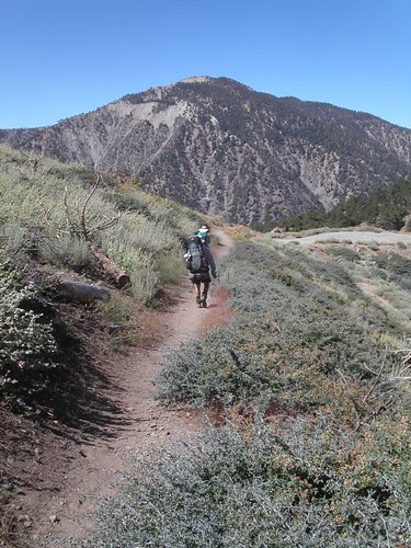
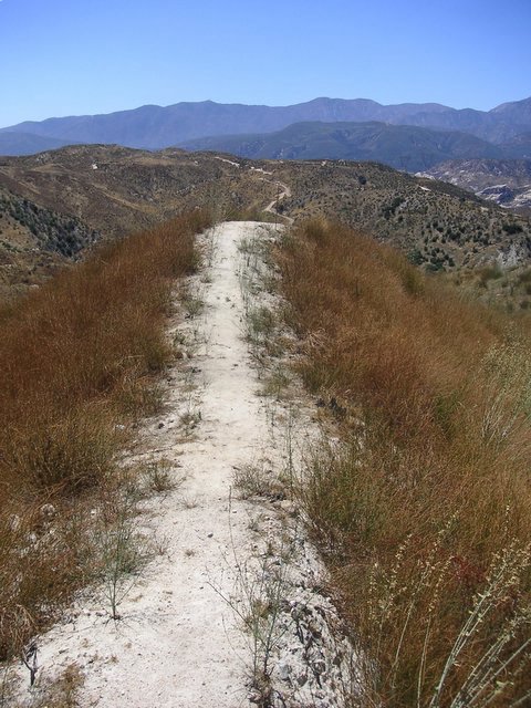

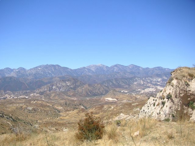
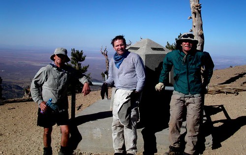
Islip Saddle
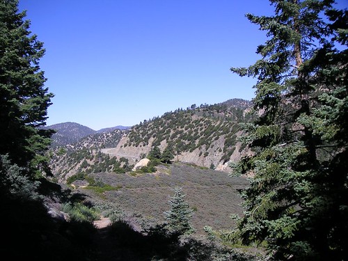
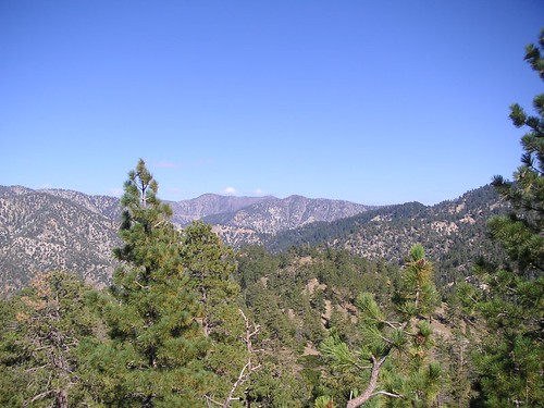
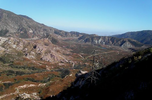
Pacific Crest Trail Trip 15 August 21 to 24th - 2005- Silverwood Lake to Cloudburst Summit – 68 miles
This was a beautiful and exciting section. We camped late on the 20th next to a creek bed at Silverwood Recreation Area. Visitors nearby, but unseen, whupped it up until about 3:00AM. Males in the group successfully got coyotes to sing along with them. Bizarre! Leaving camp the next morning we quickly passed through creek bottoms so washed out from the season's rains that we lost and found the trail several times. Bill's GPS shows where the next waypoint is but you can't always get to one directly. We gained Cleghorn Ridge via a detour because of damaged trail. Every once in a while the gentle grade of the PCT turns very steep. This time I tried walking backwards. I had cached water at three points on this trip and it turned out to be a perfect balance between natural sources and dry places. This first day took us along Highway 138 and a view of a train transfer station of some sort to the north. 
Wednesday, May 25, 2005
Whitewater River to Highway 18 near Big Bear City - May 15 to 18th 2005
The next day was overcast most of the day but I sweat like crazy as it became muggy. Mission Creek goes up, up forever or about 12 miles which seemed like forever. No big ups or downs. Someone has put trees across all the crossings to keep you out of the water , there are over 27, which slowed us down considerably. Only Ray got wet. Our first goal was the South and Fork confluence of Mission Creek which was the longest five miles I have ever hiked. Lots of through hikers passed us and then we passed them when they stopped for a hot lunch. Several of the women (thirty percent of all hikers) were wearing gossamer wraparounds which reminded me of Gauguin’s Samoan women. A little like Hippies. One of them was using couscous an ingredient I will add it to my trail meals in the future. One subject of constant conversation on these trips in what we will eat; especially for lunch. Bill wants to get away from the bagel to the pita for a variety of fillings. I like that. I have added pink salmon in packets for dinner and it is a great success. It was a long day and the only person handling it well was Bill. I got really tired but kept trudging on. Most of this trip is treeless. We saw 8 horny toads, a hundred coal black lizards and two racers, one trying to kill a lizard, and the lizard got away. We stopped short of Mission Creek camp for dinner. The theory being that we could avoid bears if we cooked in another area than we slept. It is only a theory weakened by the fact that at rest we were surrounded by cooking hikers. This area takes you far away from civilization. Perhaps as far as we have been since northern
We were in the seasonal “herd” of through hikers here. Usually we are practically alone on our trips. It was a pleasure to meet so many birds of a feather: young and old sharing the same dream. Reaching the tree line is always a pleasure. It is prettier and cooler. There are some big grades here before camp. Ray fell behind but not too far. We left messages that he never saw but he caught up to us in camp quickly. We gave up trying to put up our food in the trees and put it in our tents as bait. It is very hard to tie a stone to a rock and throw it accurately. My rear tent pole snapped in half which makes for an ugly tent. There were many hikers there but we just said hi and went to bed. It got down to about 40 degrees and my new sleeping bag kept me warm.
We went the wrong way out of Mission Creek Camp for about a ¼ a mile along with a lady. Finally we went up and over a hill north of camp and found my water cache from last October still in good shape. We were full up so I left them by the trail. We ran into snow on the north side of the mountain. Mainly drifts of 10 to 100 feet covering the trail. It was pretty soft but we stayed in the footsteps of those ahead of us. One of the disks on my poles vanished recently so it was funny to see that pole plunging all the down into the snow and the other a few inches. We took a break with a pair of hikers we camped with later. Nice people. The women had been saved, she said, by the man she was with when she got a case of hypothermia on
Tuesday, April 12, 2005
April 11, 2005 Interstate 10 to Whitewater River.
Dana Law, Bill Redman and Ray Ellis
Our first trip of the season was a day hike of 9.1 miles on trail. Making it a day hike was an adventure. After the rainest season in memory we restarted our journey north. The trail appears and disappears in the wash. Look for the 4X4 posts. Stubb Canyon Creek actually had some water in it up near the now defunct Pink Motel. The new owner has put up a sign welcoming hikers to pass through their property. There is a good stream running inCottonwood Canyon Teutang Canyon Whitewater River Whitewater Canyon Whitewater River
Our first trip of the season was a day hike of 9.1 miles on trail. Making it a day hike was an adventure. After the rainest season in memory we restarted our journey north. The trail appears and disappears in the wash. Look for the 4X4 posts. Stubb Canyon Creek actually had some water in it up near the now defunct Pink Motel. The new owner has put up a sign welcoming hikers to pass through their property. There is a good stream running in
Thursday, October 14, 2004
Fuller Ridge Remote Campsite to Highway 10 October 5, 2004
This section is 19.6 miles and nearly all downhill. As a matter of fact it goes from 7750 to 1360 feet above sea level. We passed the lowest point between this section and the Columbia Gorge on the Oregon Washington border. We camped the night before at the campsite after a 2 ½ hour ride with Ray’s son Jim up to the top. We are asking a lot of our relatives with this shuttling but it is working out. It was a warm and beautiful night. The sky was packed with stars. I slept badly. Don’t know why. The moon came up and I thought Ray had turned on his headlamp. We got off about 7:15 for our march to the bottom. The first thousand feet is covered with trees. We had fabulous views of the desert, mountains to the north, east and west. San Gorgonio looms bare and forbidding ahead. The next section is listed as difficult. We will take it slow and easy. There was a fire here in July and the vast majority of the hike down is scorched desert scrub. We have spent so much time walking in burn areas I think our little group should be called the “Fire Walkers.” The fire turned the mountain into a dirt slide. Most of the trail is covered with soft soil that has slipped over it and, in places, made it appear just like the rest of the slope. We saw lots of prints from deer. They seem to think staying on the trail is a good idea too. We believe we saw the paw prints of a mountain lion. Bill said that the way to tell the difference between those of a dog is that the nails don’t show and they didn’t. This section is a very long series of switchbacks through boulder strewn hills and canyons. Most people have bitched about the length of the trip. We decided in advance that “it is just the way it is” so we didn’t worry about it. It helps to have an attitude check to keep your spirits up. We passed though another giant boulder area. Some of them are 30 feet tall. We went under some giant rocks that looked like they were about to fall anytime. This was the perfect time for Ray to reminisce about a bridge project where several people were flattened under a boulder so large they didn’t bother to dig them out. They just put a memorial on top, lovely. Snow Creek Village is a small group of varied structures on the desert floor below and we finally saw it about 2:00PM. The end of the trail is in view most of the day. I suppose that is why people get tired of this section. We have hiked this distance before and have never seen the end until the last few minutes. The end of Snow Creek has a water district that serves Palm Springs. The miracle is that they have put a water fountain, with cold water; at the point the trail hits the desert floor. It was wonderful. We drank, filled out bottles, and poured it on our heads. The weather was nice on the way down but now it was hot. We had to walk across the desert floor and it was 95 degrees. It didn’t take long to drag us down. Of course we have already walked 16 plus miles. I have a tendency to keep on slogging regardless of how I feel. I should listen to my body. I noticed Bill flagging so we took a couple of breaks. The strange part about this area is a series of 4 X 4 posts marking the trail to keep the shifting sand from obscuring it. Closing in on the freeway I had spoken to my daughter Janessa and she was waiting on the other side. A fire broke out near the Exit and I called her and said “are you all right?” She said, “I’m fine, I see the fire. Should I go and look at it?” I said no and she said “you’re no fun.” It turned out a mobile home had gone up in flames but it gave us a start. We passed under the railroad and freeway and we were happy to finish, a great trip.
Sunday, August 01, 2004


Subscribe to:
Posts (Atom)