Wednesday, March 22, 2006


Tuesday, March 14, 2006
PCT 18 - Section E – Highway 138 to Highway 58 - 48 miles.
We crossed the desert in the winter! What a difference compared to our early days leaving the border. We spent the night before the trip in White's Motel in Mojave. White’s Motel has seen better days. Unless you are enthralled by the opportunity to hear trains all night as they stop to take a dinner break at the McDonald's next door, you’d be better off spending the night in your own sleeping bag.
The first day takes you on dirt roads mostly following the Los Angeles aqueduct. This is the one that "stole" water from the Owens Valley to feed the speedy growth of Los Angeles in the early 1900's. It is about 16 miles of flat walking all the way to Cottonwood Bridge. You pass through Joshua tree forests that look like Christmas tree farms. We were passed several times by languid aqueduct security in an SUV. The water is off right now and a work crew unknowingly provided a port-a-potty for us along the way. I got a hot spot on my right foot about 12 miles into the trip and cured it with duct tape; never bothered me again!
There are some terrific PCT signs here, they are heavy iron, maybe the best since Campo, and it helps keep the hiker from taking one of the many trails that cross it. The spooky thing was we started to hear gunshots, and not just single shot but automatic fire. I have fired a lot of rounds in my life but I think they fired as many in that afternoon as I have in all my days. We never saw them and fortunately we slowly moved away from the sound. We had water cached by Bill just past Cottonwood Creek and the trough, which was dry. Two of the four gallons had tipped over and run out. We suspect that they freeze and fall over easily. It was the first time this had happened. Fortunately two gallons was plenty. We decided to put in a couple of extra miles to make the next day easier. Unfortunately it got harder and harder to find a flat place to camp. We found one in a draw near the base of the mountain. I am getting better and better at eyeballing a flat spot but it was hard to avoid the cow pies in this area. Bill and I cooked our dinner in the biting wind while Ray got right into his tent, warmed up, and had a cold dinner.
The next morning I woke up to frost on the inside of my canopy. It was 28 degrees. That was cool, literally. This whole section is usually windy and hot, so our winter trip, though sometimes brisk, was a real gift. We saw a red tailed hawk or chicken hawk; a good looking bird. I had put my camera in my sleeping bag to warm it up and left it there by mistake. Bill took pictures that day. The climb up to the Tehachapi’s is not particularly steep but it is over 6200 feet where we crossed over. We made one wrong turn and wasted 40 minutes and some energy going the wrong way. We had a short snow flurry and passed through some pinyon pines. I can't wait to try the nuts when they are in season. There are a mess of motorcycle trails here; a group of bikers stopped to talk and promised to stay off the PCT as much as possible, which is not easy. Tylerhorse Canyon had water but Gamble was dry. There is a stiff series of switchback here. We crossed over the top in pleasant trees and views of the Antelope Valley. The north side of the mountain has a nice secluded ridge of cabins and more motorcycle trails. We paid close attention and had to reroute twice to get back on the PCT. The snow from the last storm ran about two to four inches in places. Our trail runners stayed dry. We saw cute little bunny and deer tracks. It was mighty cool. I need winter gloves for this but the rest of me was warm and comfy.
The trail goes down, down, down past the first wind farm above Oak Creek where we camped for the night. It was plenty chilly again so we all jumped in our tents for an early night and a cold dinner. Better to eat it in a warm sleeping bag where I found my camera. This camp is right by Tehachapi-Willow Springs Road, which we crossed in the morning to go over rolling hills filled with wind farms. There are old school windmills here with their new modern giants next to them. It wasn't too windy this time but this is the place to catch the power. The trail goes gently up and finally descends steeply to Highway 58 with a great view of the Southern Sierras. We have made it to the Tierra Del Fuego tip of the mountains ahead. Near the Highway, Ishmael from Tehachapi Taxi picked us up for the trip to Mojave. This wasn't too difficult a hike - the next trip is 84 miles.
Sunday, January 29, 2006

PCT Trip 17 Aqua Dulce, Ca to Highway 138 at Neenach, Ca January 22nd to 25th 2006.
We managed about four hours of sleep before the first day but I never felt tired. You follow the road out of town for a mile or so before you hit the dirt again. What looks like a junk yard has the fuselage of a large commercial aircraft in it. It was a very windy day and as we gained a view of the lovely sequestered Annan Ranch, we were almost blown off our feet. There is a large exposed vein of quartz along the trail and scattered pieces all about as if someone had tried to blow it out of the ground. The mountain here is called Sierra Pelona. It is better looking than most mountains, and though it is high the trail is an easy grade. It was plenty windy on top so we didn’t dawdle long.
We passed some French day-hikers on the way down and took our lunch in a quiet spot soon after. Ray took a quick nap which he does so easily. I’m jealous anyway. We got to Bouquet Canyon Road, the source of the day-hikers, crossed the street, and started another trek up the hill there. Within a mile and a quarter we saw two small streams running well. It appears, though there have been some recent rains, that last year’s massive downpours have kept a lot of streams and springs going into the new season. Our day ended at 4:30PM with about 18 miles traveled. We worry about finding camping spots in this chaparral cloaked area, but were surprised to find the Anderson’s Oasis water cache before road 6N09 to be the perfect spot. They hollowed out an area under a large Manzanita, put in lawn chairs, a pink flamingo and a hanging skeleton – I guess for a Halloween theme. It fit two of our tents, and Bill put his in a big spot on the trail. We cooked our new trail food: Tortellini with dried tomatoes. It was terrific! It got to 36 degrees that night, but we were warm and comfortable in our bags.
The chaparral here is boring and unattractive. This is a devilish section in the late spring and summer. We weren’t consuming a lot of water but it is critical later in the year. For the first time on the PCT, I wore my wind stopper jacket all day. The trail after Bouquet Canyon Road is in poor shape. It needs maintenance. We saw the first evidence of motorcycles using the trail. They had ripped up the tread in many places where the ground was soft and muddy. It creates erosion zones, is bad for the trail and just plain illegal. I believe about 70% of the trail has been used by them between Agua Dulce and Highway 138. We hate the results of what they are doing. Bill said if he lived closer to this section he would come out on the weekend with a lawn chair and a camera and get them in trouble.
There are remnants of wild cucumber on the entire section. This is one strange looking plant. Passing San Francisquito Canyon, another big climb, we saw two big water caches that had been brought up from the dirt road below. Elizabeth Canyon was running well. This is a tough section because you are going up and down crossing canyons. We are strong hikers but it wasn’t easy. We saw some great views of the eastern Antelope Valley. The desert and surrounding mountains are beautiful. We have a great view of the sections ahead. At length, we ran into some conifers, big cone spruce, and soon after saw some black oaks with their acorns making the ground slippery. The big surprise, though it shouldn’t have been, was snow. It started to cover the ground in patches and eventually nearly covered it completely. We passed a beautiful stand of trees that looked good for camping but was too windy. Our camp for the night was built by a scout troop in the nineties and, though chilly, had a very soft duff so we slept very well. We didn’t cook hot breakfast because of the shortness of the days – wanting to make the most of daylight. We are all coffee drinkers and Ray brought some magic beans from his wife Kay (at least that is what I named them) – chocolate covered coffee beans, to feed our need at the beginning of the day.
The next morning we passed a stream that had a cap of ice over the small waterfall, and
a small pond behind it that would have been the perfect ice rink for fairies. You can see the Pacific here; I don’t remember ever seeing it since the start at Campo. The coulter pines are a beautiful species with a large cone. They are found here healthy and beautiful. Also sprinkled about are incense cedars which they make pencils from. Most of the hills are chaparral and brush so these trees are a gift to walk through.
We always carry a ton of information on these trips. I have step-by-step directions, Bill has a GPS and maps, and we always study the section before we go. Still sometimes we get confused. There is an intersection of the old and new PCT on Liebre Mountain. The sign is broken and we stood around, walked around, and consulted our notes and the stars before taking off the right way. Our friend. Paul Freiman, 2 days ahead of us, wasn’t so lucky. He went 2 miles down the wrong way before stopping for the night and doubling back in the morning.
On the way down to Pine Canyon Road, we made our last camp under a massive oak in a grass covered saddle sprinkled with ice. No wind and soft undergrowth. I spent my 12 hours in my tent sleeping or listening to Stephen King’s Carrie. The whole area has clumps of Miner’s Lettuce which I ate a handful of. Bill and I promised ourselves to make a salad the next time we run into it.
We left our long underwear on for the last cool segment but we had to strip them off at Pine Canyon Road. On the way down we saw maybe two tons of Mistletoe hanging everywhere, 4 or 5 washouts of the trail in the creeks, the remains of last year’s fire, a bizarre post conflagration plant and, surprisingly, fruit trees. We couldn’t figure out which kind from the mummified fruit on the ground, but it was remarkable at that altitude. Miner’s Lettuce everywhere, and beautiful views of the valley below including a giant crop circle of green grass or alfalfa. The trail is in rough condition here. We descended slowly, sure in our minds this would be an easy day. At Pine Canyon there is a river, and we passed a bucolic vernal pond with ducks. A road worker grading the sides of the road from a washout said he would like to hike, too, but hadn’t been in that kind of shape since the army. We assured him he could do it. He also said that deer sightings in the area, once common, were way down due to increasing populations of mountain lions: something I confirmed later. Comforting…
Then we crossed the street into No Man’s Land. The map showed a gentle slope down to our terminus of about 7 miles, but it turned into a roller coaster through Hell’s Half Acre. A topographic map shows altitude in 40 foot contours so it looked like we would go down about 1000 feet until the end, but in reality it goes up and down meaninglessly and strenuously through hills until the last 500 or so yards. To top it off the whole section is burned out. Very few pleasant sights except the occasional glimpse of the valley ahead and the shock of a gingerbread mansion dream house on a hill nearby. The PCT handbook says this torturous section was designed by lawyers from the Tejon Ranch who kept the PCT skirting their land 20 years ago. They have agreed to reroute the trail through their property sometime in the future, which will take it out of the desert and properly through the mountains as God intended.
We found a dead ostrich tied to a fence not long before highway 138. Our first impression was of an animal owner’s cruelty though we will never know. We were pretty tired and achy at the end, but took the time to visit Bob at Hikertown across the street to get permission to park our car there for our next segment. We walked a mile east to Gil’s Country Store in Neenach to wait for Jeff Saufley for our ride back to Agua Dulce. Those 3 hours will live in our memories forever. We met, saw and listened to the strange and interesting characters of a small town.
Gil of course doesn’t sell stuff on credit anymore. His wife runs the store now because he is laid up in the trailer out back: He shattered his leg while trying to collect on a debt. Patty, who has worked at the store for 6 years through 3 owners, was there, and the guy who built the store in ’75 and ran it for 15 years stopped by to say, “Hi.” Another “Gil”, Gilbert, a big hulk of a man from Lebec “since 48”, who knew everything about the surrounding area, played with the giant five month old dog who tried to eat our food. A cowboy, who stopped by to pick up hay, went in and out of the place 5 times, walking like he spent most of his time on a horse. At least five school buses dropped off kids from area schools while parents picked them up. Several people got the new lecture about no credit, and one slightly brain damaged young man asked for a case of beer that he would pay for on Thursday, while his Methamphetamine-high friend waited in the truck for him. I asked Patty what percentage of their sales was alcohol and cigarettes and she said, “All of it.” It was almost more interesting than the last 4 days.
We have traveled 519 miles on the trail and it has been challenging and fun. The next segment crosses 16 miles of desert before going up into the Tehachapi’s. See you soon.
Wednesday, November 30, 2005
Cloudburst Summit to Aqua Dulce- October 2nd through 5th, 2005.

Bill Redman and I parked at the Saufley’s in Agua Dulce and got a ride up to the trailhead from Salt and Pepper. They had just finished the PCT in sections after four years! The have the perfect van for section hiking. It was the size of an airport van all fitted out for getting where you need to be to hike. We got there late and took off to Camp Glenwood in the dark with fresh peaches. It was an easy cool downhill. During the night I reached out to replace a tent peg that the wind blew out and tore a muscle in my side. It hurt like hell at times. The next day paralleled above SR-2 for a while with some shear cliffs and good views. The pines are healthy here and the forest looks very good. Sulfur Spring is verdant and we saw remnants of some sort of pagan ritual with sand made into a symbol and burnt incense sticks placed like birthday candles. We should have taken a picture. We passed a good spring after Sulfur springs running across the trail. It may have been Fountainhead Spring. The days were cool and the trail good. There has been some work done along this stretch. Some glimpses of the Mojave here as well. We ran into some ripe Blueberries. We’ll they aren’t Blueberries but they were blue, had a pit like an apricot, and were tasty. I ate about 20 and didn’t die. The trail down to Mill Creek Ranger Station is steep and long. We saw a bunch of footprints near days end and found that a bunch of firefighters from Oregon had used it to stay in shape. They had come down for the Topanga Fire as a reserve force. They have to carry a lot more weight than a hiker. It was hard finding a good spot near the Station for camp. The next day we crossed the Angeles Forest Highway to follow the crest west. We spent a surprising amount of time in the shade this day. We also ran into regular carpets of fallen acorns. We both fell several times on nature’s seasonal slip and slide. We passed below the prison camp on the north side and had great views of the mountains we must pass through. I can’t believe we have come so far. It was unimaginable just a few years ago. Once again we were paralleling a road, rarely used, for car campers, bicyclists and prisoners. Apparently the road was for a Nike Missle base, now defunct, near the end. I planted too much water for this trip so it was a pleasure to leave some for future hikers. Several times in the San Bernardino’s and Angeles Crest we walk along the crest of a long mountain and then finally leave it steeply at the end. Such was the case after Messenger Flats Campground when we zoomed down to North Fork Saddle Station a weird outpost which according to its caretaker of seven years, Todd, was the most isolated in the Angeles Crest: so isolated that there are no paved roads and no permanent Fire Fighters. It is a staging area for troubled times in the mountains. Todd has a dog, TV and the Internet and he likes it. He watches the place and paints the signs we see all over the mountains. It was very windy and he gave us permission to camp on the least windy side of the saddle. We cooked on a bare spot in the horse corrals. There is a special kind of weed here that stuck to everything. The next morning we got an early start down the edge of a long canyon. This was another day of being able to see the end of the hike from the beginning. There was a good flow of water in Mattox Canyon. We ran into a Skydiving instructor on his day off. He said he would pass us again on his way back. We thought that was pretty impossible until he did it. At Soledad Canyon road they are building a nice new trail building and parking. We crossed the road and thought we would find the trailer park we had read about for a snack but found we had gone to far north so we moved on. We found the monument to the completion of the PCT in 1993 vandalized by some idiot: a rare occurrence on the trail but still an annoyance. There are some strange giant monoliths of mud here that you pass around. It was a blustery day and we gripped the earth tenaciously to keep from being blown about. After a long hilly walk we passed under Highway 14. This long tunnel is not for the claustrophobic. We though it was really cool though. I took us on a wrong turn after the tunnel that took us 15 minutes to figure out. We entered the Vasquez Rocks Park and Bill said he recognized a place where the Lone Ranger and Tonto camped. I found the place underwhelming though the signature rocks near the parking area are remarkable. We exited the park, walked the road into Aqua Dulce, and had a great meal before walking over to the Saufley’s. We turned a 4 day trip into a 3 and I was wiped out. It took me days to recover. It still was a great trip. We start again in January.
I have had a terrible time adding pictures to this Blog. Please go here for photos from this trip
Monday, November 07, 2005
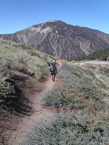
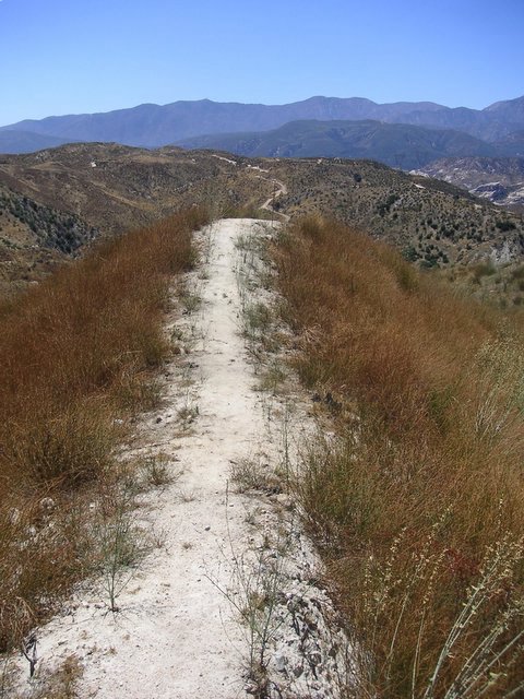

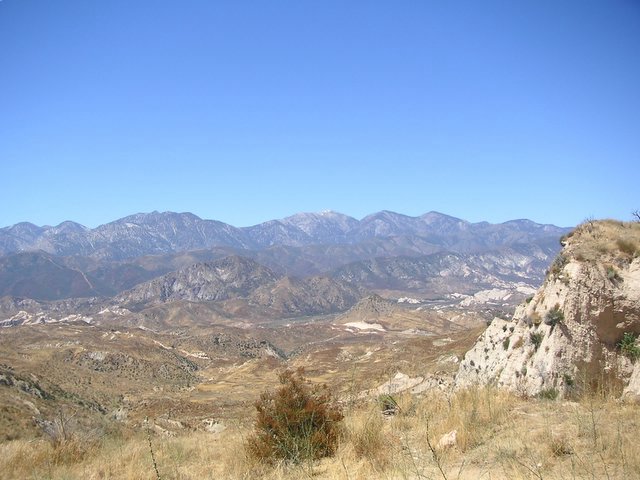
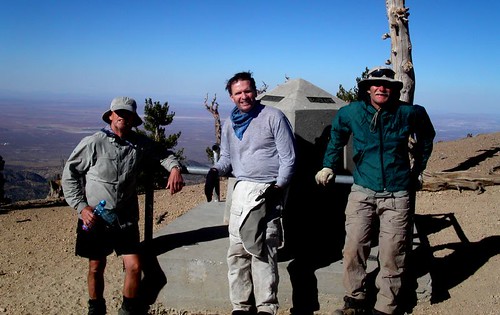
Islip Saddle
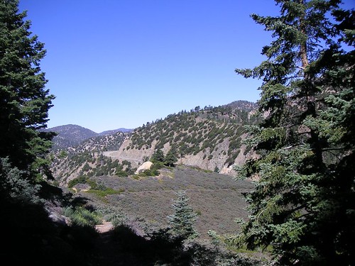
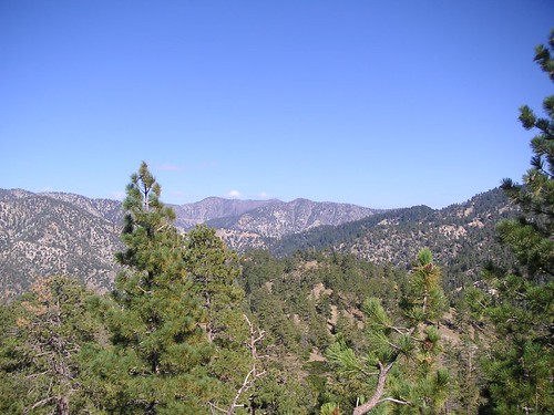
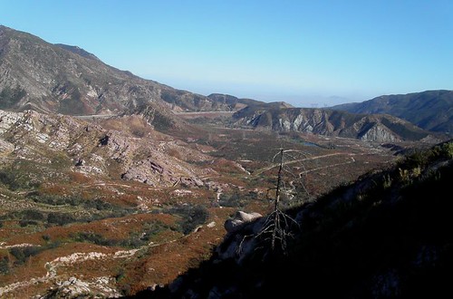
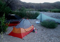
Pacific Crest Trail Trip 15 August 21 to 24th - 2005- Silverwood Lake to Cloudburst Summit – 68 miles
This was a beautiful and exciting section. We camped late on the 20th next to a creek bed at Silverwood Recreation Area. Visitors nearby, but unseen, whupped it up until about 3:00AM. Males in the group successfully got coyotes to sing along with them. Bizarre! Leaving camp the next morning we quickly passed through creek bottoms so washed out from the season's rains that we lost and found the trail several times. Bill's GPS shows where the next waypoint is but you can't always get to one directly. We gained Cleghorn Ridge via a detour because of damaged trail. Every once in a while the gentle grade of the PCT turns very steep. This time I tried walking backwards. I had cached water at three points on this trip and it turned out to be a perfect balance between natural sources and dry places. This first day took us along Highway 138 and a view of a train transfer station of some sort to the north. 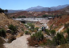
Wednesday, May 25, 2005
Whitewater River to Highway 18 near Big Bear City - May 15 to 18th 2005
The next day was overcast most of the day but I sweat like crazy as it became muggy. Mission Creek goes up, up forever or about 12 miles which seemed like forever. No big ups or downs. Someone has put trees across all the crossings to keep you out of the water , there are over 27, which slowed us down considerably. Only Ray got wet. Our first goal was the South and Fork confluence of Mission Creek which was the longest five miles I have ever hiked. Lots of through hikers passed us and then we passed them when they stopped for a hot lunch. Several of the women (thirty percent of all hikers) were wearing gossamer wraparounds which reminded me of Gauguin’s Samoan women. A little like Hippies. One of them was using couscous an ingredient I will add it to my trail meals in the future. One subject of constant conversation on these trips in what we will eat; especially for lunch. Bill wants to get away from the bagel to the pita for a variety of fillings. I like that. I have added pink salmon in packets for dinner and it is a great success. It was a long day and the only person handling it well was Bill. I got really tired but kept trudging on. Most of this trip is treeless. We saw 8 horny toads, a hundred coal black lizards and two racers, one trying to kill a lizard, and the lizard got away. We stopped short of Mission Creek camp for dinner. The theory being that we could avoid bears if we cooked in another area than we slept. It is only a theory weakened by the fact that at rest we were surrounded by cooking hikers. This area takes you far away from civilization. Perhaps as far as we have been since northern
We were in the seasonal “herd” of through hikers here. Usually we are practically alone on our trips. It was a pleasure to meet so many birds of a feather: young and old sharing the same dream. Reaching the tree line is always a pleasure. It is prettier and cooler. There are some big grades here before camp. Ray fell behind but not too far. We left messages that he never saw but he caught up to us in camp quickly. We gave up trying to put up our food in the trees and put it in our tents as bait. It is very hard to tie a stone to a rock and throw it accurately. My rear tent pole snapped in half which makes for an ugly tent. There were many hikers there but we just said hi and went to bed. It got down to about 40 degrees and my new sleeping bag kept me warm.
We went the wrong way out of Mission Creek Camp for about a ¼ a mile along with a lady. Finally we went up and over a hill north of camp and found my water cache from last October still in good shape. We were full up so I left them by the trail. We ran into snow on the north side of the mountain. Mainly drifts of 10 to 100 feet covering the trail. It was pretty soft but we stayed in the footsteps of those ahead of us. One of the disks on my poles vanished recently so it was funny to see that pole plunging all the down into the snow and the other a few inches. We took a break with a pair of hikers we camped with later. Nice people. The women had been saved, she said, by the man she was with when she got a case of hypothermia on
Tuesday, April 12, 2005
April 11, 2005 Interstate 10 to Whitewater River.
Our first trip of the season was a day hike of 9.1 miles on trail. Making it a day hike was an adventure. After the rainest season in memory we restarted our journey north. The trail appears and disappears in the wash. Look for the 4X4 posts. Stubb Canyon Creek actually had some water in it up near the now defunct Pink Motel. The new owner has put up a sign welcoming hikers to pass through their property. There is a good stream running in
Thursday, October 14, 2004
Fuller Ridge Remote Campsite to Highway 10 October 5, 2004
Sunday, August 01, 2004


Fobes Saddle to Fuller Remote Campsite
The first morning, we didn’t start at the Fobes Saddle spur trail till after eight and got to the PCT at the Saddle just after nine. The early starts are getting harder the farther north we go. We found a six gallon cache here courtesy of Bill’s Trail Kitchen. The trail gets steep immediately. We passed Spitler peak on the way to Apache peak.
Bill stopped to fix a hot spot on his foot. I have never had a problem with my New Balance trail runners, but they slip too easily. I have fallen for the ultra light mantra about using these shoes instead of boots. I think without hiking poles I would have hurt myself. I have a new pair, and if they don’t improve my stability I am looking for another shoe.
It was already about 85 degrees here with a fair wind. Very few wildflowers at this time of year, but we did see some Red Penstemon, Indian Paintbrush, and a very cool plant with a red cone and purple flowers. When the pictures come back we have to identify it.
We lunched at about 1:00 after Apache peak, and were already wiped out. Ray said, “When I feel like this I am ready to stop.” I got a headache from the altitude but Advil, food, and a break made me feel like a new man. You can see the Coachella Valley all along this part of the trail.
Near Antsell Rock, we ran into a shirtless man with a British accent walking the other direction who said he was from the Zen Mountain Center. We don’t know where he entered the trail. We ran into gnats that flew around our faces like a mask of bugs. I inhaled one in my nose and it came out my mouth. Ray ate one and said, “Good protein!” The trail is carved out of solid rock in many places here and must have been a Herculean task to build. This section is dangerous in the winter with snow. We are glad to be walking it in dry conditions. Red Tahquitz Peak is literally red, and we had to round it on the east side to enter the forest beyond.
The wilderness up here is a patchwork of National Forest and Mount San Jacinto State Park. We entered the Eden that is the top of Mount San Jacinto. It looks like a punchbowl surrounded by peaks. At first glance you might think it is a dormant volcano. It is filled with trees, and has a big green meadow, Skunk Cabbage Meadow, near the bottom northeast side. Unfortunately up here the bark beetle infestation is in full force, and a good twenty percent of the trees are dead or dying. Only several years of average or better rainfall will solve the problem. It is still quite beautiful.
The grade went down into the valley and it was a welcome breather. Our permit was for Strawberry Junction Campground, and it was still 7 miles away. Just before the trail meets a 1/3 mile cutoff to water in Tahquitz Meadow, we came across good flowing Tahquitz Creek. This stream, which surprised us, came from Tahquitz Peak above, and since all the snow is gone Bill and Ray surmised that it originated from ground water. It was a lot of water. We filtered about 10 liters of good, cold water between us. We decided any pauper can have water down the mountain, but on the mountain the man with water is King! I drank six liters today! We saw a mule deer and heard some doves. We were exhausted and no where near our goal.
We arrived at Saddle Junction to see a very tired man about 30 years old sitting on a tree stump. “I used to hike all the time, and this is first time I’ve been out in two years,” he said. Apparently, the 2-1/2 mile Devil’s Slide Trail had been more than enough for him. We finally decided to camp north of Saddle Junction on a sandy area overlooking Idyllwild and Hemet beyond. We had covered nine miles. It was impossible to get to Strawberry Junction, where we had arranged for the camping permit, from Fobes Saddle in a day of hiking, but that was the only permit area available to us. We felt bad about it, but it was getting dark. We all agreed to tell the truth if we ran into a Ranger. We didn’t have a choice. I understand why they restrict camping: People have damaged the area in the past. We treaded lightly. I was stunned to realize that I had left my new stove at home. Ray shared his cooking gear with me, and I enjoyed Red Beans and Rice. I added tuna to both our dishes. Bill had lent me a tent because my Tarptent had not arrived in time. Unfortunately, he brought the wrong poles, but my hiking poles crossed and adjusted did the trick, and I had a tent. It was a warm night, and with a half-moon everything was quite clear.
We heard some people whooping as they descending the trail to Humber Park. It became obvious we were probably the only people on the whole mountain; a strange but powerful feeling, especially with millions below in our view. I did not fall asleep till 1:00AM, but lay there for nine hours. I don’t know why; perhaps I was too tired. I heard Ray rustling at 5:30 and woke up. Bill had blisters on both heels. He treated them and we were on our way by 7:00AM. We climbed another 900 feet in the next few miles. We were over 9000 feet, a record so far. It was cooler than the day before. It took my body a while to wake up.
Strawberry Cienega was a revelation. It was really a seep. It takes only a little water to change the flora dramatically. All the plants are different and lush for over a hundred feet on each side, with Ferns, Bracken and Skunk Cabbage (which Bill says works well as toilet paper, although I’ll take his word for it). As usual, Bill took a lot of great pictures. We got to Strawberry Junction and stopped for a snack. There are some giant boulders beyond here with large, pock-marked faces. People have decorated the holes with pine cones. Bill said he had learned that these “soft spots” form when different kinds of molten rocks come together in a lava flow, and later erode more quickly leaving the pocks. We shall call them “Devil’s Marbles”. We saw and smelled some beautiful Wild Azaleas. We soon crossed a creek. It wasn’t much, but we could dip Ray’s cook pot in to fill his bucket for filtering. We loaded up.
We had much more shade today and the walk was easier. After we took the Fuller Ridge turn-off, we came across a whopper of a creek. It turns out this was the north fork of the San Jacinto River and boy was it running well! We didn’t need water ,but we marveled at it for a few minutes. Fuller Ridge, like the San Felipe Hill before it, has made us nervous. We thought it was sun baked; lacking shade. That is not true. It is well shaded, but it is perilous at times. It is mostly rock, and during the winter I am sure it is dangerous. I slid about some and found the trail hard to follow at times for the lack of soil. A little snow and you could get lost. The grade was mostly downhill, but the steep incline up to Castle Rocks is short but hard. We could see the San Jacinto Peak from here, and also the burned trail area down to Highway 10. It is really something and worth the walk. We met our third and final person on the way to Fuller Ridge Remote Campsite. He was sunburned, without a hat, and carrying a backpack with the tag still on it. His name was Gerald, and he seemed a bit addled. He was heading for an overnight up the trail. I realized he was mumbling something about us not having a ride at the campsite, and this being a bit late in the season for through hikers. Actually I think he was fine but I was confused. We found his motorcycle at the campsite. Past the campground we passed Black Mountain Truck Trail, and found the barricaded final section to Highway 10. We will go as soon as it opens. We walked down to Black Mountain Campground and were picked up by my daughter, Janessa, and her friend Christie soon after. A great, hard and beautiful trip.