Wednesday, November 02, 2011

I made it to Oregon!

Pacific Crest Trail trip 26 2011

221 miles – August 13th through August 26th, 2011 Castle Crags State Park, California, to Callahan’s Siskiyou Summit, Oregon. This year the strapped state of California said it would close a lot of parks, among them our trailhead, Castle Crags State Park. The good news is they’re not closed yet and the PCT continues through an unmanned portion of the park. I don’t think closed California parks will stop PCT hikers. I’d been thinking about or preparing for this trip all year. I don’t think you ever stop thinking about your sections: doing, buying, training, studying etc. You can never be fit enough, but you have to be fit to start. Crasher, a through hiker we met this year, said, “I think it’s harder for section-hikers,” but I think she’s wrong, especially after successfully negotiating the snowed-in Sierras. Rachel Ginsburg kindly, for the third time, picked me up at Oakland airport and drove me to Dunsmuir to meet John Hart, my hiking companion and mental trail giant, for our second section together. He’d just finished a week on the trail from Burney Falls to make up for the part he missed last year. His final total for this trip would be 301 miles - his longest! Rachel gave us a send-off kiss, and although she and her new dog, Athena, intended to join us in the Marble Mountain Wilderness, that sadly didn’t come to pass due to another commitment. To start off, I went back under the Hwy 5 underpass to touch a post on the other side. John and I always make every trip “honest”; we don’t miss a step. That first afternoon we started off at 1PM and hiked nine miles. We had a ridiculous hope we’d do 11 miles. Our intentions are stronger than our legs. We ended the day at Castle Crags, a dramatic and beautiful outcropping. The next morning we started a big day: 20 miles or so, with over a 4500 feet gain in altitude, to the only guaranteed spring in the first section. There were several water sources in the first miles but we were so enamored with the sight of the Pitcher Plant at a stream (the North American habitat of this carnivorous plant) that we’d tanked up too late. It made for a dry end-of-day. We did meet our first through-hikers: Feisty, Gnarly, and Han Solo, who was from Germany. Even with my 35-year-old German, I succeeding in convincing him I was fluent. He went on in German for quite a while before he caught on. Late in the day, but before the final spring, we found our first Trail Magic. We were far from dying of thirst, but were thrilled to come across a five gallon drum filled with Hansen’s soda just past the dirt road down to Gumboot Lake! Thank you, Trail Angel, whoever you are! We trudged on, found the spring, filled up our bladders and bottles, and found a campsite late. I’ve said it before: the most important thing to find is water next to a flat spot. It’s amazing how few places there are to camp in the wide open wilderness. Settling down to start cooking dinner, I found that my gas canister was empty! Note to self: Shake that thing before a trip! John shared his cooking gear with me. Later , as I was dropping off to sleep, it seemed that the earth below me was getting harder every second. Another surprise: my NeoAir Mattress had sprung a leak! It was two days of lying on the ground positioning my three foam pads on shoulders and butt before I found and fixed the hole. Also, I found spiders and silverfish crawling all over me during the night. I’ve never been bit or harmed, but I’m buying an enclosed tent next year. I think I drink half again as much water as John. He uses bottles, and has to stop to drink. I sip away on my bite valve as I go. Extra water weight creates foot pain, I’ve found. More about that later… This section is a big tipped over U. We launch east and southeast from Hwy 5 for several days. You often see Mount Shasta and realize you’re barely moving north. John, who knows these things, says for every mile north we have over 4 miles of trail here. There are 2.3 trail miles for every mile north to Canada. The territory north of Shasta is very dry, which explains the routing. We laughed over how often we’d discussed the bazillion trees we’ve seen in 1700 miles. We’ve seen plenty of nature. There’s no lack of it. Every day on the PCT is hard. Climbing up and down mountains with a pack on your back is masochistic. Everything is inconvenient in the wilderness. You have to bring everything with you. The challenge of the adventure is what drives me on; not nature, but the achievement and social aspect of hiking with friends.

We met Pete from Portland going south. He’d hiked the trail before but was walking from Ashland to Sierra City. A transplanted Brit, he was one of those hikers who look shockingly clean and unfazed by the rigors of the journey. He’s probably doing more sensible miles than we are. We spent a long lunch at Upper Deadfall Lake. Few lakes are accessible from the trail, and even when they are it’s often hard to get to the water. Reeds, logs and mushy ground make it hard to filter water or jump in. This one was lovely, and we saw lots of day hikers who had gotten there from a nearby forest road for good camping and a beautiful view of Mount Eddy. After the road we had a 4 mile half-circle of easy walking. We had a laugh when we finished a long traverse and then looked over to where we started hours ago. We wondered why the PCT doesn’t have an air bridge. There were lots of signs and posts in this area. Like states’ rights, the marking of the trail is inconsistent. I thank the energetic people of this area for clearly posting the trail. We passed a lake listed as a water source in Erik the Black’s book. We would have stopped for water, but it had a hundred foot drop so we would have needed someone to rappel down to get it! Baby wipes are sure handy. Ultralight hikers don’t carry them but I use them for cleaning my hands before putting in contacts, general cleanup and of course after the outdoor toilet. Figuring out what to take in your pack, and in what form, is a big job. It’s got to be light and have multiple applications if possible. When we got to Chilcoot Creek we met the previously-mentioned Crasher and her parents from Connecticut. While filtering we learned she had successfully navigated the snowy Sierras and was spending five days with her daring parents on the trail. She was jumping to Ashland to rejoin her through-hiking group to Canada, hoping to do the section she missed in October. I complemented her and she said, “Go big or go home.” What a sweet and determined young woman. Around noon, when we stopped to rest after a long, hard traverse on steep slopes,Frito Ray and his wif (wish I could remember her name) caught up with us.. He worked for Frito Lay and had a bag of the chips on the back of his pack. As I mentioned before, I drink a lot of water. Seems I carried too much up the mountain and my right heel started to hurt. Stopping to check it out, I saw a red spot on the bottom of the heel. John helped me apply Moleskin with duct tape. I was fearful the trip was in jeopardy, but that was my hysteria, as usual. We passed by Echo Lake and Rattlesnake Mountain on this trip. It reminded me of the limits of human creativity. There are at least three “Buckhorn”s, and probably too many “Kennedy Meadows” to count. So many places: you have to call them something. But it’s much more pleasant that just using a number, as in “Peak 5142”. We ran into Overload (good name), One Step (finishing her last section, she’d met Bill Redman at Paynes Lake), and Silver Toes and Mog Apion, all going south. We spent the night at Bull Lake. It was a great camp but we had to descend a rocky slope to get there. The next night was spent at Mosquito Creek, which lived up to its name in a minor way. We go a few bites that night, but on the whole the trip was blessedly free of mosquitoes. Positive ID came in late and camped with us. He’s Adam from Portland, and his father knows a man who knows me. Small world. Our last day before Etna Summit was a long one. We couldn’t find a camp until late after an arduous climb that left us exhausted. John and I knew we’d done too much and were breaking down. I’ve had tendonitis in my left wrist for the last year. Using hiking sticks doesn’t bother me as long as it’s a vertical motion, but my hiking pole slipped and twisted on a steep climb and it hurt like hell. I had to favor it for the rest of the trip. I slipped on the trail that day but fortunately fell on my backpack and lay there squirming like the beetle in Kafka’s Metamorphosis. Anyone who says they haven’t tripped or fallen on the trail has never hiked. It wasn’t all bad, though - we passed some plants that smelled like sweet pumpkin. I carry my MP3 player on the trip so there are plenty of programs to listen to at night in the tent. FM reception was poor: country western - Red Neck Yacht Club; religion - How to share your faith with the Muslim next door; a little NPR. We were definitely in the tulies. I heard about future Chinese leader Xi Jinping. Wouldn’t that make a great trail name? As I said, there’s never an easy day on the PCT, but some are worse than others. This is the hardest thing I’ve ever done: carrying your 35 pound house on your back; walking up 5000 feet in one day. There’s nothing like it, and it’s great for weight loss. I lost 8 pounds on this trip and have a new business concept: “Lose belly fat with this simple trick. Hike the PCT!” Paynes Lake was our last body of water before Etna Summit. We met a batch of day hikers: “Seniors on a Mission”. Saw Newts! There I said it: Newts! I was dumbfounded. I didn’t recognize the swimming lizards immediately, and didn’t know they existed in North America. I’d never seen Newts in the wild. We met Bill Jeffrey (Asabat) at Etna Summit. He has huge hiking experience and is a wiz with maps. Plus, he’s a trail celebrity because of his water report for Southern California. He brought potato chips on request from John. Etna Summit is a terrible place to camp. I wound up in the parking lot on gravel behind an SUV parked on a slope. Bill ended up near some buildings and John on a dirt road. The next day we had an 800 foot up and stopped at a trail register along the way. Someone had put a baggie of marijuana in the box, but we were the wrong demographic for it. We ran into Oakdale going southbound. The climb continued through a landscape of steep granite dotted with lakes and streams. We broke off early to camp at Fisher Lake, putting off to the next day a big climb to a saddle. It’s risky to go on unless you have assurances of camping ahead. Wiz and Mrs. Wiz from Australia passed us that night. He was a through-hiker but she’d joined him at Sierra City to share quite a big section. He had a cute miniature Aussie outback hat. The Marble Mountain Wilderness is unique. Soon after dropping into a pretty valley you pass marble outcroppings dotted with jagged caves. John remarked on the two dramatic peaks that dominate the area: one black and one white.

 About that this time, John’s back started to bother him. I looked back at a crooked man hiking behind me. I know that feeling. He was better off after the day in Seiad Valley. We met some archers in a jeep on the way down to Seiad Valley, and had a nice talk about the trail. They were hunting deer. If you can shoot a deer with an arrow you’re a serious hunter. I haven’t had deer or Elk (venison) meat since I was a child. We talked about how hard hiking is. They jokingly offered to drive us to Cook 'n Green Pass, hard miles ahead, but, as I said, hiking is masochistic, so we turned them down. The long way down to Seiad Valley is a green tunnel with excellent trail through lush forest that ends with a long parallel to Grider Creek. We camped at Grider Campground, wiped out after a big day. Even downhill, 20 miles can tear you up. I took a lovely bath in a natural half-Jacuzzi at the creek, then had to scurry back to our tents through a short summer rain. I found a frog in my tent trying to get out. I liberated him and went to sleep. The next day we road-walked 6 miles along the Klamath River into Seiad Valley.

 What a joy to come into a town with food, a shower and rest at the Mid Valley RV Park! Seiad Valley is about 50 compact yards of town on one side of the highway. It’s a plum and poke town as my fellow traveling magicians would say. “If you poke your head out of the window you’re plum out of it.” However small it may be, it is mighty! We had lunch at the Seiad Café. Shanda, the proprietor, is a sweet lady, as is her daughter, the waitress. I had Eggs, Bacon and Pancakes! We met Bruce who runs the RV Park where we spent the night. “I sweat when I think” was one of his memorable sayings. He had had some trouble with immature hikers who’d made a mess of the place. We’d heard about it from the trail grapevine. I heard him out (which took some time) and apologized. He sets aside a covered space on the grounds for hikers: chairs, fridge, microwave, space for tents, power for charging, hiker box, Wifi and a whole lot more for 12 bucks including showers and laundry. It’s a low rent hiker wonderland. I picked up my resupply box at the PO, and bought stuff at the general store which stocks a little bit of generally everything. We met Will, Noodles Romanoff, Rockfish (a triple crowner doing the PCT again) and Icarus and saw a family picking Blackberries. For a week in advance, we’d been lamenting the next day’s climb out of Seiad Valley and its more than 5000 feet in elevation gain past the delightfully named Lower, Middle and Upper Devils peaks. John repeated his distaste for it. We decided to launch early in the morning at 6. Bill left separately about 4:30. I worried out loud about having enough water but Icarus said take no more than two liters (“It weighs two pounds per liter!”) and “Camel up” before you go. So I chugged as much water as I could, and waved at Shanda in the dark as we passed the Café. Remarkably it went well and easy. We were strong and slowly conquered the elevation. Some days that should be easy are hard and vice versa. Bill stayed ahead of us, and we shared updates via text about his progress. Icarus flew by us (I know) and I thanked him for the good advice. We passed some vestigial outcroppings of marble, and then had lunch on the south side of desert-like Kangaroo Mountain. We shared our beloved Gallo Dry Salami. That afternoon, we passed lovely eponymous Lily Pad Lake, and at about 4 met Bill at Cook and Green Pass where we camped at the crook of a well used dirt road. Reason 42 for hiking with friends: Remember how I discovered the canister I brought was empty and John kindly shared his? We discovered at about this point that he left his canister somewhere, and so I was able to return the favor and I shared mine that I got from my resupply at Seiad Valley. I carry the Pacific Crest Handbook section pages for each hike. John and Bill, great navigators, carry every other bit of data about the trail. They provide the facts of the trail and I provide the color. It makes for a great combination. Again I was reminded how much an altimeter helped locate us. The weather was good during the trip. The first night was the coldest. I don’t carry long underwear so I put my fleece on my legs and wore my windbreaker in the sleeping bag. It did get really hot down in Seiad Valley but we were lying around in the shade eating ice cream. One remarkable thing was that it was Spring in the mountains and Fall in the valley. Up at altitude the big winter produced wildflowers and gorgeous butterflies in August and down low there were leaves on the ground. I’ve never seen much fauna on the trail. Rarely do you see or hear a bird. I’ve realized that the mammals in particular hear, see and smell you long before you them. John mentioned that he sees and hears enormous amounts of birds at home, but rarely in the wilderness. We did hear a Hoot Owl twice, and can vouch for the accuracy of the name. On the 24th we had a 21-mile day. It kicked our butts. John’s back acted up again and I felt for the crooked man hiking behind me. He’s a strong hiker and definitely not a quitter. During the trip, we never felt that that we were close to humanity, and the first 1/3 of the trip really is the boonies, but the last 1/3 of the trail runs pretty consistently along Road 20. We ran into an “active logging area” and a sign that insisted we follow a ribboned bushwhack detour out of the section for about a mile and a half. But it was late and we weren’t in the mood to obey, so we kept on walking. Many trees had been marked for cutting but there wasn’t a soul around. Once we heard a truck and dipped behind the trees like snipers. I realized when we got to Ward’s Fork Gap (where seven forest roads meet that the detour would have taken us down to a road and then to the Gap. There was no danger on the trail but we’re guessing that legal worries make them overreact. Always bring a watch. I have a sport Timex. It wakes me up in the morning, gives me an idea of my speed, and lets me know if we have enough time to meet our goal for the day. If you’re doing big miles you need a watch as much as if you were at work. Hiking is not a vacation for me. We have a job to do. The biggest curse of hiking is that you move in and out of your apartment every day. Setting up and striking camp is tiresome. Worried about water, I decided to filter at Mud Springs Even with cow tracks and leavings everywhere. I added Bill’s Aquamira drops to my water to insure health. No sooner had I made this poor choice than we ran into one sweet spring after another in the Bearground Spring area. Even so, it’s never worth passing water sources. I would rather have my heart broken than run out of it. We camped at Donomore Creek, with John on the bridge and Bill and I on the trail. It’s never easy to find a flat spot. We saw a deer who wasn’t concerned about us at all. Next morning: Oregon! I’ve passed many demarcation points, county lines, state and federal parks, but this was tops! We’ve accomplished a lot; over 1700 miles in eight years. As we neared Ashland, or more accurately the Siskyou Summit, we saw more roads, Ski areas and people. We ran into two Park Service guys doing work on road signage. “Welcome to the Beaver State.” One of them was with ODOT (Oregon’s Caltrans) and talked about Sheep Camp Spring being the best water around. He said, “I’ve been drinking it for over 30 years and never got sick.” Turns out the Promised Land is the interstate. This section ends at Hwy 5. There’s a cutoff with a sign for Callahan’s before the end. We wisely walked all the way to the highway before doubling back to the Inn on an easy frontage road and under 5. This was a lovely section. John told me that we walked up over 38,000 feet according to maps from Halfmile. It wasn’t easy, but nothing compared to the Sierras. It has some beautiful areas. There was more logging than I had seen on the entire trail but it wasn’t distracting. We met fewer than 25 section- or through-hikers in 220 miles. I’ve said it before, never has more money and time been spent on so few. I read recently that there’s been a 25 percent reduction of people visiting the wilderness since the 80’s, and people are wringing their hands about it. . I don’t think it’ll get better, but they don’t know what they’re missing. I think I’m the luckiest guy in the world on the trail. Next year we’ll strike out for the first half of Oregon. Looking forward to it. .

Wednesday, October 13, 2010

I'm more than half way to Canada!

Pacific Crest Trail Journal - Trip 25 August 14th through 25, 2010
Belden, Ca to Castle Crags. 217 miles.


The mountain one ridge over was on fire when Rachel Ginsburg left us at Belden. It was also about 90 degrees. We had permission to go from the Forest service but they took our names and numbers at the trail-head. We were surprised to see through hikers Crow and Dundee. Turns out they started late at Mexico and were moving quite fast. Dundee was our hiker babe. A pigtailed, gregarious beauty in short shorts. An uplifting start to the trip. Only 7 miles to Myrtle Flat for our first night but it was late, steep and smoky. The first three days of this section have the biggest ups. Very tough but lots of water. John Hart my hiking partner has a GPS and an altimeter. I never appreciated it until this trip. You know exactly where you’re at when you match altitude and map data.

Cold Spring, a lovely camp, was our next night. Best spring water right from a pipe over a barrel. No filtering needed. JC from Australia stopped in long enough to jaw and borrow matches. He was moving very fast. Woke up that night sweating in my sleeping bag. Immediately looked up in the sky to see cloud cover. Sure reason for an increase in temperature.

I had a cold for the first time on a big trip. Gave my bandanna a workout. Had to wash them in every stream. Annoying but not debilitating.

Animals like the trail. I’m sure it beats bushwhacking. Saw a lot of deer and small creature tracks. Saw a grim looking hiker lady going from Ashland to Campo. Maybe I’m losing my mind but there seem to be a lot more trees in Northern California. Most of it pristine except for patches of forestry. I haven’t seen excessive cutting of trees. We’ve spent a lot of time under their canopies except for the Hat Creek Rim.

We made 24 mile dry run from Cold Spring to Soldier Creek. There’s water in the middle about ½ mile off trail but we blew past it. It was our first big day. Soldier Creek had good campsites and we met Luke and Nat Reinsma. Luke, the dad, had a copy of James Joyce’s Ulysses. I said “I hope it’s annotated” as I’ve heard it’s impenetrable without help. Like Shakespeare. He said it was and the best translation. I said I was reading Anna Karenina. His son Nat just graduated from Seattle Pacific University and at 24 can’t find a job. My son is in the same boat. Dad is the medieval literature professor at the same school. We had a lively literary discussion. Later Nick, Pete and their three mules came into camp. We had a little trepidation about their stock but they all turned out to be the nicest people in the world, mules too. Found an extra hiker the next morning camped on the trail.

Bumped into Trace ,Untraceable, Sheep Dog and Sandals southbound on the way to Drakesbad Guest Ranch. Sheepdog and Sandals have been married for 37 years. I asked Dog if Sandals was OK. It’s unusual for wives to be on the trail. He said “About 10 years ago she started asking me questions about hiking and the next thing you know she was walking. He was shocked but happy. Then we ran into hiking legend Billy Goat. He was on his eighth trip on the PCT. He’s done over 20000 miles on it alone. We talked a bit and he said “I live on the trail.” No truer words were ever spoken. I noticed a tendency for him to speak about himself in the third person. Guess if I was out alone as often as he was I do it too. He sounded like Gollum in the Hobbit. “You know if Billy Goat’s not happy with your backpack word gets out that BG doesn’t like it.” Well.

We passed midpoint marker for the PCT. I got excited but it was a sobering fact that I’ve walking this thing for nearly eight years. We didn’t have time to split off to Terminal Geyser but had a good look and sulfur smell of Boiling Springs. I’d call it the Devil’s Bathtub. Boiling steaming mud.

Drakesbad Guest Ranch is the Ritz in the forest. Over three hundred dollars a night for the guest cabins, food and amenities. PCT hikers get a fabulous bargain on food, showers and joy.
You have to eat outside the dining hall. Guests get to be inside. The first night was an avalanche of food, fresh baked bread and dessert. $10. I tipped double. We dined with Nick and Pete, the Muleteers from Missouri, and Malcolm, Jim and Patrick. Jim ate about five plates of food and 3 loaves of bread. I think he has a hollow leg with all that hiking.
The place has been run for 20 years by Ed and Billie. Originally from Germany and Switzerland. This married couple is the best hoteliers in the wilderness. They had a Euro crew of beautiful women from the Ukraine and Russia who’ll return to teach English in their respective countries.
Shocked to learn that our resupply packages hadn’t arrived we spent the night in a campground nearby. We found out later that they were in Chester at the hardware store but unnoticed by the lackadaisical staff.

We enjoyed two more meals the next day before taking off for Old Station with what was left of our food and some goodies from the ranch.
We had a cold night at 31 ° before we left Drakesbad. I put my jacket on my legs in the sleeping bag to crank up the warmth. One of my Platypus water bladders sprung a leak. I always bring an extra so no problem.

Made my first big mistake on the trail. Got off the PCT and went up a trail 2 ½ miles to Summit Lake. Boy was I frustrated. Really much ado about nothing but I was beside myself for a bit. We did the right thing. We retraced our steps so I haven’t missed one since the trail-head at the Mexican border. Developed a new rule. Follow the purple line. John’s GPS has a purple line for the PCT. Comforting.

Deer are crazy for salt. When we finally got to Swan Lake for the night I looked back at the trail where I’d relieved myself and saw a deer licking the ground.
Had to crawl out on a log to filter water because of the growth around the lake. John cooked up some Mac and Cheese and my cooking directions turned it into Gorilla Glue.

Ran into Sugar Mama and her dog the next morning.
Walking into Hat Creek Resort I saw my first bear since Mexico. A hiker in front of me startled it. It crawled up and tree and stared at us in terror. Got some great video. Hat Creek Resort has a Deli and store. Even though a salad was not on the menu Teresa whipped a special one for me. We shopped to fill our packs with food until we could get our next package at Burney Falls. I got a free shower. Nice people. Sat with 5 hikers who’d stayed at the Heitman's. Two of them Brits. They had a pail of brews while we ate and chewed over the trail. They’d grown to hate Erik the Blacks guide because of errors. We’d already had our first problem with altitude between points. All agreed that Halfmiles maps and data were the most accurate. Firefly (Georgie Heitman) tried to kidnap us but we politely begged off and I donated $20.00 to the kitty.
She’s a legend as has done wonders as a trail angel.

We bugged out in the pm for a camp near the Subway Caves. We loaded up on water because of the approaching Hat Creek Rim. Probably had the dirtiest, dustiest camp ever. About 2 inches of soft, filthy top soil. John bought some pepperoni and I have to say that is the new trail food. Any really hard salami would do. Luscious.

A hard slog up to the trail-head in the morning brought us to a wonderful viewpoint with our first view of Shasta. What a mountain! Beautiful. Lassen peak is visible too. A great view.

The Hat Creek Rim was a long walk. Over 25 miles but we beat the heat that day. Wonderful water cache at Road 22. More like a hut under a tree. Named Cache 22. No camping on the rim but found a great one under a tree after descending.


John Hart is a retired mechanical engineer. He is a walking computer. He practically memorized the trail and all of its particulars. I’m a piker on the trail. A poser. I study the maps and details over and over but a lot of it doesn’t stick. John will walk behind me and I’ll hear him doing the math for the trail. Distances, plans, ideas. All the numbers being crunched. Every time we stop he gets out the maps and goes to work. He’s a wonder. A hiking human calculator.

Ran into Kate from Oakland about 8am. She’d got up at two that morning in Burney Falls to get up to Cache 22. Exhausted already. We all make decisions that make the day easy or hard.

We got to the powerhouse at Baum Lake with its river and fisherman. Stopped at the fish hatchery to use the bathroom and have a snack. Thousands of trout fill the ponds. A massive grid of overhead wires keep the predators out.

Burney Falls: Got in line at the Ranger hut to get our campground pass. Had a nice conversation with a ranger who was just transferred from Oroville. She had hated it there and was thrilled to be posted at the Falls. “The hikers campground is inconveniently located.” She was right. About 15 minutes away on the other side of the car camping area and the store. We did have our resupply boxes there. A joy to see the stuff you need. Camped with a bicycle camper who was doing a 1000 mile loop or so. Later a big guy came in and loudly discussed his trip. Very nice and voluble. They call me “Foghorn because I talk loud” he said with complete innocence. He was walking from Ashland to Campo.

I saw my first Bald Eagle in the continental US.
Early the next morning we saw Burney Falls. You’d think it was a river but it comes from underground. The largest spring we’ve ever seen. John reminded me it’s a million gallons a day. Plus instead of a single fall it comes out like a shower head from multiple lava holes. Beautiful and unique.

I’ve often said the most dangerous thing we do is drive to the trail-head. Still nature is unforgiving. It is beautiful but brutality lurks below the surface. It this case a tree root. John tripped on one at mile 1446 near Red Mountain peak. We’ve all tripped in the woods but this time he fell on a log and punctured his left eye. I called 911, gave them our Latitude and Longitude from John’s GPS and 40 minutes later he was picked up by a CHP helicopter in a clearing near the accident. An amazing crew of skilled pilots and an EMT who’d done his Army reserve time in Iraq and Afghanistan. We were lucky to have their help. John was flown out and by that evening had eye surgery in Redding. His prognosis is good for normal sight in about 6 months. We were more fearful of our wives reaction than anything else. The pilots wanted to fly me out. Asked me if I had bear spray or a sidearm. I asked John if I could continue the trip. He readily agreed and passed on his GPS and Spot device. The pilots told me not to forget to pay my car registration and left. I was freaked out for the next few hours. I became intensely focused and developed a case of Obsessive Compulsive Disorder. I’ve never, in 1500 miles, walked alone. I didn’t want to make a mistake, miss a trail crossing, walk the wrong way. I talked out loud, touched every trail marker, checked the map at every point, a bit nuts.

I’m always headed for the barn on each hike. Can’t wait to get home. The next day I did 25 miles. I’m amazed at my endurance. The human body is a remarkable thing.

We’ve been using the new trail guide from Erik the Black. It’s more than a data book but less detail than the PCT handbook. It’s good but with limitations. He needs to correct real altitude change details.

I picked up two blisters on my out upper right heel. I don’t believe my New Balance trail runners are to blame. I think I have problems with my gait because my soles don’t seem unequally worn.

The view of Shasta become better and better. It looks massive – a broad base, towering over everything around it.

Met Chuck going south to Sonora Pass from Ashland. Appeared, by his dress, to be a trucker who took a long walk. Camped at Great Creek, exhausted.

I ran into a very quiet, stoic hiker named Eric.
I asked about camping places he’d seen ahead. He said “I camped on a ridge last night” as if it never was a bother. Ran into two hikers later who immediately recognized him by his sober nature.
Camping places and places to sit are as rare as hen’s teeth on the trail. Basically you’re looking to find a flat spot to be comfortable in. Flat enough so you don’t slide off your mattress in the night. Or scoot to the side or end of your tent. I found a tight spot next to Deer Creek one night. It has a shallow depression that I fit right into. Might have been the best spot since Campo.

The middle of this section had several places that were quite dry. Long stretches of 20 plus miles where I carried up to six liters as insurance against dehydration. The last 40 miles were quite wet. If I had a trail name it might be Water Buffalo because I’d rather carry too much.

There are a lot of trees near the end. It finally got hot, real hot, but under the canopies it must be 20 degrees cooler. Lushness of trees and ferns like the Sequoias. Pop out into the sun and feel the heat lamp. I did run into a ton of gnats on the McCloud river valley on the last day. They have the ability to fly upside down and backwards near your face as you walk. I’ve needed my head net about 5 times since the beginning of the PCT. They drive you nuts without it. Put it on and you laugh at their impotency to enter your nose, eyes and ears.

I sat in Squaw Valley Creek in my underwear splashing about. It’s a beautiful rocky place. No worries about anyone seeing my aging body. Quite liberating. Joys of the wilderness. That night, the last night, I had to climb to a road to find a camping spot. Lost my hat as I let my hair dry. Nice spot but dusty from all the vehicles passing. Several trucks went over and a few guys stopped to pee. They all looked tough (and couldn’t see me in the trees) and one got on his cell, called his honey, and said “Just out with guys, took a little drive. Do you need anything at the store? See you soon. Love you too.”
We’re all harmless.

Ran into Step and Machine coming in from Manning. Older guy and a lovely young lady. Probably his daughter. I’ve seen 28 hikers in 217 miles.

I said it before: no more money has been spent on fewer people than for wilderness projects. If the federal government spent funds on what citizens like and use we’d have Nascar or a Football in national parks. They spend money on what believe is good for us. I’m glad I’m part of that tiny sliver of population that likes the outdoors.

I don’t hike to commune with nature. To get away from the craziness of the city. To find myself. I do it because of the challenge, the adventure. I like people and more time I spend in nature the more I appreciate human nature.

All together a terrific section. I’m more excited about the next section to Ashland Oregon than I’ve been in several years.

Tuesday, September 01, 2009

We did it! Trip 24 is finished.

I'm almost half way to Canada. Below is my trip report.

PCT 24 Journal
Echo Lake to Belden, Ca 192 miles
It took 12 days to get to Belden. We had a zero day in Sierra City which was wonderful and a day at the Sierra Club Claire Tappan Lodge at Donner Pass which was amazing. Rachel Ginsburg friend and trail angel extraordinaire took us to Echo Lake. It was Bittersweet to not have Bill Redman there. We’d done all but one of the sections from Campo together. He had important knee surgery and I hope to walk with him next year. Paul Freiman joined me or I him. Known to many as Capt. Bivy he had a lot of experience and a great attitude for this section.
Eight miles out late in the afternoon took us past Aloha Lake to a camp above Heather Lake that had a sweet waterfall above it. Lots of day hikers. Great views right off the bat. Saw very big earthbound bird. Paul said Turkey. I said giant Grouse. But why didn’t it fly? No pictures. A rodent chewed a hole into my food bag and had some trail mix.
The next day, a hard one, took us over Dick’s Pass and up to Richardson Lake. Ran into people running 28 miles in one day. I thought I was in shape. I was a little dehydrated because of my refusal to filter from standing water. You get goofy quickly without water. The lake water tasted fishy but it was clean. Slept for 9 hours and barely moved.
Picked up a buddy for the day, Jeff Smith. Retired professor. We walked 22 miles, his personal best, and walked right by creek because I read the handbook wrong. Still we found a creek to wash and filter from at the end of the day. Bill’s Pepsi can stove burns a long time. My Tortellini is always cooked right. Got my first blister on the PCT. Left inside heel. Fixed it with Duct Tape and triple antibiotic.

Paul is hurting today. Always takes a few days to acclimate. His pack is too heavy. Back bothering him but he troops on. Saw one of our favorite things on the trail. Lady hikers out for the day with a dog. Beauty itself. Reached Soda Springs. Quick hitch to the P.O. and a quicker one to Claire Tappan. Best deal on the PCT yet. $50.00 a person. Clean bed, shower, dinner, breakfast and a packed lunch. Human food and human contact. You have to help out here. I set the tables twice. The namesake of this Sierra Club Lodge said that outdoor people are “good sorts” and he’s right. Two of them wanted to take us back to the trailhead the next morning. Wonderful experience. I performed some magic at breakfast.
Peter took us to the trailhead. First time I’ve met a venture capitalist. Walked past Castle Peak to our packed lunch at Peter Grubb hut. Lovely location in a meadow. Must be a skier’s paradise. Ran into a forest recon crew of two. They had a notebook of all the blowdowns in that section and they were carrying a crosscut saw to do what they could on the trail. Heard it ring before we saw them. Spent the night at White Rock Creek. Maybe the prettiest campsite in recent hikes. Mosquitoes can sting through your clothes though. First time I was really affected by the little buggers. Paul’s feeling stronger.
Biggest day ever. 28 miles into Sierra City. Thought it would be shorter but kept going and going. Plenty of ups even with the notes showing down. Ran into Tammy and Asa coming down from Cascade Locks headed for Whitney. Tammy was talking about staying clean. Must be tougher on the ladies. She realized one day she stunk too. She’s from South Carolina. With her home drawl she said “Oh my God I smell like a boy!” Saw a doe, Paul saw a bear (I haven’t seen one yet on the trail) and two rattlesnakes mating. They did not want to move. Frozen in excitement. I believe the guy was thinking. “I been waiting to do this my entire snake life and I’m not going anywhere.” They finally slithered, still attached, off the trail in a rain of rocks. We were wiped out by the time we got to Highway 49. Picked up by a Forest Service Biologist on vacation. Went to the Buckhorn Restaurant and Inn. I couldn’t stop talking and Paul hardly muttered a word. Funny how we act when fatigued. I had my town ball cap from Soda Springs. We look and smell awful but I seem to think a cap makes me less objectionable.

Sierra City is the place I’d bring the family. What a sweet spot. Two blocks or so of Sierra fun. We met great people. Picked up our supplies at the P.O. and bought some groceries during the next day in town. Donated my protein bars. Never take them again. Ugh! It became obvious that the place is run by strong women. Except for Larry at the store women are in charge. Love a strong woman but not a weak man. Bartender at the Buckhorn. “I can’t get my husband to go ice fishing or snowmobiling with me. He wants to sit on his ass all day.” I’d go with her.
Hitched out of town early. Trail angel Jim Duffy gave us a ride after he took his blind dog for a walk. Hit the Sierra Buttes early. We powered up the mountain. Paul had hit his stride and zoomed ahead. A day hiker’s haven we met a man and his extended family going up for the 30th time on the far side. We road walked for the first time in memory, confusing. You have to read the handbook carefully. I love a duck on the trail. Helpful but often unnecessary. I call them “courtesy ducks.” Saw a “water duck” pointing to a spring.
Some hard climbs today in this section. Volcanic rocks everywhere. Water scarce. Put my sock on, felt something, found a 1 ¼” flying bug, lovely. On my now annual hike the body becomes a roaring furnace. A fat burning machine. I’m always refining trail food to make it as healthy as possible but it is the only time you can overwhelm calories with exercise. I lost five pounds on this trip. Paul must eat twice what I do in town. He’s amazing. Sample meal. Giant turkey sandwich. Polish Dog. Bag of chips. Pint of Ben and Jerry’s. The rest of my bag of chips. Bag of Twizzlers and 3 Dr. Peppers, not diet.
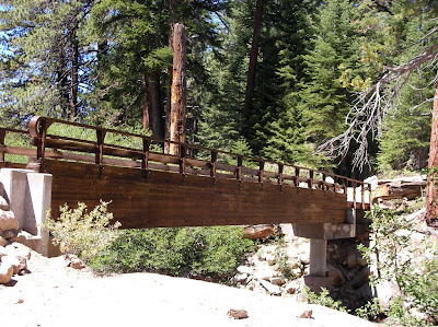
We descended into the Middle Feather River Canyon. “Delightful Spring” was a mere trickle. Saw one of the most amazing bridges on the trail. Haven’t been able to get my mind around how they haul in and build this stuff in the wilderness. I swam in a “fantastic pool” in the river. It was wonderful. I got a swim and a bath. We hiked to Bear Creek for a camp above it.

A huge climb today. In fact two. 2700 feet up to the rim and on to the alternate route through Bucks Lake. Five miles of road walking. Met Petrie with a 70 pound pack and a good attitude. Nancy Williams did Trail Angel duty for the first time this year. Haskins Store has real Turkey Sandwiches. We walked to Bucks Summit and put in another 1000 feet to get to our last camp. I lay in my Tarptent surrounded by large black ants and spiders. I’ve gotten used to them and they don’t bother me. My wife would never have anything to do with this. She might be the sane one.
The last day brought us through some sweet forest walking with the first cows in this section. 16 easy miles but a huge leg pounding descent into Belden at the end. 36 switchbacks. The hiking days never exceeded 80 degrees but it was a 100 at the end. I’m at 1289 miles from Campo. What a project. Canada or bust. Another gauntlet of giant Poison Oak. Belden Town resort is well run by Karen. Food good and beer cold. Took a shower to not offend Rachel back to the Oakland Airport.
Not as hard as the Sierra sections behind us but the most mile for me, 192. We averaged 17 miles a day in 12 days. A very nice journey.

Sunday, July 19, 2009

The next section.

Hello friends and hikers.

The next segment on the PCT for me begins August 15th at Echo Lake. Number 24 since Campo. I have two weeks to make it to Belden, Ca, 192 miles! My biggest segment yet. For the first time I'll be flying to an airport to hike a section. I'm getting picked up in Oakland by Rachel Ginsburg, friend, hiker and trail angel. (She puts in another whole week this year at Sierra City helping through hikers.) New friend and hiker Sheila O' Rourke will pick us up at the end.

Trying to figure out best places for resupply. Lot's of choices but don't want to wait a day for a post office to open.

Sad news is Bill Redman my best hiking buddy, advisor and sage will pass on the hike this year. He had knee surgery and is progressing well but no hiking per the doctor for nine months. Good news is Paul Freiman (Capt. Bivy) will join me. He has an amazing knowledge of the trail with a can do attitude.. He also has huge hiking experience. Bagged a ton of peaks too. Looking forward to getting to know him better.

We may make a push for Chester or Old Station if things go well. We'll see.
Let me know about your plans for summer adventures.

Sunday, September 14, 2008

Pacific Crest Trail Segment 23 – August 17th through the 27th of 2008

Tuolumne Meadows to Echo Lake. 152 miles.
Here is a short video of places along the way video.
Here are the photos Bill and I took.

152 miles of the PCT anywhere is a physical, mental and logistical challenge. I spend many hours over the month or so before the big walk planning, preparing, packing and getting in even better shape. Except for the last section along the John Muir Trail this part was as uninhabited as any we’ve been through so far. Twice I relied on day hikers to take out a message to my family. I never got a cell signal till the last day above Lake Tahoe. We did it in 9 days. It was hard but didn’t beat me up like the last section. I lost 7 pounds. I ate quite a bit not enough obviously. Having 10 days worth of food forced us to choose with care. No more couscous for me for a while but macadamia nuts are still great.
We got a ride from Echo Lake back to the Tuolumne Meadows trailhead from Rachel Ginsburg super trail angel, hiker, friend etc. (more later) We couldn’t have pulled off the car shuttle better. We went through a terrific thunderstorm on the way to the trailhead. We saw a fire started by a lightening strike. Rachel didn’t join on the night hike to Glen Aulin. Walking 6 miles in the dark to get a jump on the mileage was not her cup of tea. We arrived at about 11:00PM and no matter what they say you can’t hike at night with a full moon; use your headlamp. Lot’s of indistinct trails over solid rocks; camped near a bear box which we used. The next day we lit out for the territories. The first few days are a roller coaster of climbs, passes and deep canyons. Lots of pack trains out there and saw a mule stampede that made us step off the trail. The cowboys were right behind and a few hours later the mules came by again in tow. Like me the mules get free and they head for the barn.
Everyday I was able to bathe in a lake or creek except one, a great joy. Only a few of the passes come close to the height and difficulty of the last section. Heard Clark’s Nutcracker annoying scream at Bensen Pass. Like crows they are part of the bird Mafia. Had a two mountain pass day and with the ups and downs, the altitude, felt weak. Passed a pretty lake with a freaked out duck. Didn’t see the chicks or eggs but were sure that she was protecting them. Lot’s of deer. Very tame except for the skittish youngsters. They know they have no worries from us. Some pretty Aspens here. First among equals in beauty. Surprised to see some scrubby desert like microclimates above 9000 feet. A real diversity of plant life, deep forest and the occasional moonscape. Bill thought he saw some beauty that equaled the Grand Canyon on a small scale. I’d agree. Noble Canyon had a compact version of an Anasazi cliff dwelling. Some terrific trail work along the way including diversionary channels for runoff that resemble trail junctions. I think I counted six deep canyons in a few days. 2000 feet descents in a mile or two with commensurate ups. Best to do them in the morning when it is cool. You just can’t schedule a hike like that. I had about 36 pounds to start with everything. Had a few nights, one in Grace Meadow, with lots of condensation. Dried off tent and bag at lunch. Never seen such moisture before. Nearly freezing in the morning. Bad camping spot.
Trails in meadows often turn into ruts. You can be walking 4 to 6 inches below the meadow floor. I trip and stumble and can’t figure what to do with my poles. Finally I shortened the poles to compensate for the depth. Started seeing cows. They must be grandfathered in because they tear up the ground and soil the creeks but this is real grass fed beef. Don’t know where you can get it but someday I’ll find it and give it a try. Saw a 15 person Sierra Club group. Probably more brains in one group than anybody on the whole section. I entertained them for about 10 minutes with jokes and questions. Sorry I wasn’t part of this group. They had a bear GORP attack the previous night but had enough food between them to go on. We never hung out food but sealed it in multiple bags and put it at our feet. First 15 mile day. Hey we’re in Volcanic areas now. The handbook says less granite and more Volcanic rock for the next 400 miles. Some amazing piles of rock as a result of eruptions along the way. The day before and after Sonora Pass was amazing. Incredible views, high altitude, dramatic sheer cliffs, narrow passes and big ups and downs; I’ll bet` we could see 200 miles. Coming down to Sonora Pass a heavily laden pair going up asked “do you have everything you need in there?” I said “looks like you have everything you need in your packs.” “Do you have a beer?” One said “if your name is Dana there is a beer down at the pass.” I said “My name is Dana!” Turns out Rachel Ginsburg put two bottles of Heineken at Sonora Pass for us. What a sweetheart. Met Angie the Forest Service Ranger from Utah on a busman’s holiday at the pass. She was in the area for a fire but things had calmed down and she was free to wander. “This is beautiful here.” We agreed. We went back above 10000 feet that night and camped at the highest point of the trip. Ran into a group of trail guerillas who only maintain the PCT. They were filthy young people with ecological degrees starting their life with a summer in the wilderness. We thanked them for their work. They ended their arduous day by hiking up a local peak. Saw some grouse the next day. Big bird! Good eating? Nobody on the trail today. Have seen 53 people so far. A fraction of the 600 last year. We bathe daily, wash our clothes, cook hot meals lunch and dinner. We’re passing a few roads now and saw 19 people, mostly day hikers near Highway 4. Only a couple of long distance hikers, two of which were recent graduates of “U Dub” or the University of Washington. I asked “what are you going to do now that you are grown up?” She said “I’m not grown up. Look at this pack. I am a Nomad now.” I woke up that night and saw the best firmament ever. It was glorious. Even with my worsening eyesight. We walked by the very windy “Nipple” on the next to the last day and passed the Lost Lakes before camping by the “Lakelets” below. I made a mistake and passed an easy water source. We were dry, windblown, and exhausted at the end of the day. Had a flyby by a flyboy in a jet and what a sound. Great lake where I washed on a submerged rock and filtered all the water we needed as a mea culpa. Got a signal and called my daughter and son. Wife was out but called me later. The last day we did a 20 mile or so to finish off. Saw two hikers, passed Carson Pass, fabulous views into Tahoe and the southern Reno valley and long beautiful meadows. The last hiker was a young lady in a two piece black athletic bikini miles from anywhere. I figure we deserved that. She said “You’re the only people I’ve seen all day.” I said “you’re the second person and best thing we’ve seen all day.” There was a huge, slow, rocky, descent in a canyon before we got to Highway 50 and a Ski resort. You needed to be a Billy Goat to move quickly. Deep forest and couple of miles to the shores of Echo Lake and my car. The worlds best trail store is at the boat rack. Packed with goodies, fresh vegetables and fruit and a place for a good burger. They guy who delivered the produce gave us a peach and some desserts, nice. Bill and I walked to the center of the dam at Echo Lake, high fived, and made a promise to come back next year for the next segment.
PCT hiking is running a marathon everyday for 10 days. Bill says it is half a marathon. Regardless we’re starting a business: Bill and Dana’s 10 day, 10 pound fat loss program: tent, backpack, sleeping bag and food extra. The adventure is not the view but the challenge. The view is spectacular however. You see beauty and places no one will every see. The scale of nature is moving. Wilderness means being virtually alone. A handful of people every few miles. California is big, really big. 30 million people but drive 30 miles from anywhere and be alone.

Saturday, August 02, 2008

Article on my PCT talk from the San Diego Reader

Hot, Miserable, Amazing
By Barbarella | Published Wednesday, Feb. 6, 2008 San Diego Reader

“The first thing I learned was that the man who has water on the mountain is king,” says hiking enthusiast Dana Law. “Water is absolutely the most important thing you’ll have in Southern California, because this really is the land without water. When I saw my first mountain spring I was totally shocked. It’s the most amazing, unusual thing I’d ever seen.”
On Wednesday, February 13, Law will appear at the La Jolla/Riford Library to talk about his experience hiking the Pacific Crest Trail. “This is one of three national scenic trails; it encompasses the entire U.S. West Coast beginning right here in San Diego County at the border in Campo,” explains Law. “It’s a connection of mountains and desert roughly 2650 miles long, all the way to the Canadian border in Washington State.” Law, a self-employed fitness buff, has hiked 974 miles of the trail over the course of 22 separate journeys. He learned of the trail from another hiker in 2003 while on an 11-day, 140-mile “sea to sea” course from Torrey Pines to the Salton Sea.
Law experienced his first emergency on a hike in May 2004. “It was 80 degrees the day before and 80 degrees the day after, but it turned out to be 100 degrees on the day we left.” When the trio of men set out, they made a pact to speak up about any adverse condition or health problem. Several miles in, one man began to look sick. “He kept being a guy and saying, ‘I’m fine,’ but then he collapsed.” Law climbed to the top of the nearest peak and called 911. “He had to be airlifted with a helicopter. It turned out he had heat prostration. He was running on too little water.”
Law, who hikes Cowles Mountain twice a week with a 25-pound backpack to stay in shape, says he is “constantly morphing and tweaking techniques to survive.” In addition to finding the proper shoes (hiking boots are out, tennis shoes are in), Law thinks the most difficult hiking hurdle is the ongoing struggle to reduce the weight of his pack. “One of the first trips I took, my pack with water and food was about 45 pounds, which was much too much — I was totally wiped out after only a few days. In the Sierras I had a 38-pound pack with about seven days’ worth of food. An average pack these days shouldn’t be much higher than about 25 pounds.” New technology in hiking gear has helped. Law’s old pack weighed 4.5 pounds, but his new “ultralight” bag weighs only 2 pounds.
One danger for which Law has learned to prepare is hypothermia. “Staying dry is absolutely essential to your success and health and happiness. You don’t even have to be that cold — it could be 40 degrees and you might think that’s not freezing, but think of what your body temperature average is. If it’s 40 degrees and you’re wet and you start shaking, you could lose your life in the middle of nowhere.”
In Law’s experience, it’s heat that causes more problems than cold. On several occasions, he and his team realized that they had gone too far in hot weather. The worst of these may be the time when they covered 15 miles in one day across the Cajon Pass on the way to Las Vegas. “We went up 4000 feet in 15 miles, and it was incredibly hard. It was hot, it was miserable, it was the most challenging thing we’d ever done physically in our lives.” Of other hot-day treks, Law says, “I’ve had nausea and weakness. Sometimes I’ve collapsed at the end of the day and curled up, speechless in a ball for an hour.”
Oddly enough, at no time during any of his journeys has Law suffered a blister. He does not attribute this to his shoes (trail-running tennis shoes), but to the high state of physical conditioning he maintains. At 53, Law is the youngest of his hiking partners. Despite his conditioning and experience, he is not immune to making mistakes. While entering the southern Sierras, Law fell behind his friends and admitted he wasn’t feeling well. When they arrived at the nearest stopping point, Law passed out. “Twelve hours later, I woke up in the same position.” In this case, Law believes he had consumed too much water. “People get sick from drinking too much water. Remember the woman in that contest who died?” (In January 2007, a 28-year-old died after participating in a water-drinking contest on a radio station in Sacramento.)
Hiking enthusiasts love to trade information about their favorite gear, as evidenced on numerous online forums. Aside from his MP3 player, which Law says helps him get to sleep in his tent, the one piece of gear he treasures above all others is his bandanna. “You can filter water with it, keep your face covered, and wipe the sweat off.”
— Barbarella

Thursday, September 06, 2007

PCT trip 22 August 5th through the 17th. 171 miles.

Click on the links for photos and videos.

Our sections get farther and farther away. We have walked every step of the PCT consecutively north from Campo, Ca. It now means it really takes a whole day to get to the trailhead. In this case we had to drop off a car at Tuolumne Meadows, spend a night in the backpacker’s campground, and get a ride to Onion Valley near Independence to reenter the trail. There was a search on up in the Yosemite area for a lost hiker. The rangers didn’t have time to talk. Our driver was Rachel Ginsburg of Oakland. She was my “blind date” early this year when I picked her up at the San Diego for a ride to a PCT segment here in San Diego. I have a lot to do to make up for her help on this long section. Getting back to our latest section means walking over Kearsarge Pass, just west of Independence which itself is over 11000 feet. It wasn’t easy getting out last year and a bit harder getting in. I am in good shape but none of us could be prepared for the altitude. Ray Ellis got up there first after one of my water bottles sprung a leak and I fell back. I rearranged my pack and Rachel accompanied me for an hour. Paul Freiman went up before me but I caught up to him in a little while. He started feeling unwell quickly; something that would bother him for most of the trip. This is a dramatic spot, one of the great views of the Sierras. Once we joined up at the pass we descended past a section which had been recently rerouted and improved.

Our first night was spent at the northern junction above Charlotte Lake. I shoehorned my tent into a tight space and realized I should have placed us at the bigger junction. At my first dinner I found out I had forgotten my salmon. Fortunately between jerky and protein bars I was fine.

Our first true mountain pass the next morning was Glen Pass. At the time it seemed incredibly challenging but as the hike progressed it was remembered a merely as a good warm up. Most passes are bleak rocky ascents into a treeless world. Some like Selden Pass have a beautiful run up. Still they are an alien place. After Glen Pass we passed through Rae Lakes a fine area and crossed our first creek ford. In this case a lake outlet. We were reminded how difficult it must be for early or wet season hikers to cross these things. It is dangerous, time consuming and scary. For me it was sobering.

On day two we ran into a hiker looking for the local Forest Ranger. A diabetic man on Taboose Pass had collapsed and needed help. He said that two doctors were with him, which should be no surprise because of the talent, experience, and quality of the people out hiking. We saw a helicopter fly over later and found out the next day he was in the hospital and doing fine. Saw 103 people on the first full day and 28 women.

I bent one of my hiking poles going up Pinchot Pass which was a bitch with a dozen switchbacks up a nearly vertical rock slide of talus; like walking through steep gravel pit. Many are what I have deemed “Landslide Trails.” Steep rocky trails in a gravel pit. One earthquake and the pass would be blocked. Water is scarcer this year and we make sure to get plenty when we need it. We did Pinchot and Mather in one day. It was too big a chunk. We ran into a very clean hiker: shaved, sparkling, a real scout who said “one pass a day for me.” He was a bit smug. We passed one cool suspension bridge over I believe South Forks Woods Creek. Only one person at a time passes while it swings back and forth. I keep saying to myself “keep looking straight ahead”, spooky. I had blown out two of my three Platypus water bottles. Ray gave me a Nalgene bottle that I used for the rest of the trip. I have to buy new bottles for each trip or risk having none.

The Muir trail section of the PCT is a roller coaster, a pass, a deep valley, steep climbs and descents, a pass and so on. Most of them are beautiful but difficult. Descending in to Deer Meadow we saw patches of dead trees. This was sad because the flora in the Sierras is in such good shape. I thought it was the Bark Beetle but turned out it was fire damage. It appeared a lightening attack had centered itself there.

Paul Freiman decided to fall back and hike at a more comfortable pace to reduce his discomfort from the altitude. His plan was to exit earlier and meet us at the end. I got pretty sick of my protein bars by this time. We always find a food we can’t stand on a trip. I could never get enough beef jerky but later replaced my food bars with Snickers at Vermillion Valley Resort , heaven! We are averaging 11 hour days. Brief stops for water and a short lunch. Before Muir Pass we had the largest campsite, Big Pete Meadow. An early stop, good wash from the creek and lots of really nice people to talk to. There are lot’s of sharp interesting people on the trail. It is a self selected group of educated, aware, motivated people. One lady, a newbie, with a big dream who had struggled in that day over Bishop Pass asked “will Muir Pass be hard?” I told her I hadn’t been there but they were all hard. Very few minorities except for the Asian’s mostly of American extraction. Are white people in general the most likely to enjoy outdoor pursuits? Is this a cultural thing? Ran into to two African Americans both youths with scout groups. I have seen lots of people with fishing poles but only one person with fish.

We had a late camp one night at high altitude above the Palisades Lake near a feeder creek. It was near freezing in the morning. It is never easy to get out of the sleeping bag when there is a chill. Saw a naked man on a rock fresh from a bath, female co hiker looking on. We descended the Golden Staircase which is blasted out of the rock in a narrow canyon. The handbook says that it was the last section of the Muir trail to be finished and I can see why. We expected summer rains on this trip but it never happened. We had blue skies almost every day. Saw two other people with ULA Catalyst packs. Like me they had changed from the ultra light packs that just don’t carry enough weight. It is a lot more comfortable too.

I like the Sierras but don’t always see the beauty others find. Muir Pass was really a long hard slog but quite a pay off with the view. The Muir hut is one cool thing. Bigger than I imagined. Must have been a heck of a project. Saw Marmots and their babies.

We crossed a lot of rivers on this trip. Most of them were quite low. I can’t imagine trying to cross them in a normal season of snow and rain. It must be quite difficult for early season hikers. I had to take off my shoes once and those rocks hurt bare feet. Only reason I could imagine taking ugly Crocks. I have never had camp shoes.

It got a bit frosty on a couple of mornings. I have 20 degree down bag and I was toasty except for the coldest night. I felt the chill a little.

Ran into a guy who had named himself Wilderness Destroyer the day before when the Rangers asked him to move his tent farther away from the river and trail. He cussed a lot about the situation. Claims he dared the Rangers to give him a ticket. Don’t believe him. I think he is a coward and had the conversation in his tiny head. Ran into a nerd hiker who had just “bushwhacked cross-country.” I got the feeling he felt real winners had what it took to go cross-country. I’d like to try it sometime but not by myself.

Ran into our first Pack Train. There are hikers up here with small packs doing about 10 miles a day that are supported in every way by pack trains. Tents, food, fuel and anything else except the basics is carried for them. I wouldn’t do this plan but it still sounds like a sweet deal. Horses have a pretty good deal up here too. They can poop on the trail. Forgot the riders name but he had 8 horses and mules packed to the gills.

Near Selden Pass I tripped and fell flat on my face. Banged up my legs and right knee. It would be so easy to get hurt up here. I was carrying my poles while walking on a flat rocky trail and promised myself it wouldn’t happen again. Quite a scare but I was fine. You have to pay attention all the time. You can’t spend too much time sightseeing when you are walking. Selden had the best approach to a pass. Two wonderfully pretty lakes and the perfect forest. It reminded me a bit of some of the trees in the San Bernardino’s that all the same height with no messy forest floor; like a Christmas tree farm. This bit of Eden was enhanced by another beautiful pigtailed hiker who wanted to talk. I think these young women see me as a father figure. I can go with that. They all remind me of my daughter anyway.

My friend and former co hiker Bill Redman is a few days ahead of us on the trail. He has become my PR agent telling several groups we were behind him and describing us. Three groups of hikers recognized me from his description. I feel like a celebrity. I wear a bandana over my face when I hike to protect myself from the sun. I think that is what Bill has told them to look for. One lady who didn’t know me said “you look gangster” and another guy said “I thought I was going to be robbed.” I cover up completely when I hike. I wear long sleeves, long pants, gloves, big hat, sun block and the bandana. The sun is the devil to the skin. We are getting plenty of Vitamin D just being out there. Young hikers look awfully good but the older hikers with a lifetime of sun worship look like a wrinkled leather bags. Not a pretty picture.

Every time I unload my pack it looks like I getting ready for a yard sale. What a mess of bags and detritus. The contents are organized and essential but it doesn’t look like it.
My legs are really starting to ache at night. This was an eleven day trip but I could see a through hiker could never heal with one zero day. This is the hardest consistent physical effort I have ever done and that is saying a lot.

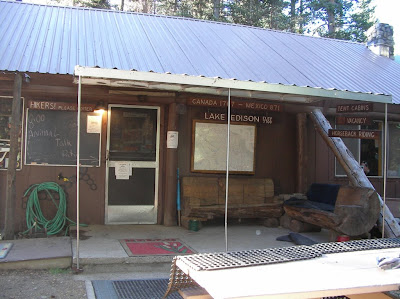
We got to Mono Creek and peeled off to Edison Lake for a ferry to Vermillion Valley Resort. The lake is very low. I heard it was 30 feet below normal. It is pretty surreal. You walk about a mile across mud flats to a place deep enough for the pick up. Three low life young people drinking beer arrived with the Ferry. 15 hikers filled up the ferry which is a euphemism. It is a flat pontoon boat. The pilot put his empty bottle of Stone Ale at his feet and lost control of it as it rolled about and he did foot ballet to keep it there. Most of us looked at each other in stunned silence. I suppose it is difficult to find good help in the middle of nowhere but this was the low end. The “Resort” was a scream. Like a trailer park after an earthquake. The food was great and the young losers that picked us up turned out to nice enough just lost early in life. We suspected the owner who was in town getting supplies lost control when he left the property; when the cats away the mice play. You do get a free tent cabin to sleep in the first night. The chef, waitress and store manager were fine people. After I went to sleep Ray sat at the campfire and watched a bear attack the camp looking for chow. They fired some sort of cherry bomb gun at it with mixed success. We had time to meet some cool people at VVR. One lady, an American living in Oman, we get our help as she comes into the dry Southland.

Going north on the trail means 90 percent of the hikers pass you quickly going the other way so having time to meet people is special. We ran into Paul Freiman getting on the “ferry” when we left. He is doing better. After getting back on the trail had a very stiff climb which ended with 53 switchbacks on the other side of the mountain. Hiking the Muir/PCT trail is a roller coaster. I pitied the people going up that side even though we had done the same in other places. Not long after we stopped for water and creature the size of a fox run by with a small squirrel in its mouth. It must have been his dinner. Saw several deer.

Silver Pass was a gentle climb and pretty one too. There is a notch at the top that turns out to be the pass. Bill Redman’s PR got me recognized by two hiking ladies my age near the top. This trail is becoming very dusty. One particular day I found I had a fine layer of dust on everything.

We had a scare the day before Reds Meadow. In the morning we were climbing up out of Tully Hole and I said to Ray “it is pretty hazy today.” Later it got worse and I smelled smoke. At Lake Virginia the sky was completely socked in. The first trail gossip we heard turned out to be correct. He said that a Ranger told him it was from the fires near Santa Barbara. For a few hours though we were trying to figure out how we would escape a Sierra Fire. This was a big day for us, 18.5 miles into Reds Meadow. The last 10 miles is pretty pleasant walking. It was good to have a hot meal and a free hot springs shower. The old building has no lights and I had to leave the door open a crack to wash up but it was wonderful. I met owner of the restaurant, store and stables: Bob Tanner. He has run the place for the last 47 years. He has had three strokes and moves at a snails pace with a cane but his mind is great. He doesn’t think that Ansel Adams deserved a forest. He says that he and his buddies did more for the Sierras’ by blocking the Trans Sierra Highway that was going to be built from the Owens Valley to Fresno in the 1960’s, very interesting guy.

Leaving Red’s the next day we walked past the Devil’s Postpile. Having seen it as a child in the nineteen sixties it does, as one older hiker said to me, “look smaller now.” It still is a remarkable geologic site. After Agnew Meadow there is a steep climb into higher altitude but virtually treeless. There is a lot of water here. This mountain must be a big sponge. The view of the Minarets and Shadow Lake is breathtaking. The skies were still hazy from the fire. I will find a picture of the view we had and post it here. My photo wouldn’t have done it justice. As I mentioned before I quickly get my fill of the beauty of nature after hiking for days but this transcended it. The Muir Trail which splits from the PCT after Red’s rejoins it in this section.

We camped at Badger Lake off trail after we met the Badger Lake Chamber of Commerce. This was a family that was camping there and insisted we meet them later. We went to the lake and kept hearing them say “over here, over here” and then never saw them again. Except for a few fisherman it was empty. My feet were in good shape. Haven’t had a blister in all these miles but my legs started to ache at night in the tent. Thank goodness for ibuprofen. Did I mention catch and release fishing is silly. You should eat them unless they are too small. Not that I am fishing. What a lousy hobby if you can’t eat the result.

We came down into Thousand Island Lakes the next morning and I missed a turn and wasted an hour touring the shoreline. When we finally got out of there I tried not to turn back and look at it. I was afraid I’d turn into dressing.

Our last pass was Donahue and it looked like a piece of cake on paper but it is a pile of rocks on both sides. It is a real leg beater. I got really tired going up to the summit. I didn’t want to slow down because some clouds were coming in and I didn’t want to get stuck up there in a storm. I waited for Ray and said “let’s get the hell off this pass before something happens.” He said “I don’t care if it rains.” I replied “who cares about rain.” Descending from Donahue is rougher than ascending. Both sides are very rocky but the north side is bone shaking and knee jarring. Just when you can’t take it anymore it smoothes out to flat Lyell Canyon the best way to finish this section. We spent the night at the trail for Vogelsang High Sierra Camp. I thought I saw a Bigfoot but it turned out to be a teenager. The last day was very chilly till the sun came into the canyon and then an easy short walk to Tuolumne Meadows. We ran into Paul Freiman early just as he said and to our surprise Bill Redman who was hanging around for a permit to go. We had a tough but fulfilling hike. As soon as I was done I started thinking about the next segment north to Lake Tahoe. Often I can’t wait for a hike to end but then….

I was reading about poetry in a history of Japan. The poet-scholar Tsurayuki said “In a world full of things man strives to find words to express the impression left on his heart by sight and sound.” The impression I have is that the Sierras are dramatic, stark, beautiful and inhospitable right below the surface. We only have a small window in which we can pass fairly safely. The biggest impression for me was the achievement of finishing this section. Personal accomplishment moves me more than nature. I could never be a poet.

Sunday, September 24, 2006

Pacific Crest Trail trip 21 – August 18th through August 25th, 2006. 87 Miles.

See the photos here:
Pacific Crest Trail Hike 21
Aug 18, 2006 - 197 Photos


This was the longest trip yet. We spent seven days on the trail and took a ton of food. As always it took a bit of work dropping off a vehicle at the end and getting back to Kennedy Meadows. We hired Gary from Ridgecrest to take us to Kennedy. It took about 10 hours to pull it off and then we walked 11 miles. The weather was nice for the whole trip. I don't think it got much above 80 degrees. We passed and saw Beck and Monache Meadows. There was a controlled burn in this area that made the view a little murky. There never was a real clear day because of other fires. We are all carrying about 40lbs with food and bear canisters. It is the law up here and three extra pounds. I immediately felt the extra weight. I decided to bring my Mariposa Pack and it is overloaded. I took a chance with a light pack that turned out well. There is a lot of water up here. I think the farthest distance between water sources is seven miles and that is a miracle after 700 miles in Southern California. This is still cow country. We saw a big black object near the South Kern. Our eyes are old enough that for a while we thought it was a bear. Only a bovine. At the South Kern River we ran into a Sierra Club group that had bagged Olancha Peak. A guy came up to us in the dark and recommended we camp on the other side of the river. He thought we were part of his group and frankly he was a little nosy. After he found out we weren't with him he kept giving us advice. He turned me off. We were at 8000 or so feet and the stars were awesome. We got frost the next morning and our water bladders were frozen. It was a reminder to sleep with your water bottles. You can't filter water either with frozen tubes. Our first leg took us a long way up Cow Canyon. We filtered along the way: 14 hard miles today. We did see a lot of skunk cabbage. It was a bit hard to follow the trail in places because the whole area is so recently wet that every bush and plant is growing like a weed. There are still some wildflowers at higher altitudes which is a pleasure. We crossed Gomez Meadow on a causeway (a word I like to use) that keeps your feet out of the swampy meadow. A sheepherder carved a man smoking a pipe on a tree here about 100 years ago. I like ancient graffiti. We took a long to time to go the eight miles to pass the turn off for Olancha Peak and then down into Death Canyon. Our camp location that night was sensibly set by Bill before a 2000 foot climb that next day. I have developed a rash again on my lower back from the heavy pack. I think it is from the pack. I put duct tape on it and wrapped my fleece around my waist to stop its progress. The big climb on the 20th gave us a great view of Owens Valley to the east and the White Mountains. Perhaps we shall investigate them some day. We ran into Dave Drew recently retired from the Alaska DOT doing a section. Most of the hiking today followed a ridge that had several places to go off trail for water. I watched them all closely so we could get water at the last possible one, Dutch Meadow, to reduce water weight and then I missed it. We had to walk to Corpsman Creek to get water and we were thrilled when we saw it. We passed Trail Pass Trail. We needed a good camping spot and we found it at the edge of Poison Meadow which had a beautiful view east and west here.

On the 21st after Cottonwood Pass we passed Chicken Spring Lake. This beautiful lake with surrounding dramatic rocks called cirques marked the beginning of uniquely Sierran views. We had a big up after this and walked through a nasty section of rocks and sand. It slows you down and beats up your feet. There were some great views of mountains to the west. We passed a young couple. The women was pregnant and seemed to be far along. It couldn't be too long until a hiker baby was born. Another hiker, Bill, was starting his JMT trek from Cottonwood Pass. He was way overloaded and later we shared our water so he could survive to the next source. This day was the shortest. We slowly descended into Rock Creek, one beautiful place. We were alone when we arrived but soon there were 20 other hikers in the campground, a Sierra Club group, some older Boy Scouts with dads and a few strays. Bill, Ray and I were able to wash off very well in the river and even do some laundry. This has to be one of the more idyllic places we have ever been. One guy in the Sierra group figured out Bill's age and accomplishments and went on and on about how amazing he was. It made his day or week. It was nice to have some company to talk to. Saw our first Ranger who wanted to see our permits and bear canister. I showed her everything she needed while washing Ray's hair. She looked at the permit and said, "Where's Manning?" I explained it was the Canadian border. We attained Guyot Peak by 9:00AM the morning of the 22nd on the way to Crabtree Meadow. 3800 foot gain today which is the biggest of the hike. At 1:00PM today we met the John Muir Trail. The PCT and JMT join each other for 176 miles. It came after Crabtree Meadow which has a terrific view of the mountains to the east including Whitney. We had a big tiring climb up to the Bighorn Plateau that we were sure was badly routed. I renamed it "What's the Point" but it turned out to be the best way. Most of all our hiking has been at ten or eleven thousand feet, often above the tree line. The plateau has a 360 view of every mountain range within 50 miles. I saw my first Marmot. Our camp was at the crossing of Tyndale Creek which appears to run through blocks of rock stacked like Legos. I found a personal pool protected from the rushing water. It was wonderful. I almost got clean. We put our food in a Bear Box for the first time, a bear canister in a bear box, funny.

The next day we went over Forrester Pass after passing through a land of mystery and beauty. It was a something out of Tolkien. We passed creeks, ponds, grass, views of Whitney and patches of snow, some of which was watermelon snow, pink from algae. It reminded me of a Chinese contemplative garden. Now we have seen what they try to recreate in an urban setting. We met a very attractive lady, a Veterinarian from Canada, on the way up, obviously a veteran hiker. We took her picture and Bill and I were smitten. The trail over Forester Pass is a remarkable achievement. In places it seems to be carved out of the rock. Huge boulders everywhere. A nineteen year old died in 1930 when it was built and there is a plaque commemorating his death. We all felt very strong going up to the highest point on the PCT. There were at least eight hikers coming up the other way when we arrived. This turned into a flood of people we passed in the next few hours. Most of them loaded to the gills. I was worried that we had too much weight but almost everyone else had to be carrying ten to twenty pounds more. I felt sorry for them. I passed through a strip of snow covering the trail and the guys decided to walk around it on the talus. Bill said "you seem to be doing well" and then I fell on my butt. Soft landing and I was fine. Pride goeth
before the snow fall. There are lots of lakes here and many have a beaten path to them. I am sure the angling is good because we can see the fish hitting the surface. We descended into Vidette Meadows in a lovely treed area with Bubb's Creek nearby. We passed a lot of small streams and near the end of the meadow there were about six in a row which must be a record. We took a long break near the end of the day for a meal, washing and rest before climbing steeply out of the canyon. We saw a batch of lightly loaded hikers on the way up. There was a large pack train near the bottom and we deduced that they had been dropped off near the top to get the hiking experience. This climb was hard. We arrived about 7:00PM for our final camp near the junction of Kearsarge Pass and Charlotte Lake trails. We started the walk over Kearsarge early the next morning. It was Ray's 61st birthday. There are several lakes near and below the trail on both sides. Several feeder streams cross the trail. We never had to take off our shoes to ford a stream on this trip. The way out of a Sierra hike is a familiar one now with a sharp climb to a place in a rock wall and then down. There was good stream of hikers passing us on the way down. The first had a fishing pole and a Labrador. A Lab seems like the perfect trail dog and happy to be hiking. It is a long way down to the parking lot. We arrived about 11:00AM. I saw 154 hikers on this trip. The Sierras are pristine. People seem to be taking careful care in their travels. This was tough hiking. The views are becoming more beautiful and dramatic. It don't think, with snow pack, that we will be able to continue our journey for at least 10 or 11 months but we hope to get in some kind of trip in the meantime.

Tuesday, June 20, 2006

Pacific Crest Trail Hike 20

Walker Pass to Kennedy Meadows – June 5th – 8th, 2006 51.6 miles.

See the pictures here
Listen to the Podcast here
powered by ODEO

On June 5th we left Walker Pass Trailhead after 2:00PM. These hikes are getting more difficult to get to. We had Dollar rent-a-car pick us up in Kennedy Meadows and drop us off. It was 91 degrees. A few minutes into the walk a fighter jet flew west through the canyon below us. It was very quiet. At first Ray thought it was a big rig. In five miles we got a big view of Inyokern, China Lake and Ridgecrest and plenty of budding Pinyon Trees. We still haven't eaten from them yet. There is a memorial plaque here to Jim Jenkins who helped the PCT a lot before he left this world early at the age of 28. Lots of footsteps from the through hikers here. This is the season. I have mixed feelings about the through hikers. I want to see them and talk to them but we have the trail to ourselves, at least so far, for most of the year. We met 10 hikers in 50 miles. I can't imagine why I think this might be important. It was a joy to see all 10 of them.

We got in 8 miles that first day and climbed several thousand feet to the Owens and Jenkins Mountains saddle. Its big shadow is projected on the Mojave Desert at dusk. Met the Mad Scientists, Amy and Mike. She is a botanist; he is a wildlife expert. They have done California before and this time they are using the trip to gather information for their graduate thesis on determining what kind of wildlife exists based on the vegetation in an area. They both attend UC Davis. Great couple. We slept well and had good views east and west.

The next day we got our water at the seasonal creek before Joshua Springs spur trail (the water source at Joshua Springs has traces of uranium in it, and though not serious is worth missing) before going down Spanish Needle Creek. We saw Nolina Plants (Parry's Nolina) which are related to the Yucca but with an incredible lantern of small yellow blossoms that are firm like a leaf. At a Spanish Needle Creek tributary we had lunch in cool shade and filled up on water for our steepest climb of the trip. Along the way, we spooked two families of Mountain Quail with cute tiny chicks running around. The moms aren't as nervous around us when they have kids and spend their time rounding them up. It is funny to watch. Fortunately out first two
afternoons were cloudy and cool. Trainman had just gone through this section with his hiking partner a few days before and had a tougher time of it, I suppose because of the heat. The saddle above Spanish Needle near Lamont Peak provided a nice view and break. Soon we got another great view of the Mojave. The trail is in good shape here. We arrived tired after a 20 mile day. We bumped into Tadpole at a creek before Chimney Creek Camp and were barely civil. We apologized later. We walked up Canebrake road to the camp and met Moondancer and his son Prickly Pear at the campground. This kid is precocious and quite a climber. Talking to Moondancer later, he says, "Are your Dana Law?" Turns out he had called me several months
earlier about information on a previous section. He is a professor at Boise State University. Birds of a feather hike together! Thirty million people in California but if you have a niche interest you will probably meet someone who shares it. Three other hikers came into camp, two young men and a lady. Her name was Twisted Sister. You gotta love trail names. The three left early the next morning and we didn't see them again. A good camp and pleasant dinner, though my alcohol stove is getting sooty. I think my fuel has been contaminated.

On June 7th, we had big climb but over many miles. We saw a lone Sequoia far south of its usual habitat. Passed Fox Mill Springs and entered into the 14 mile burned section. Did some magic tricks for Prickly Pear on the trail. He has money in his ears! Crossed the highest point on the trip, over 8000 feet. Not much to look at because of the burn but got a beautiful view of the Dome Lands National Park. It looks like a climber's paradise. Also a great view again of the snow-capped Sierras. Bill could pick out Mount Langley which hides Mount Whitney nearby. We had a long descent into Woodpecker Meadow crossing many diorite rivers of rock down to Rockhouse
Basin. Long two-hour lunch with hot food under a giant burned out tree. Good stream here. I washed just about everything. We arrived at the first true river in 700 miles, the Kern. Even though Whitewater River was big last year because of the record rains, The Kern is a true river. For some reason I thought we had to cross the thing but that was not the case. Ray said, "I am not crossing any rivers!" and I felt the same. We won't have that luxury further up the Sierras. We camped with Sonny and Tadpole at Pine Creek before it runs into the Kern River. They had seen a big bear on the trail that day. Tadpole is as nice as she can be, and Sonny is the same with the addition that he is a total gear head and loves learning about every aspect of hiking. I wish when I was that age I asked as many questions. He was picking up a ULA pack in Kennedy Meadows that we didn't get to see. I gave him my pack of salmon I wouldn't have been able to eat, and he filtered my water at the creek. We had some thunder and a bit of rain that made us put our rainflys on but they came off for a night of a nearly-full moon and bright stars. It cooled off and chilled our water for the last day's segment.

June 8th: We walked about seven miles into Kennedy Meadows, a pretty area. The Kennedy Store looks just as a mountain store should. We had drinks and snacks with Tadpole and Sonny. We ran into the famous Lawn Ornament (famous to me for her trail name). The trail ahead is the most challenging because we will have to make much longer sections during a limited time of the year. We will go again for as long as we can in August. Hiking is outdoor therapy.

Wednesday, May 17, 2006

Pacific Crest Trail Hike 19 – Highway 58 Tehachapi Pass to Highway 178 at Walker Pass. 84 miles May 7th to May 12th 2006

This remarkably diverse section goes through mountains and deserts. After the traditional musical cars we slept in windy wash next to Highway 58 the night of May 7th and it was noisy, dirty and difficult to sleep. The walk up from Tehachapi Pass is steep and I got dehydrated and bonked at the end of about 18 miles; don’t know why. I thought I drank enough water. Saw 3 plastic PCT signs knocked over. Lots of Pinyon Pines which I found out always exist below the pine forests in dryer areas. Too bad pine nuts are out of season. Begin to see some wildflowers beginning with lupine. We scared off a large animal at Golden Oak Spring which is running well. We couldn’t see what it was because of the trees but it was big. Lots of cow pies in this section. This windy mix of public and private land means windmills for about 25 miles. Our first camp was at a very nice saddle. I slept for 9 hours! The body is a walking biology lab and some days the chemistry is out of balance.

On May 9th we left the camp under west facing windmills and walked to Robin Bird Spring. Keystone Kid and Balls from Portland joined us. They started the PCT early and skipped Section C because of the snow. Very nice young men and Balls is my son’s age. We saw a lot of cow pies in this area but no cows until we saw a giant black steer that ran away from us. Bill has cached water at two places for this trip but we had to depend on this and the last spring for the first 36 miles of the trip. Ray lost a walking stick; a nice one that had been made by a friend. We made a very nice camp above Cottonwood Creek and its tributary. Very quiet no wind. Balls and the Keystone kid passed by as we prepared our dinner. We never saw them again.

May 10th brought beautiful healthy pine forests along Landers Creek with an abandoned miners sluice box at waters edge. Crossed Piute Mountain road and found a trail journal with an invite for the house down the road about half a mile and history of this area once a town site called Claraville. Saw Velvet Ants, Grey Rats with a white butt (Bill calls them Bobtail Rats) and something that looks like babies breath and smells just as great. Got to Kelso Valley road after a big downward slope that took us completely out of the forest to a desert floor where the only shade is Joshua Trees. When we came near the road miraculously Mary Barcik super trail angel drove by. I hailed her and she said, “finally some through hikers.” We aren’t through hikers but we were thrilled to see her too. She said Robin Bird Pass road was repaired thanks to the efforts of Warner Springs Monty and some PCT hikers haranguing the proper officials and she had cached water at this important spot. She took Ray and my home numbers to call our wives as there is no signal in any part of this area. The walking is pretty easy afterwards but becomes a hot bitch on the way up to Desert Divide. We passed it about 1.6 miles to a great camp overlooking the desert. Through hikers who come through this area later must really suffer from the heat. We camped at the top of a wide desert valley to the east. We heard the braying of wild mules left over from the days of the prospectors. Hope they don’t come up here and try to mate.

May 11th gave us an early start out of lower elevations. It got hot yesterday which is what killed us. I have come up with a definition of PCT hiking especially in this area. It is a forced march with breaks. We have to cover so many miles to accomplish our goal that we must good use of daylight. I don’t want to walk at night even though we encountered our first full moon in three years of segment hiking. We saw an old rusty bus in a ravine and then as we descended farther found the hoof prints of the mules we heard the night before and then a carpet of flowers on the way to Bird Spring Pass. They smell great but they make Ray sneeze. We saw a rattler at the pass and curiously a Jackrabbit rolling in the dust like a happy dog. He didn’t seem too worried about us. Mary has a big cache here. Bill had left 4 gallons for us and we drank or packed it all out of there. There is no spring at Bird Spring Pass. Four well equipped motorcyclists went by on Hondas while we enjoyed our lunch break. Skinner Mountain is the big jump after the pass and the highest point on the trip at 6900 feet. We ascended 1100 feet in 1.1 mile fully loaded with water. Bill started to get sick. We still can’t figure out why because he fully hydrated at the bottom. Maybe he drank too much but we don’t know for sure. We got back into the Pinyon Pines on the north side of Skinner. I finally realized that it isn’t just altitude that brings you back into the forests but the side of the mountain. It can be barren desert at altitude on one side and a lush forest on the other. Bill couldn’t eat or drink at our next break. His stomach had taken over his body.
There are some killer views of the snow capped Sierra from here; beautiful. This has been first really clear day on the trip. Bill slowed downed and finally stopped. I went ahead to scout a camp and got my first cell phone signal when I recorded a journal note on my phone. We finally camped in a craggily haunted forest after Yellow Jacket spring. Bill lay down and slowly recovered but wasn’t able to eat or drink until the next morning.

May 12th we passed a big white steer in burn area that was just a nervous as the first one. There are a lot of blow downs here and it is bleak because of the burn. Didn’t see the road to McIvers Spring but saw a seasonal stream crossing near there. It is mostly flat here before descending to Walker Pass. We have our best view yet of the Sierras. The forest reappeared and smelled great along with the wild flowers. We met two older men coming up from Walker Pass campground one of which was the father of a PCTA board member named Corsine-Dennis. That is only four hikers in 84 miles. It was a joy to be near the end. We have never walked farther. A great guy named James who worked at China Lake and had done some hiking took us all the way into Ridgecrest. I apologized for us smelling up the truck and he said it was payback for all the times he had done the same to others. A hard but wonderful section of the trail.

Thursday, May 04, 2006