Monday, November 07, 2005


Islip Saddle


Pacific Crest Trail Trip 15 August 21 to 24th - 2005- Silverwood Lake to Cloudburst Summit – 68 miles

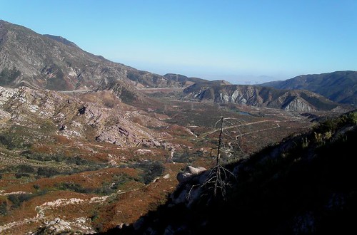
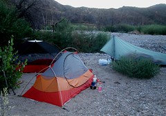
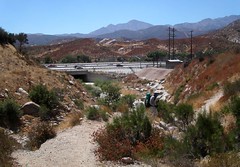
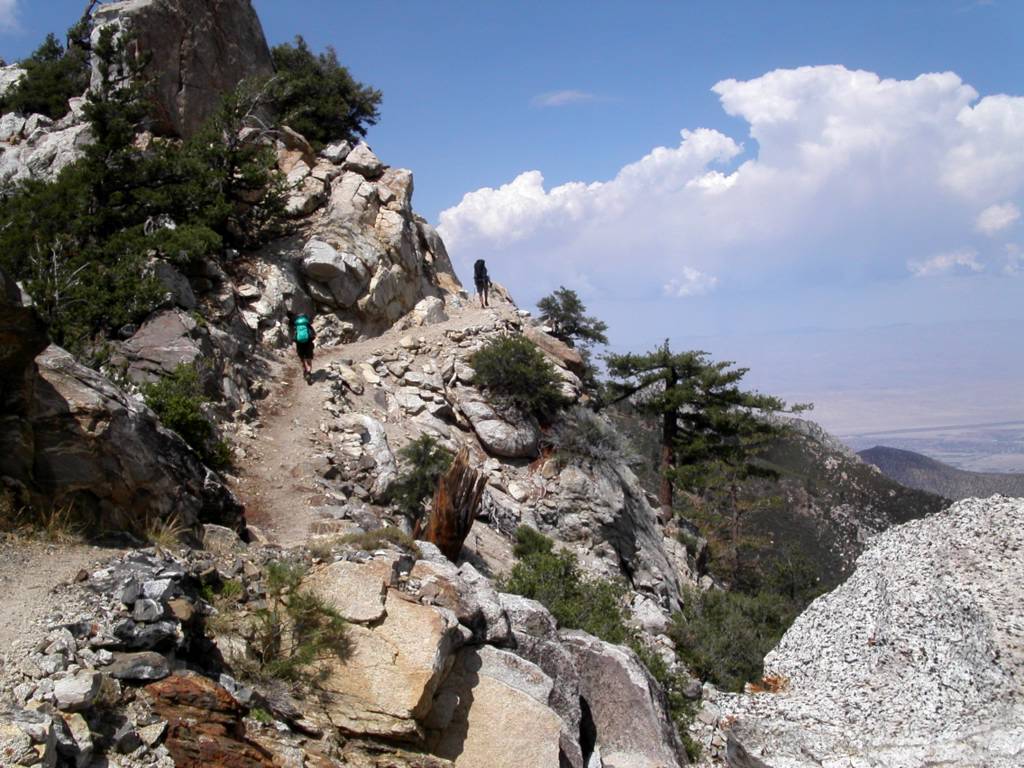
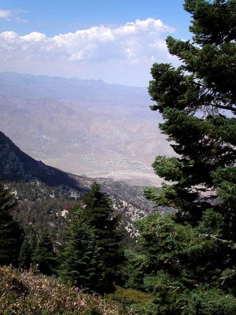
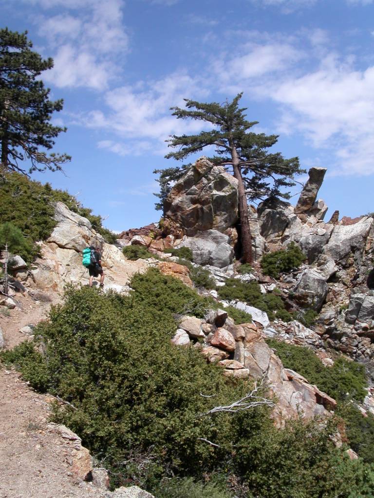
This was a beautiful and exciting section. We camped late on the 20th next to a creek bed at Silverwood Recreation Area. Visitors nearby, but unseen, whupped it up until about 3:00AM. Males in the group successfully got coyotes to sing along with them. Bizarre! Leaving camp the next morning we quickly passed through creek bottoms so washed out from the season's rains that we lost and found the trail several times. Bill's GPS shows where the next waypoint is but you can't always get to one directly. We gained Cleghorn Ridge via a detour because of damaged trail. Every once in a while the gentle grade of the PCT turns very steep. This time I tried walking backwards. I had cached water at three points on this trip and it turned out to be a perfect balance between natural sources and dry places. This first day took us along Highway 138 and a view of a train transfer station of some sort to the north. These giant trains all seem to be a mile long. I imagine they carry everything from all over the world. The trail here snakes steeply down sharp ridges to Highway 15. Crowder Canyon Creek was running well and you can see that it may have been the original road over the pass, maybe a toll road. We surprised people on the river panning for gold uncovered by the season's rains. They didn't realize that the trail passed just above their heads. At the frontage road we went to McDonalds for lunch! It felt like cheating. Ray relaxed in the culvert under the freeway and we brought him a burger and soda with plenty of ice. Passing to the other side is a zigzag through high bushes and creeks. We got to a big train curve under the Mormon Rocks and were confused by a detour around damaged trail for about 15 minutes. We passed around Ralston Peak to a great camp in Swartout Canyon. The next day we found a hikers cache on the west side of the canyon toward Lytle Creek Ridge. Day two was the hardest day with a gain of 6000 feet and a loss of 1400! My water cache was farther than Bill thought because I wasn't clear about it. It was about half way to Guffy Campground which worked well. We saw a lot of buckwheat and dreamed about fresh pancakes on the trail. We got a view up higher of Telescope Peak to the north though the Mojave was pretty murky. This is a long section and Guffy Campground is the top of a mountain! We saw some deer. We had to go downhill to find the spring. Bill's waypoint for it was right but the map was wrong. I found it 300 yards downhill from camp on the other side of a chasm. It was surrounded by a tropical jungle and I nearly burst my heart from my chest bringing back the bucket and Ray's cook pot filled with water. The boy's met me half way up and we traded off to the top. Bill said I looked like he felt before his heart attack. Comforting. He asked me to rest a bit and I did. I got an incredible desire for meat and wolfed down several pieces of jerky. Weird. Bill didn't feel like eating. We went to sleep in wind swept tents. Day three brought us down to Highway 2 and Mount Baden Powell. It got steep and rocky down to the top of the Wrightwood ski areas. A rocky trail gets uncomfortable fast. Both of the ski runs have massive reservoirs to make snow with on the top. It was strange to walk across dry ski slopes. We made it to the highway and basically followed it on the north side to Grassy Hollow campground. We tanked up, used the facilities and rested here. We passed two trail runners, one of them large, red, and without a tee shirt, a scary sight. There is a huge downhill to the road at the base of Baden Powell. We mused that it would be easier to build bridges straight across in places but we won't hold our breath. I had cached water here and was so concerned that we would need all we could carry I lugged along another half gallon in a jug. I encouraged the boys to fill all their containers even though Lamel Spring lay only few miles further. We wouldn't have another chance for water until the next day. Baden Powell is a big, steep four mile zigzag to the top. It felt surprisingly easy. Lamel Spring was running well. The top of Baden Powell is a new climate with a rare gnarled but beautiful tree called the Limber Pine. There is a large monument to Baden Powell, the Boy Scout founder, on the top. Getting the concrete and steel up there for it was an act of faith. We met a local hiking expert named John who gave us a good camp spot a mile or so past the peak and pointed out a B-24 crash on a far mountain that occurred after WW11. It was a dream camp in a draw beneath Mount Burnham facing the Mojave. We got a great view of Edwards Air Force Base where the shuttle recently landed. The most surprising thing was all the lights at night from a rapidly urbanized desert. I slept well. We passed our first hiker, Dale, in 35 miles with two backpacking Saluki dogs. There is a lot of downhill again along ridges here but it went quickly to Little Jimmy Spring where we filled up from our waterless camp. Someone has built a nice place here to rest and hydrate. We passed Windy Gap which though windy was the least windy of the many gaps we passed and descended to Islip Saddle which is unique in look with a wide table of brushy land between mountains. Passing a group of Senior Sierra Club Weekday hikers we crossed Highway 2 again. Trail mix sucks. Time and again on our trips we get disgusted with one of our trail foods and often it is trail mix. You want to avoid eating it and only do so for survival. Passing the Highway 2 to Mount Williamson to what the handbook calls a moderate ascent was a heart pounding bitch and we agreed if the author was there we would have strangled him. Ray fell sensibly behind while Bill and I forced ourselves up the grade and took a big break near the top. I grabbed a low hanging pine cone saying that in California the fruit is ripe for the picking and got sap all over my glove. Very soon the trail plunges back to the highway past a rock chasm Bill had to photograph and a parallel trail to Eagles Roost. We paused here and left a message for my daughter that we had decided to go to Cloudburst Summit. Going down an old jeep trail we entered Rattlesnake Canyon. Lot's of water here. We topped off at Little Rock Creek and moved on. We crossed good streams several times and entered Cooper Canyon which eventually goes up and around, way around, to Cloudburst Summit. It is very pretty down near the water. You could spend a week down here on vacation. Ray fell behind and made a wrong turn up a dirt road which fortuitously brought him right to the end of the trail, whew! Janessa was waiting for us with her laptop open working on Medical School Applications. This was a beautiful section of the PCT. Plenty of hard work and lots of great views.

Wednesday, May 25, 2005

Whitewater River to Highway 18 near Big Bear City - May 15 to 18th 2005

This may be the hardest but most satisfying section so far. We walked farther, 46 miles, than before and covered dramatic territory. It was 100 degrees when Donna dropped us off just east of the Whitewater River. It was flowing almost as well as it had been a month before. Section hiking has its plus’s and minus’s. The minus in this case was a difficult crossing a mile up river to get to the PCT. It took us an hour and a half to do it. The riverbed is sand filled with millions of rounded stones. One of which, the size of a bowling ball, fell out of a wall I brushed against and nearly crushed my foot. It was an obstacle course. We met our first through hikers on west side of the river after removing our boots, putting on sandals, and fording it. It is scary because the current is so strong. Bill lost his only bandana in the river. I need to take two next time. Ray left one of his water bottles somewhere as well which affected how we tanked up along the way. One of the hikers had taken off his clothes and sat right down in a tributary to take a bath. A pair of hikers, one from Israel, sat in the meager shade of a bush for a hot meal. They were surprised to see us. Going north from this point is like crossing a swamp. The heavy rain has turned much of the trail into a river. Fortunately 4 X 4 posts give the general direction of the trail. One last ford back to the east of the Whitewater started our trip over to Mission Creek. Ray already felt sapped by the heat and we had 7 miles to go. It is quite a roller coaster in this area. I have noticed that many of heads of canyons hereabouts end in an earthen damn; appearing manmade by nature, like a spillway. The most dramatic is Coon Creek Jump-off on the second day. This area is still all desert and plenty hot. Some good views to the south though. The tip to Mission Creek took us a long time and we arrived near the river at 6:40 PM. Just enough time to pitch camp before dark. A hiker that looked like an adult boy scout passed through camp. We had seen him eating and bathing earlier covered in tattoos, a bit strange. The river was quite loud and I remarked to Bill that I hoped they turned it off so we could get some sleep. We ineffectually hung our food in low trees for the night after a very hearty dinner.

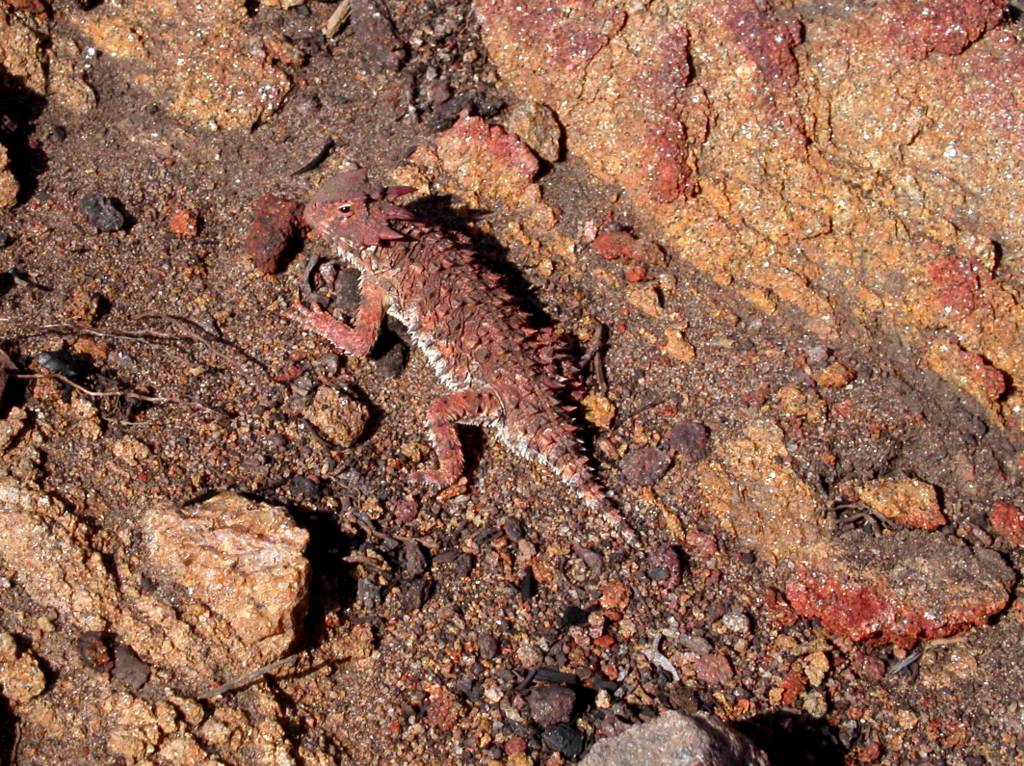
The next day was overcast most of the day but I sweat like crazy as it became muggy. Mission Creek goes up, up forever or about 12 miles which seemed like forever. No big ups or downs. Someone has put trees across all the crossings to keep you out of the water , there are over 27, which slowed us down considerably. Only Ray got wet. Our first goal was the South and Fork confluence of Mission Creek which was the longest five miles I have ever hiked. Lots of through hikers passed us and then we passed them when they stopped for a hot lunch. Several of the women (thirty percent of all hikers) were wearing gossamer wraparounds which reminded me of Gauguin’s Samoan women. A little like Hippies. One of them was using couscous an ingredient I will add it to my trail meals in the future. One subject of constant conversation on these trips in what we will eat; especially for lunch. Bill wants to get away from the bagel to the pita for a variety of fillings. I like that. I have added pink salmon in packets for dinner and it is a great success. It was a long day and the only person handling it well was Bill. I got really tired but kept trudging on. Most of this trip is treeless. We saw 8 horny toads, a hundred coal black lizards and two racers, one trying to kill a lizard, and the lizard got away. We stopped short of Mission Creek camp for dinner. The theory being that we could avoid bears if we cooked in another area than we slept. It is only a theory weakened by the fact that at rest we were surrounded by cooking hikers. This area takes you far away from civilization. Perhaps as far as we have been since northern San Diego. One of the hikers that passed us had a dog named Buddy. He wore booties covered in Duct Tape. The hiker had no walking sticks. When asked how it was to walk with out sticks he said, “I wouldn’t know I have never used them”, makes sense.

We were in the seasonal “herd” of through hikers here. Usually we are practically alone on our trips. It was a pleasure to meet so many birds of a feather: young and old sharing the same dream. Reaching the tree line is always a pleasure. It is prettier and cooler. There are some big grades here before camp. Ray fell behind but not too far. We left messages that he never saw but he caught up to us in camp quickly. We gave up trying to put up our food in the trees and put it in our tents as bait. It is very hard to tie a stone to a rock and throw it accurately. My rear tent pole snapped in half which makes for an ugly tent. There were many hikers there but we just said hi and went to bed. It got down to about 40 degrees and my new sleeping bag kept me warm.

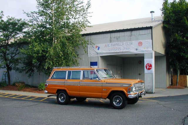
We went the wrong way out of Mission Creek Camp for about a ¼ a mile along with a lady. Finally we went up and over a hill north of camp and found my water cache from last October still in good shape. We were full up so I left them by the trail. We ran into snow on the north side of the mountain. Mainly drifts of 10 to 100 feet covering the trail. It was pretty soft but we stayed in the footsteps of those ahead of us. One of the disks on my poles vanished recently so it was funny to see that pole plunging all the down into the snow and the other a few inches. We took a break with a pair of hikers we camped with later. Nice people. The women had been saved, she said, by the man she was with when she got a case of hypothermia on San Jacinto after a storm. She raved for hours while he warmed her up with hot liquids, good advice and conversation. Most of the trail here cuts through slopes of the many mountains it crosses. There are great views in all directions at different points. We saw Mount Baldy and Baden Powell. for the first time ahead to the west with It is a long way to Agua Dulce but we want to do it this year so we can hike the desert in the winter and miss winter in the mountains. Coon Creek Jump-off is a dramatic break between the alpine habitat and the desert below in North Fork Mission Creek. It has to be seen. There was a bathroom there at a still closed camp! After ascending another mountain we got a great view of the north side of Mount San Gorgonio. We all took pictures. I never thought I would see it this way. You go from trail to dirt road to trail in this area. We bumped into two lovely 25 year old recent college graduates from Canada who became our campmates later. They were fit and fast hikers. We saw the movie animal place along the way here. There was a Grizzly, brown bear and a white tiger that could be seen from the trail. The Canadian girls thought having them in captivity was just terrible. The place was a mess though. We had planned to camp at Onyx summit close to Highway 18 but that was a mistake. It was a waterless spot and we decided to pushed on to definite water at Arrastre Trail Camp. Even though there is record breaking water in the area we needed to make sure we had enough for the long stretches. I made us stop by a mountain rivulet that allowed us to make it easily to our night’s camp. There were about eight hikers in the camp when we arrived. It made for a great night of talk and sharing. I did a little impromptu show and Ray told many a story. I think all but one of the through hikers was in their twenties; all nice and interesting. The Canadian girls had nasty blisters but couldn’t have been less worried about them. One of the guys gave us a wonderful rundown of his favorite beers. I helped a few of them get a cell phone call out to loved ones. The next morning we left late after the others. We only had about 10 miles to go and relaxed a little. One guy who had arrived late said he was hiking with his retired dad “who is hiking like he is retired and is two days behind me but we will meet in Victorville.” The trail is basically north here and we followed an escarpment of alpine and desert habitat. We saw the Mojave Desert north of the San Bernardino’s for the first time. It is massive. It is amazing to think we will go a hundred miles or more west and still be in it when we leave the San Gabriel’s. There are good views of the lakes here and remarkably groves of Joshua Trees on the desert like hills. Also the Pinyon Pines are quite beautiful. We kept thinking we heard cars just ahead on Highway 18 at our terminus for about 2 hours. We decided we were delusional. We were all strong that day and our walk ended about 2 pm. We tried for a bit to see if the other hikers could get a ride then lit out for town on foot. We soon got picked up by a 60 something Norman Bates like character in a 73’ Jeep Wagon who we believe lived with his mother. We arrived unmolested in Big Bear City for the best meal so far at Stella’s. Good, cheap and filling. Check out the pictures here.

Tuesday, April 12, 2005

April 11, 2005 Interstate 10 to Whitewater River.

Dana Law, Bill Redman and Ray Ellis
Our first trip of the season was a day hike of 9.1 miles on trail. Making it a day hike was an adventure. After the rainest season in memory we restarted our journey north. The trail appears and disappears in the wash. Look for the 4X4 posts. Stubb Canyon Creek actually had some water in it up near the now defunct Pink Motel. The new owner has put up a sign welcoming hikers to pass through their property. There is a good stream running in Cottonwood Canyon. We missed the trailside map mentioned in the handbook. We did see something we never would have thought of seeing, a tortoise! It was twelve inches long and crawling the PCT. I suppose it is a good trail for them as well. Though the trail is carpeted with growth in many places it is easy to distinguish. The meeting of Gold and Teutang Canyon is dramatic. It reminded me of Desert Divide; a sliver of a saddle between two distinct areas. Descending into Teutang we passed several yards of trail undermined by erosion in the first tributary. There was water running well in the next two streams coming into the canyon. We met an old man with a giant pack coming down into the canyon. He looked very tired. He had parked somewhere on the other side of Whitewater though it was never clear. The far side of Teutang is like a beautiful mountainside meadow. From here you can see precipitous animal trails on the southwest side. Descending to Whitewater River we were amazed to see the PCT tread north had become a stream. It looks like you’ll have to walk the shoulder until it dries up. Now the big adventure began. We had turned this into a day hike by parking Bill’s truck a mile downstream at the road crossing in Whitewater Canyon. There used to be a trail but a few hundred yards downstream the river has eroded it. We spent a great deal of time safely fording the river in a zigzag manner to get on the opposite side. It was a bit scary. Once across we were able to walk to the truck. Lee, Trout farm employee, stopped by to say his boss didn’t want people to park there. I said we had heard it was BLM land even though it is posted no trespassing. He really was nice though. Asked us about our trip and gave me permission to walk up the east side of Whitewater River to connect with the PCT for our next hike to Onyx Summit. Here are the pictures

Thursday, October 14, 2004

Fuller Ridge Remote Campsite to Highway 10 October 5, 2004

This section is 19.6 miles and nearly all downhill. As a matter of fact it goes from 7750 to 1360 feet above sea level. We passed the lowest point between this section and the Columbia Gorge on the Oregon Washington border. We camped the night before at the campsite after a 2 ½ hour ride with Ray’s son Jim up to the top. We are asking a lot of our relatives with this shuttling but it is working out. It was a warm and beautiful night. The sky was packed with stars. I slept badly. Don’t know why. The moon came up and I thought Ray had turned on his headlamp. We got off about 7:15 for our march to the bottom. The first thousand feet is covered with trees. We had fabulous views of the desert, mountains to the north, east and west. San Gorgonio looms bare and forbidding ahead. The next section is listed as difficult. We will take it slow and easy. There was a fire here in July and the vast majority of the hike down is scorched desert scrub. We have spent so much time walking in burn areas I think our little group should be called the “Fire Walkers.” The fire turned the mountain into a dirt slide. Most of the trail is covered with soft soil that has slipped over it and, in places, made it appear just like the rest of the slope. We saw lots of prints from deer. They seem to think staying on the trail is a good idea too. We believe we saw the paw prints of a mountain lion. Bill said that the way to tell the difference between those of a dog is that the nails don’t show and they didn’t. This section is a very long series of switchbacks through boulder strewn hills and canyons. Most people have bitched about the length of the trip. We decided in advance that “it is just the way it is” so we didn’t worry about it. It helps to have an attitude check to keep your spirits up. We passed though another giant boulder area. Some of them are 30 feet tall. We went under some giant rocks that looked like they were about to fall anytime. This was the perfect time for Ray to reminisce about a bridge project where several people were flattened under a boulder so large they didn’t bother to dig them out. They just put a memorial on top, lovely. Snow Creek Village is a small group of varied structures on the desert floor below and we finally saw it about 2:00PM. The end of the trail is in view most of the day. I suppose that is why people get tired of this section. We have hiked this distance before and have never seen the end until the last few minutes. The end of Snow Creek has a water district that serves Palm Springs. The miracle is that they have put a water fountain, with cold water; at the point the trail hits the desert floor. It was wonderful. We drank, filled out bottles, and poured it on our heads. The weather was nice on the way down but now it was hot. We had to walk across the desert floor and it was 95 degrees. It didn’t take long to drag us down. Of course we have already walked 16 plus miles. I have a tendency to keep on slogging regardless of how I feel. I should listen to my body. I noticed Bill flagging so we took a couple of breaks. The strange part about this area is a series of 4 X 4 posts marking the trail to keep the shifting sand from obscuring it. Closing in on the freeway I had spoken to my daughter Janessa and she was waiting on the other side. A fire broke out near the Exit and I called her and said “are you all right?” She said, “I’m fine, I see the fire. Should I go and look at it?” I said no and she said “you’re no fun.” It turned out a mobile home had gone up in flames but it gave us a start. We passed under the railroad and freeway and we were happy to finish, a great trip.

Sunday, August 01, 2004


Near Castle Rocks. Posted by Hello

Fobes Saddle to Fuller Remote Campsite

Fobes Saddle to Fuller Ridge Remote Campsite July 25th, 2004

The first morning, we didn’t start at the Fobes Saddle spur trail till after eight and got to the PCT at the Saddle just after nine. The early starts are getting harder the farther north we go. We found a six gallon cache here courtesy of Bill’s Trail Kitchen. The trail gets steep immediately. We passed Spitler peak on the way to Apache peak.

Bill stopped to fix a hot spot on his foot. I have never had a problem with my New Balance trail runners, but they slip too easily. I have fallen for the ultra light mantra about using these shoes instead of boots. I think without hiking poles I would have hurt myself. I have a new pair, and if they don’t improve my stability I am looking for another shoe.

It was already about 85 degrees here with a fair wind. Very few wildflowers at this time of year, but we did see some Red Penstemon, Indian Paintbrush, and a very cool plant with a red cone and purple flowers. When the pictures come back we have to identify it.

We lunched at about 1:00 after Apache peak, and were already wiped out. Ray said, “When I feel like this I am ready to stop.” I got a headache from the altitude but Advil, food, and a break made me feel like a new man. You can see the Coachella Valley all along this part of the trail.

Near Antsell Rock, we ran into a shirtless man with a British accent walking the other direction who said he was from the Zen Mountain Center. We don’t know where he entered the trail. We ran into gnats that flew around our faces like a mask of bugs. I inhaled one in my nose and it came out my mouth. Ray ate one and said, “Good protein!” The trail is carved out of solid rock in many places here and must have been a Herculean task to build. This section is dangerous in the winter with snow. We are glad to be walking it in dry conditions. Red Tahquitz Peak is literally red, and we had to round it on the east side to enter the forest beyond.

The wilderness up here is a patchwork of National Forest and Mount San Jacinto State Park. We entered the Eden that is the top of Mount San Jacinto. It looks like a punchbowl surrounded by peaks. At first glance you might think it is a dormant volcano. It is filled with trees, and has a big green meadow, Skunk Cabbage Meadow, near the bottom northeast side. Unfortunately up here the bark beetle infestation is in full force, and a good twenty percent of the trees are dead or dying. Only several years of average or better rainfall will solve the problem. It is still quite beautiful.

The grade went down into the valley and it was a welcome breather. Our permit was for Strawberry Junction Campground, and it was still 7 miles away. Just before the trail meets a 1/3 mile cutoff to water in Tahquitz Meadow, we came across good flowing Tahquitz Creek. This stream, which surprised us, came from Tahquitz Peak above, and since all the snow is gone Bill and Ray surmised that it originated from ground water. It was a lot of water. We filtered about 10 liters of good, cold water between us. We decided any pauper can have water down the mountain, but on the mountain the man with water is King! I drank six liters today! We saw a mule deer and heard some doves. We were exhausted and no where near our goal.

We arrived at Saddle Junction to see a very tired man about 30 years old sitting on a tree stump. “I used to hike all the time, and this is first time I’ve been out in two years,” he said. Apparently, the 2-1/2 mile Devil’s Slide Trail had been more than enough for him. We finally decided to camp north of Saddle Junction on a sandy area overlooking Idyllwild and Hemet beyond. We had covered nine miles. It was impossible to get to Strawberry Junction, where we had arranged for the camping permit, from Fobes Saddle in a day of hiking, but that was the only permit area available to us. We felt bad about it, but it was getting dark. We all agreed to tell the truth if we ran into a Ranger. We didn’t have a choice. I understand why they restrict camping: People have damaged the area in the past. We treaded lightly. I was stunned to realize that I had left my new stove at home. Ray shared his cooking gear with me, and I enjoyed Red Beans and Rice. I added tuna to both our dishes. Bill had lent me a tent because my Tarptent had not arrived in time. Unfortunately, he brought the wrong poles, but my hiking poles crossed and adjusted did the trick, and I had a tent. It was a warm night, and with a half-moon everything was quite clear.

We heard some people whooping as they descending the trail to Humber Park. It became obvious we were probably the only people on the whole mountain; a strange but powerful feeling, especially with millions below in our view. I did not fall asleep till 1:00AM, but lay there for nine hours. I don’t know why; perhaps I was too tired. I heard Ray rustling at 5:30 and woke up. Bill had blisters on both heels. He treated them and we were on our way by 7:00AM. We climbed another 900 feet in the next few miles. We were over 9000 feet, a record so far. It was cooler than the day before. It took my body a while to wake up.

Strawberry Cienega was a revelation. It was really a seep. It takes only a little water to change the flora dramatically. All the plants are different and lush for over a hundred feet on each side, with Ferns, Bracken and Skunk Cabbage (which Bill says works well as toilet paper, although I’ll take his word for it). As usual, Bill took a lot of great pictures. We got to Strawberry Junction and stopped for a snack. There are some giant boulders beyond here with large, pock-marked faces. People have decorated the holes with pine cones. Bill said he had learned that these “soft spots” form when different kinds of molten rocks come together in a lava flow, and later erode more quickly leaving the pocks. We shall call them “Devil’s Marbles”. We saw and smelled some beautiful Wild Azaleas. We soon crossed a creek. It wasn’t much, but we could dip Ray’s cook pot in to fill his bucket for filtering. We loaded up.

We had much more shade today and the walk was easier. After we took the Fuller Ridge turn-off, we came across a whopper of a creek. It turns out this was the north fork of the San Jacinto River and boy was it running well! We didn’t need water ,but we marveled at it for a few minutes. Fuller Ridge, like the San Felipe Hill before it, has made us nervous. We thought it was sun baked; lacking shade. That is not true. It is well shaded, but it is perilous at times. It is mostly rock, and during the winter I am sure it is dangerous. I slid about some and found the trail hard to follow at times for the lack of soil. A little snow and you could get lost. The grade was mostly downhill, but the steep incline up to Castle Rocks is short but hard. We could see the San Jacinto Peak from here, and also the burned trail area down to Highway 10. It is really something and worth the walk. We met our third and final person on the way to Fuller Ridge Remote Campsite. He was sunburned, without a hat, and carrying a backpack with the tag still on it. His name was Gerald, and he seemed a bit addled. He was heading for an overnight up the trail. I realized he was mumbling something about us not having a ride at the campsite, and this being a bit late in the season for through hikers. Actually I think he was fine but I was confused. We found his motorcycle at the campsite. Past the campground we passed Black Mountain Truck Trail, and found the barricaded final section to Highway 10. We will go as soon as it opens. We walked down to Black Mountain Campground and were picked up by my daughter, Janessa, and her friend Christie soon after. A great, hard and beautiful trip.
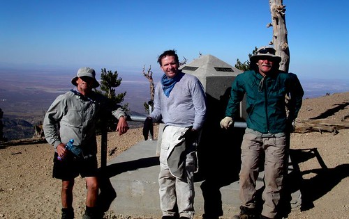
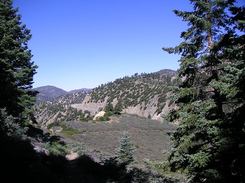
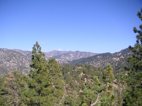
Pacific Crest Trail hewn from rock. Posted by Hello

Wild Azaleas Posted by Hello

Where we came from Posted by Hello

Mount San Jacinto from the north Posted by Hello

Mount San Jacinto ahead Posted by Hello

Gorgonio Pass Posted by Hello

Devils Marbles Posted by Hello

Saddle Junction Camp Posted by Hello

Raw Beauty Posted by Hello

Thursday, June 03, 2004


We have passed through our first county and look at the sign! Posted by Hello